Hampton, Virginia — The American South (Mid-Atlantic)
Hampton Is Burned
"Suddenly the flaming torches were seen"
Photographed by Evan Dwyer, August 9, 2025
1. Hampton Is Burned Marker
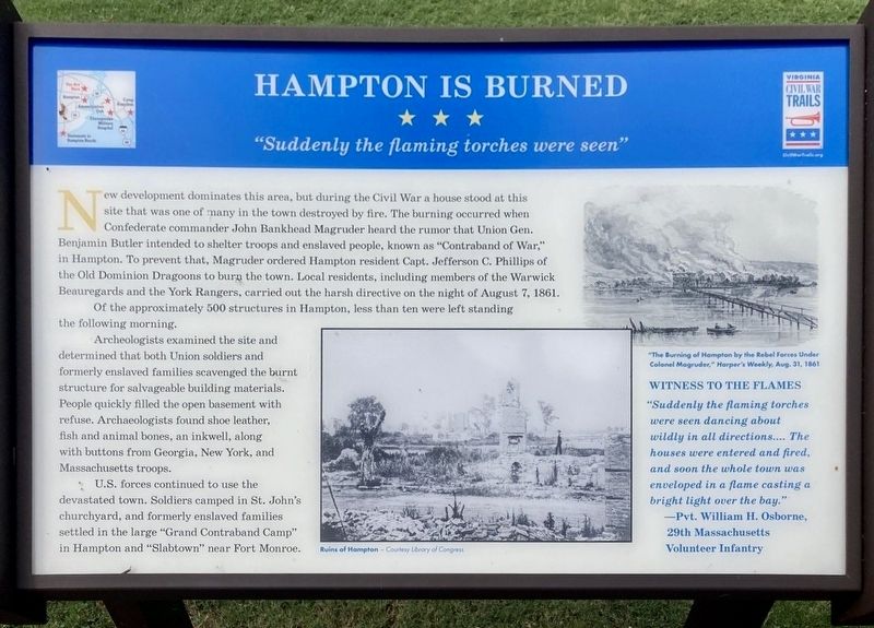
Of the approximately 500 structures in Hampton, less than ten were left standing the following morning.
Archeologists examined the site and determined that both Union soldiers and formerly enslaved families scavenged the burnt structure for salvageable building materials. People quickly filled the open basement with refuse. Archaeologists found shoe leather, fish and animal bones, an inkwell, along with buttons from Georgia, New York, and Massachusetts troops.
U.S. forces continued to use the devastated
this page online
Witness to the Flames
"Suddenly the flaming torches were seen dancing about wildly in all directions .... The houses were entered and fired, and soon the whole town was enveloped in a flame casting a bright light over the bay." —Pvt. William H. Osborne, 29th Massachusetts Volunteer Infantry
(captions)
Ruins of Hampton - Courtesy Library of Congress
"The Burning of Hampton by the Rebel Forces Under Colonel Magruder," Harper's Weekly, Aug. 31, 1861
Erected by Virginia Civil War Trails.
Topics and series. This historical marker is listed in these topic lists: African Americans • Anthropology & Archaeology • War, US Civil. In addition, it is included in the Virginia Civil War Trails series list. A significant historical date for this entry is August 7, 1861.
Location. 37° 1.471′ N, 76° 20.594′ W. Marker is in Hampton, Virginia. It is at the intersection of Settlers Landing Road (U.S. 60) and South King Street, on the right when traveling east on Settlers Landing
Photographed by Evan Dwyer, August 9, 2025
2. Hampton Is Burned Marker

Regionally, this marker is on Virginia’s Peninsula and in Coastal Virginia. It is also in the American South, specifically in the Upper South, in the Tidewater, and on the Eastern Seaboard. Globally, it is in the North Atlantic Region, North America, the Western Hemisphere, the Western World, and the Anglosphere. Historically, it finds itself in what was once the territory of the Mississippian Culture, one of the original Thirteen Colonies, one of the Confederate States of America, and the Antebellum South.
Other nearby markers. At least 8 other markers are within walking distance of this marker: Eighteenth-Century Hampton (a few steps from this marker); Seventeenth-Century Hampton (a few steps from this marker); Indian / African / Settler (a few steps from this marker); Ninteenth-Century Hampton (within shouting distance of this marker); Twentieth-Century Hampton (within shouting distance of this marker); Langley Field: Creating an Air Force (within shouting distance of this marker); Langley Field: Discovering Aerospace (within shouting distance of this marker); Dr. Katherine G. Johnson (within shouting distance of this marker). Touch for a list and map of all markers in Hampton.
Other markers no longer nearby. British Approach to Hampton / The War of 1812 (was within shouting distance of this marker but has been confirmed missing); Hampton (was within shouting distance of this marker but has been replaced with another marker now near it).
Related marker. Click here for another marker that is related to this marker. Old CWT Marker Near This Location also titled "Hampton Is Burned".
Credits. This page was last revised on September 5, 2025. It was originally submitted on September 3, 2025, by Evan Dwyer of Richmond, Virginia. This page has been viewed 133 times since then and 45 times this year. Photos: 1, 2. submitted on September 3, 2025, by Evan Dwyer of Richmond, Virginia. • Bernard Fisher was the editor who published this page.
