Garrison in McLean County, North Dakota — The American Midwest (Upper Plains)
Lake Sakakawea
Lewis and Clark in North Dakota
Photographed by Barry Swackhamer, July 23, 2025
1. Lake Sakakawea Marker
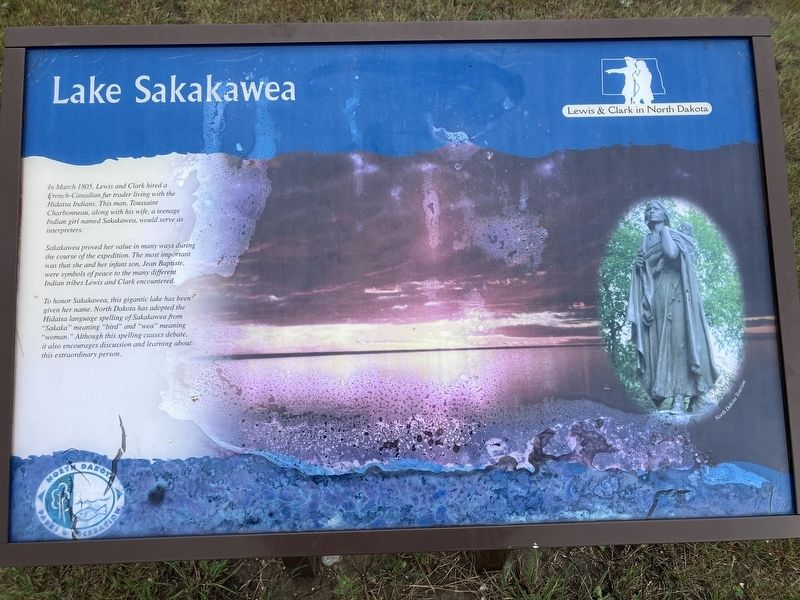
Sakakawea proved her value in many ways during the course of the expedition. The most important was that she and her infant son, Jean Baptiste, were symbols of peace to the many different Indian tribes Lewis and Clark encountered.
To honor Sakakawea, this gigantic lake has been given her name. North Dakota has adopted the Hidasa language spelling of Sakakawea from "Sakaka" meaning "bird" and "wea" meaning "woman," Although this spelling causes debate, it also encourages discussion and learning about this extraordinary person.
Erected by North Dakota Parks and Recreation Department.
Topics and series. This historical marker is listed in these topic lists: Exploration • Indigenous Peoples and Communities • Women. In addition, it is included in the Lewis & Clark Expedition series list. A significant historical month for this entry is March 1805.
Location. 47° 35.254′ N, 101° 25.278′ W. Marker
this page online

Regionally, this marker is in the Mandan, Hidatsa, and Arikara Nation, in the Standing Rock Sioux Tribe, in the Drift Prairie, and on the Missouri Plateau. It is also in the American Lewis & Clark Corridor, on the prairies, and on the Northern Plains. Globally, it is in North America, the Western Hemisphere, the Western World, and the Anglosphere. Historically, it finds itself in what was once Rupert’s Land and also the Louisiana Purchase.
Other nearby markers. At least 8 other markers are within 6 miles of this marker, measured as the crow flies: Garrison Dam (here, next to this marker); Fort Stevenson State Park (a few steps from this marker); A Blank Canvas (a few steps from this marker); De Trobriand (a few steps from this marker); Buffalo (within
Photographed by Barry Swackhamer, July 23, 2025
2. Lake Sakakawea Marker
Credits. This page was last revised on September 4, 2025. It was originally submitted on September 4, 2025, by Barry Swackhamer of Brentwood, California. This page has been viewed 97 times since then and 20 times this year. Photos: 1, 2. submitted on September 4, 2025, by Barry Swackhamer of Brentwood, California.
