Port Dalhousie in St. Catharines in Niagara Region, Ontario — Central Canada (North America)
Port Dalhousie and the Niagara St. Catharines and Toronto Railway (NS&T)

Photographed by Tim Boyd, November 7, 2024
1. Port Dalhousie and the Niagara St. Catharines and Toronto Railway (NS&T) Marker
The NS&T, formed in 1899, was an electric freight and passenger railway serving communities in the eastern portion of the Niagara Peninsula (see map). It was an integrated transportation company that provided both local transit services within Niagara's two largest urban centres and service between communities. It also owned a navigation company that provided day boat service on Lake Ontario between Toronto and Port Dalhousie.
In 1901, the NS&T constructed a 7.2 km route that crossed to the west side of the Twelve Mile Creek and on to Port Dalhousie. This alignment was chosen to allow for a planned westward expansion to link with another electric railway in Beamsville and a future expansion to Toronto. The westward expansions were never built.
In 1902, the NS&T acquired a company that provided day boats between Toronto and Port Dalhousie and created an approximately 2.4 ha park that would become known as Lakeside Park. The park was created to stimulate ridership for both the new line to Port Dalhousie and the boat service.
In 1912, Lakeside Park was doubled in size to 4.8 ha. It eventually would include a midway,
this page online
Thousands of people would come to Lakeside Park. In the peak year, more than 55,000 people came to the park by trolley or boat for organized picnics. Trolley service was frequent and extra trains often ran at peak times.
In addition to the passenger service, the NS&T also provided freight service to industrial users in Port Dalhousie and a connection to the freight shed next to the harbour. This link was particularly important in the fresh fruit season.
With increasing car ownership and improvements to roads, ridership began to decline in the 1920s. On June 2, 1949, the NS&T ship Northumberland was destroyed by fire in Port Dalhousie. Running the service with only one ship was not practical. In March of 1951, the last scheduled run of an NS&T trolley from Port Dalhousie to St. Catharines occurred. The service was replaced with buses. The tracks were removed from the park and along Main Street in October of 1951. The northern section of the existing Martindale Road runs along the old NS&T right of way.
The park was operated privately for a few years before
Photographed by Kevin Westell, August 10, 2025
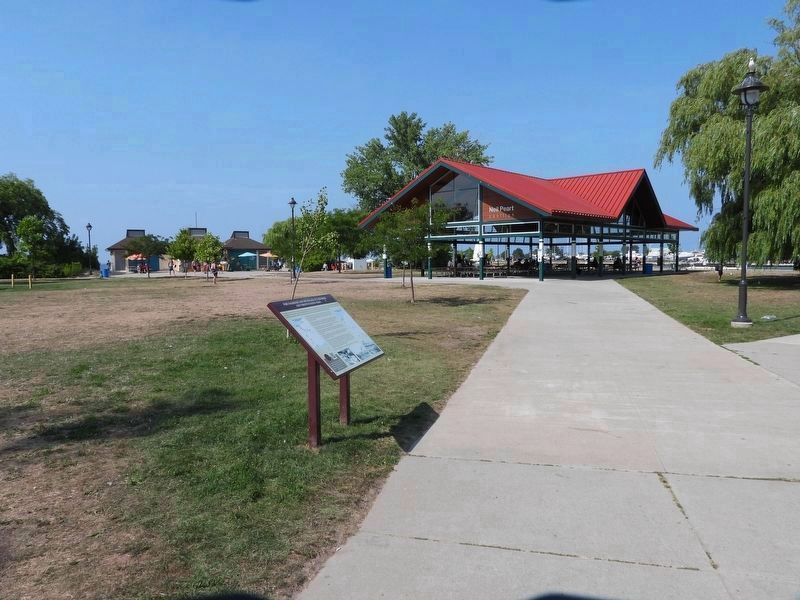
2. Port Dalhousie and the Niagara St. Catharines and Toronto Railway (NS&T) - Marker in context
Photo faces north and north-east from the parking lot. The marker is 15 metres from the parking lot, along the path to the Neil Peart Pavilion.
Erected by CRHA Niagara Divison.
Topics. This historical marker is listed in these topic lists: Entertainment • Parks & Recreational Areas • Railroads & Streetcars • Waterways & Vessels. A significant historical year for this entry is 1899.
Location. 43° 12.235′ N, 79° 15.878′ W. Marker is in St. Catharines, Ontario, in Niagara Region. It is in Port Dalhousie. It can be reached from Lakeport Rd, on the right when traveling west. The marker stands in Lakeside Park, 15 meters north from the parking lot at the end of Lakeport Road. Touch for map. Marker is at or near this postal address: 1 Lakeport Rd, St Catharines ON L2N 4P6, Canada. Touch for directions.

Regionally, this marker is on the Golden Horseshoe and in Niagara Canada. It is also in Central Canada. Globally, it is in North America, on the Great Lakes, in the Western Hemisphere, in the Western World, and in the Anglosphere. Historically, it finds itself in what was once a British colony, the Viceroyalty of New France, the Haudenosaunee (Iroquois) Confederacy, and Rupert’s Land.
Other nearby markers. At

Photographed by Tim Boyd, November 7, 2024
3. Port Dalhousie and the Niagara St. Catharines and Toronto Railway (NS&T) Marker

courtesy Andy Panko
4. Port Dalhousie and the Niagara St. Catharines and Toronto Railway marker photo detail

courtesy Andy Panko
5. Port Dalhousie and the Niagara St. Catharines and Toronto Railway marker photo detail

courtesy Johan Wigt
6. Port Dalhousie and the Niagara St. Catharines and Toronto Railway marker photo detail
Photographed by Tim Boyd, November 7, 2024
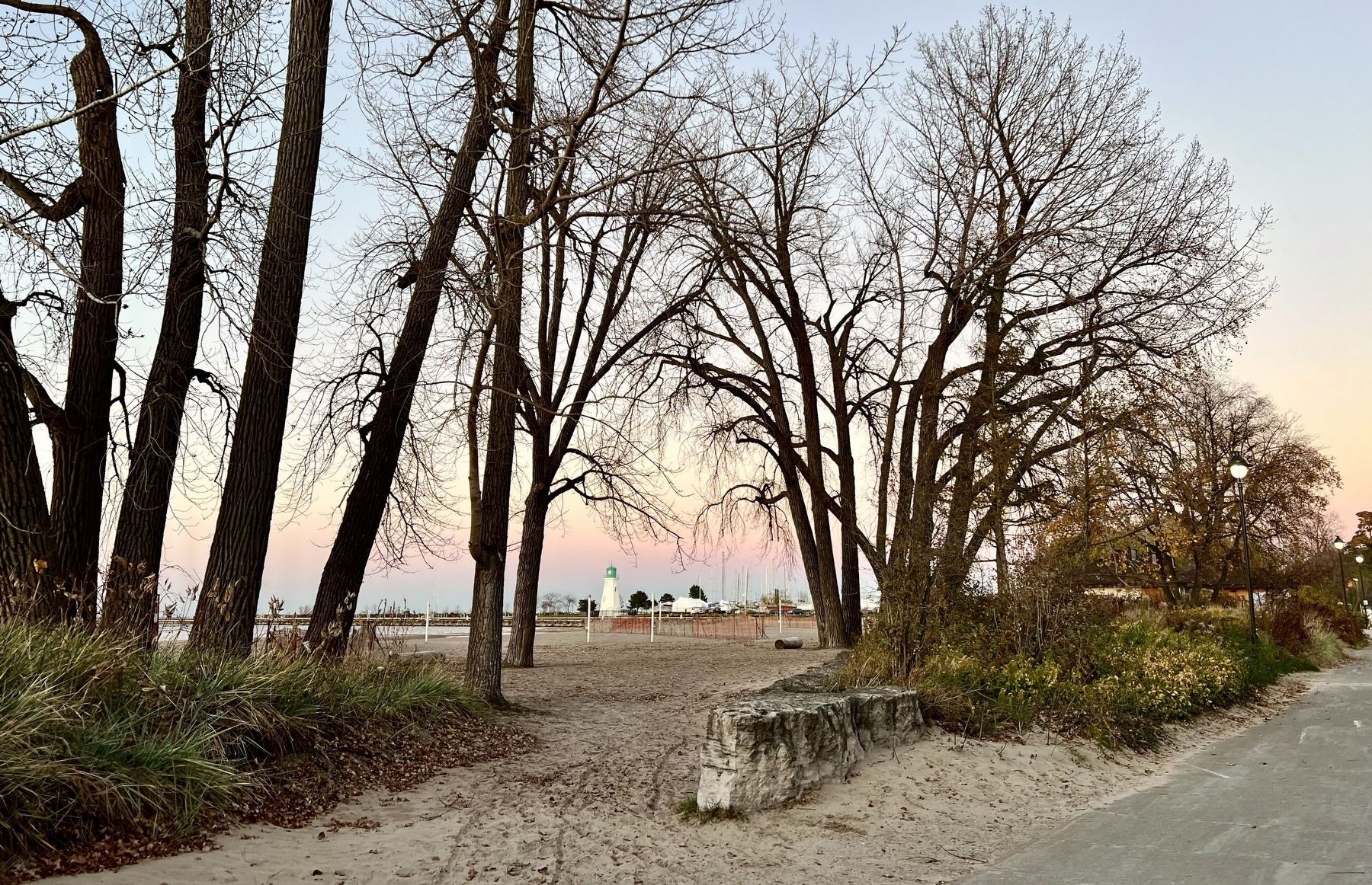
7. Lakeside Park, Port Dalhousie, 2024
Credits. This page was last revised on September 9, 2025. It was originally submitted on November 13, 2024, by Tim Boyd of Hamilton, Ontario. This page has been viewed 375 times since then and 97 times this year. Last updated on September 5, 2025, by Kevin Westell of St. Catharines, Ontario. Photos: 1. submitted on November 13, 2024, by Tim Boyd of Hamilton, Ontario. 2. submitted on August 11, 2025, by Kevin Westell of St. Catharines, Ontario. 3, 4, 5, 6, 7. submitted on November 13, 2024, by Tim Boyd of Hamilton, Ontario. • Devry Becker Jones was the editor who published this page.
