
Niagara Falls in Niagara Region, Ontario — Central Canada (North America)
Whirlpool Rapids Gorge
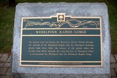
Photographed by J. J. Prats, October 15, 2014
1. Whirlpool Rapids Gorge Marker
Erected by The Niagara Parks Commission.
Topics. This historical marker is listed in these topic lists: Environment • Natural Features. A significant historical year for this entry is 9999 BCE.
Location. 43° 7.076′ N, 79° 4.229′ W. Marker is in Niagara Falls, Ontario, in Niagara Region. It is on Niagara River Pkwy, on the right when traveling west. The marker is 10 metres north-west of the road, at the west end of the parking lot for the Whirlpool Aero Car. Touch for map. Marker is at or near this postal address: 3850 Niagara River Pkwy, Niagara Falls ON L2E 7M8, Canada. Touch for directions.

Regionally, this marker is on Ontario’s Golden Horseshoe and in Niagara Canada. It is also in Central Canada. Globally, it is in North America, on the Great Lakes, in the Western Hemisphere, in the
this page online
Other nearby markers. At least 8 other markers are within walking distance of this marker: Niagara Spanish Aero Car (about 150 meters away, measured in a direct line); The Niagara Spanish Aerocar / Le Téléférique Espanol Du Niagara / El Transbordador Español De Niágar (about 150 meters away); Eddy Basin (approx. half a kilometer away in the U.S.); Whirlpool Rapids (approx. half a kilometer away in the U.S.); Niagara Gorge Natural History (approx. half a kilometer away in the U.S.); Challenging the Whirlpool Rapids (approx. half a kilometer away in the U.S.); Welcome to Whirlpool State Park (approx. 0.6 kilometers away in the U.S.); Niagara River Recreation Trail (approx. 0.6 kilometers away). Touch for a list and map of all markers in Niagara Falls.
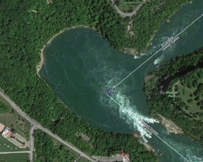
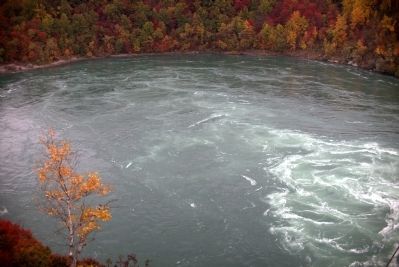
Regarding Whirlpool Rapids Gorge. The surface water of the Niagara whirlpool reverses flow, based on the volume of water drawn off for hydro-electricity:
1. At high-flow times, such
By Google Maps (Fair use)
2. Whirlpool Rapids Gorge
2. At low-flow times, when the maximum water is directed to power generation, the surface water in the whirlpool flows clockwise.
Also see . . . Whirlpool Rapids, A History & Pictorial. “The White Water Walk [in Canada] is the quickest and least strenuous method to view the Whirlpool Rapids. It is wheelchair accessible. Visitors are transported to the base of the Niagara Gorge by elevator. A boardwalk provides access to several viewing areas from which to view the rapids. The Whirlpool State Park [in the U.S.] allows the more adventurous visitor to follow a series of stairways and paths to the base of the gorge. A marked path can be followed along the remnants of the former Great Gorge Route railway to an old observation station overlooking the rapids. This station was used as a way-point for visitors riding the Great Gorge Railway from which to view the Whirlpool Rapids. The hike is physically demanding but provides a view of
Photographed by J. J. Prats, October 15, 2014
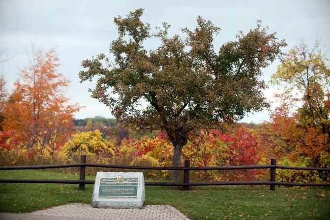
3. Whirlpool Rapids Gorge Marker
The gorge begins just beyond the marker and if were not for the trees, the whirlpool rapids could be seen from here. The tree-line in the distance is at the far end of the gorge. The nearest view of the whirlpool is 150 meters away across the parking lot at the viewing area for the Whirlpool Aero Car.
Photographed by J. J. Prats, October 15, 2014
4. A Portion of the Whirlpool Rapids Gorge
Credits. This page was last revised on October 12, 2025. It was originally submitted on December 10, 2014, by J. J. Prats of Powell, Ohio. This page has been viewed 622 times since then and 20 times this year. Last updated on September 5, 2025, by Kevin Westell of St. Catharines, Ontario. Photos: 1, 2, 3, 4. submitted on December 10, 2014, by J. J. Prats of Powell, Ohio. • Andrew Ruppenstein was the editor who published this page.
