
Niagara Falls in Niagara Region, Ontario — Central Canada (North America)
Indigenous Culture
Les Approches Culturelles
⎯⎯⎯
Approaches to Water
Autochtones de l'Eau
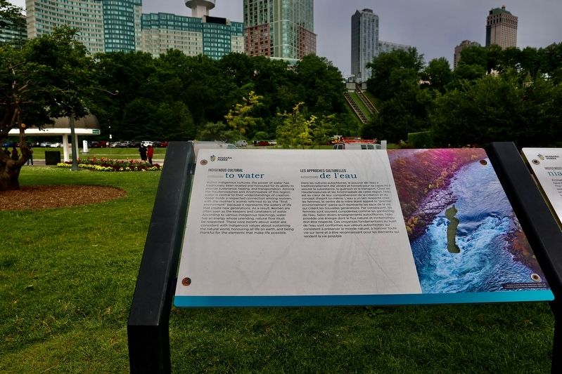
Photographed by Sandra Hughes Tidwell, June 25, 2024
1. Indigenous Culture Marker

Within Indigenous cultures, the power of water has traditionally been revered and honoured for its ability to provide sustenance, healing, and transportation. Among the Haudenosaunee and Anishinaabek of this region, water is central to their understandings of creation. Water holds a respected connection among women, with the mother's womb referred to as the 'first environment' because it represents the waters of life that create new generations. As a result, women are often seen as the keepers and caretakers of water. According to various Indigenous teachings, water has an energy whose unending, natural flow must be respected. These core beliefs about water are consistent with Indigenous values about sustaining the natural world, honouring all life on earth, and being thankful for the elements that make life possible.
this page online
Erected by Niagara Parks.
Topics. This historical marker is listed in these topic lists: Environment • Parks & Recreational Areas.
Location. 43° 4.704′ N, 79° 4.735′ W. Marker is in Niagara Falls, Ontario, in Niagara Region. It can be reached from Niagara River Parkway, on the right when traveling north. This marker is along the Trans-Canada trail near the Table Rock bus parking and Horseshoe Falls. Touch for map. Marker is at or near this
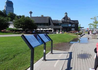
Photographed by Kevin Westell, July 18, 2025
2. Indigenous Culture - Marker in context
Photo faces north. This marker (and its twin) are 20 metres south of a patio which is part of the Table Rock complex; and adjacent to the walking path that runs all along the west shore near the falls (out-of-screen right).

Regionally, this marker is on Ontario’s Golden Horseshoe and in Niagara Canada. It is also in Central Canada. Globally, it is in North America, on the Great Lakes, in the Western Hemisphere, in the Western World, and in the Anglosphere. Historically, it finds itself in what was once a British colony, the Viceroyalty of New France, the Haudenosaunee (Iroquois) Confederacy, and Rupert’s Land.
Other nearby markers. At least 8 other markers are within walking distance of this marker: Indigenous History along the Niagara River (here, next to this marker); The Niagara Parks Commission / Commission Des Parcs Du Niagara (a few steps from this marker); Niagara Falls Park and River Railway Powerhouse (within shouting distance of this marker); José María Heredia (within shouting distance of this marker); Geological Formation of Niagara Falls and the Niagara River (within shouting distance of this marker); The History of Tourism around Niagara Falls (about 90 meters away, measured in a direct line); Tightrope Walker Nik Wallenda
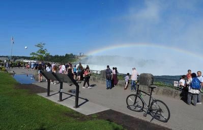
Photographed by Kevin Westell, July 18, 2025
3. Indigenous Culture - Marker in context
Photo faces north-east and east. This marker (and its twin) are at the brim of the Horseshoe Falls. Goat Island in Niagara Falls, New York is the far shore. The American Falls are visible (distant left, under balloon).
Credits. This page was last revised on September 9, 2025. It was originally submitted on July 11, 2024, by Sandra Hughes Tidwell of Killen, Alabama, USA. This page has been viewed 202 times since then and 24 times this year. Last updated on September 6, 2025, by Kevin Westell of St. Catharines, Ontario. Photos: 1. submitted on July 11, 2024, by Sandra Hughes Tidwell of Killen, Alabama, USA. 2, 3. submitted on July 19, 2025, by Kevin Westell of St. Catharines, Ontario. • Devry Becker Jones was the editor who published this page.
