Near Manassas in Prince William County, Virginia — The American South (Mid-Atlantic)
Signal Hill
“Look out for your left, you are turned”
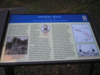
On the morning of July 21, 1861, Alexander was posted here. A Union diversionary attack at the Stone Bridge seven miles northwest required him to keep watch on the Van Pelt signal station. Alexander later wrote that when he looked to the left of that station at about 8:45 A.M., “my eye was caught by a glitter in this narrow band of green. I recognized it at once as the reflection of the morning sun from a brass field-piece. Closer scrutiny soon revealed the glittering of bayonets and musket barrels.” Alexander had spotted a large Union column marching toward Sudley Springs to turn the Confederate left flank. He immediately signaled the Van Pelt station to warn Col. Nathan G. Evans, in command at the Stone Bridge, “Look out for your left, you are turned.” It was the first time in history that the wigwag system had been used in combat. Alexander’s timely warning enabled Evans to intercept the Union Ranking column and buy time for Confederate reinforcements, contributing significantly to the Confederate victory at First Manassas.
Erected by Civil War Trails.
Topics and series. This historical marker is listed in these topic lists: Communications • War, US Civil. In addition, it is included in the Virginia Civil War Trails series list. A significant historical month for this entry is July 1861.
Location. This marker has been replaced by another marker nearby. It was located near 38° 45.188′ N, 77° 26.298′ W. Marker was near Manassas, Virginia, in Prince William County. Marker was on Signal View Drive. The marker was located on the east side of Signal Hill Drive across the street from Signal Hill Park. There was a small parking area at the marker. Touch for map. Marker was at or near this postal address: 7970 Blooms Rd, Manassas VA 20111, United States of America. Touch for directions.
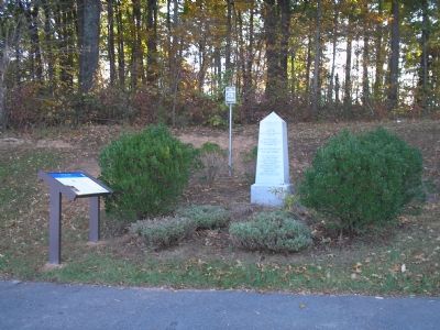
Other nearby markers. At least 8 other markers are within walking distance of this location. Signal Hill Monument (here, next to this marker); a different marker also named Signal Hill (here, next to this marker); Building Mayfield Fort (approx. ¾ mile away); Battle of Bull Run Bridge (approx. ¾ mile away); a different marker also named Battle of Bull Run Bridge (approx. 0.8 miles away); Casualties of Battle (approx. 0.8 miles away); Role of Mayfield in Battle of First Manassas (approx. 0.8 miles away); Preservation of Mayfield Fort (approx. 0.8 miles away). Touch for a list and map of all markers in Manassas.
Related marker. Click here for another marker that is related to this marker. This marker has been replaced with the linked marker.
Additional commentary.
1. “the Willcoxon signal station”
From Bull Run Remembers…by Joseph Mills Hanson:
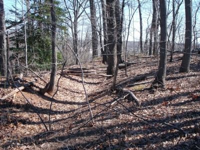
About two and one-half miles east of the [Manassas Junction] station and half a mile west of Bull Run, was the most formidable work of all; an oblong-shaped fort following the crest line of Signal Hill, the highest elevation in the vicinity of Manassas, about 400 feet above sea level. The fort on Signal Hill, still well preserved under heavy forest cover, shows interval embrasures for 16 guns…
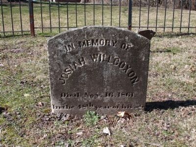
At the time of the war the farm on which Signal Hill stands belonged to Mr. Josiah Willcoxon for which reason the hill was formerly sometimes called the “the Willcoxon signal station.”
— Submitted March 8, 2010.
Credits. This page was last revised on May 15, 2021. It was originally submitted on November 16, 2007, by Bill Coughlin of Woodland Park, New Jersey. This page has been viewed 2,701 times since then and 77 times this year. Last updated on March 8, 2010. Photos: 1, 2. submitted on November 16, 2007, by Bill Coughlin of Woodland Park, New Jersey. 3, 4. submitted on March 8, 2010. • Craig Swain was the editor who published this page.


