Essex in Essex County, New York — The American Northeast (Mid-Atlantic)
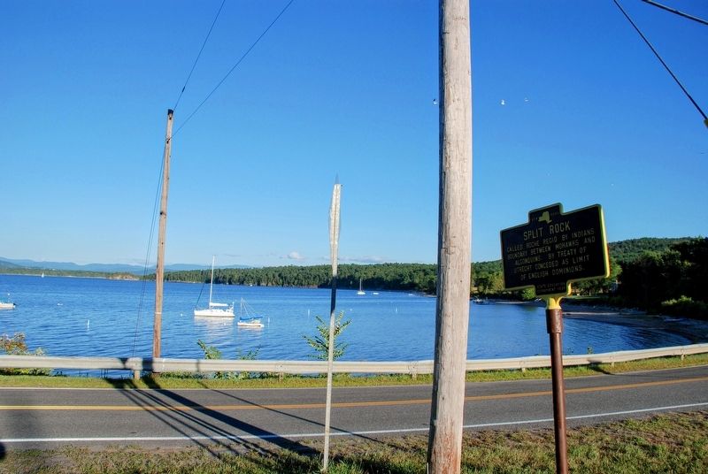
Split Rock

Photographed by Tim Dusablon, August 31, 2025
1. Split Rock Marker
Called Roche Regio by Indians. Boundary between Mohawks and Algonquins. By Treaty of Utrecht conceded as limit of English Dominions.
Erected 1939 by State Education Department.
Topics. This historical marker is listed in these topic lists: Colonial Era • Indigenous Peoples and Communities. A significant historical year for this entry is 1713.
Location. 44° 16.41′ N, 73° 21.017′ W. Marker is in Essex, New York, in Essex County. It is at the intersection of Lake Shore Road and Whallons Bay Road, on the right when traveling south on Lake Shore Road. Touch for map. Marker is in this post office area: Essex NY 12936, United States of America. Touch for directions.

Regionally, this marker is in Upstate New York, in the Adirondacks & North Country, and in the Champlain Valley. It is also in the American Northeast and in the Mid-Atlantic. Globally, it is in North America, the Great North Woods, the Western Hemisphere, the Western World, and the Anglosphere. Historically, it finds itself in what was once the Viceroyalty of New France, New Netherland, and one of the original Thirteen Colonies.
Other nearby markers. At
this page online
Regarding Split Rock. Split Rock Point on Lake Champlain was the ancient boundary between the Mohawk and Haudenosaunee (Iroquois) First Nations to the south, and Algonquin First Nations to the north. The Treaty of Utrecht in 1713 brought and end to Queen Anne's War in North America and set the boundary between New France and the English colonies as Split Rock Point. The English accepted this boundary, but the French did not, claiming all of Lake Champlain and Lake George by right of discovery. The French forts and settlement at Crown Point, NY (Fort St. Frederic), almost 20 miles south, was a
Photographed by Tim Dusablon, August 31, 2025
2. Split Rock Marker
Also see . . .
1. King George's War (Wikipedia). (Submitted on September 12, 2025, by Michael Herrick of Southbury, Connecticut.)
2. French and Indian War (Wikipedia). (Submitted on September 12, 2025, by Michael Herrick of Southbury, Connecticut.)
Additional keywords. Queen Anne's War
Credits. This page was last revised on September 12, 2025. It was originally submitted on September 7, 2025, by Tim Dusablon of Georgia, Vermont. This page has been viewed 222 times since then and 116 times this year. Photos: 1, 2. submitted on September 7, 2025, by Tim Dusablon of Georgia, Vermont. • Michael Herrick was the editor who published this page.
