
Welland in Niagara Region, Ontario — Central Canada (North America)
Main Street Bridge (Bridge 13)
⎯⎯⎯
Pont de la Rue Main (Pont 13)
cmh2315fl via Flickr (CC BY-NC 2.0), July 28, 2017
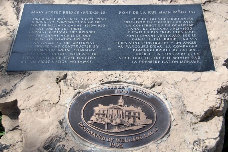
1. Main Street Bridge (Bridge 13)/Ont de la Rue Main (Pont 13) Marker

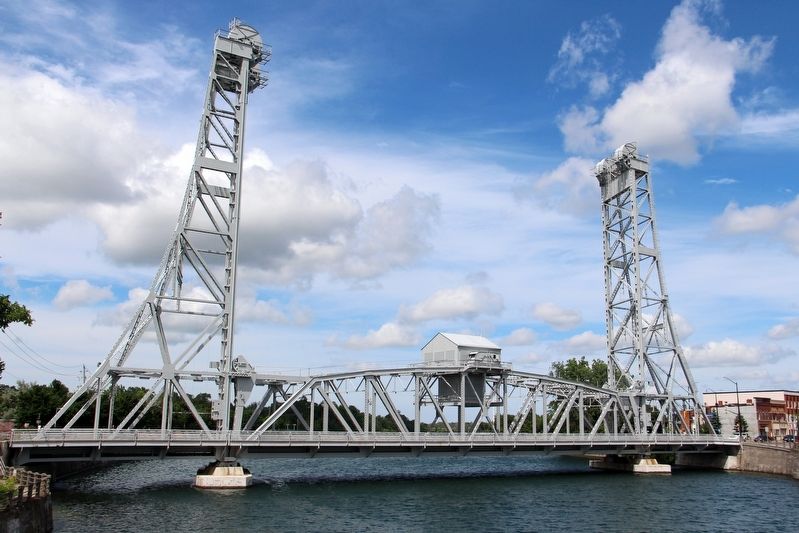
This bridge was built in 1927-1930 during the construction of the Fourth Welland Canal (1913-1933). It was one of the three largest vertical lift bridges on the canal and is unique because its towers are set at an angle to the waterway. The bridge was constructed by the Dominion Bridge Company of Lachine, Quebec with all the structural high steel erected by the First Nation Mohawks.
Ce pont fut construit entre 1927-1930 en conjonction avec la construction du Quatrième Canal de Welland (1913-1933). C’était un des trois plus gros ponts levant verticaux sur le canal. Il est unique car ses tours sont construites à un angle au parcours d’eau. La Compagnie Dominion Bridge de Lachine, Québec l’a construit et la structure entière fut montée par la Première Nation Mohawk.
Topics and series. This historical marker is listed in these topic lists: Bridges & Viaducts • Indigenous Peoples and Communities • Waterways & Vessels. In addition, it is included in the The Welland Canals series list. A significant historical year for this entry is 1927.
Location. 42° 59.491′ N, 79° 15.05′ W. Marker is in Welland, Ontario,
this page online

Regionally, this marker is on Ontario’s Golden Horseshoe and in Niagara Canada. It is also in Central Canada. Globally, it is in North America, on the Great Lakes, in the Western Hemisphere, in the Western World, and in the Anglosphere. Historically, it finds itself in what was once a British colony, the Viceroyalty of New France, the Haudenosaunee (Iroquois) Confederacy, and Rupert’s Land.
Other nearby markers. At least 8 other markers are within walking distance of this marker: Main Street Bridge 1930 (here, next to this marker); Heritage Site Guide - W West | Ouest (a few steps from this marker); The Bridges of the Fourth Canal (within shouting distance of this marker); The Main and Division St. Bridges (within shouting distance of this marker); M. Beatty & Sons, Foundry and Machine Shops

Photographed by Kevin Westell, July 21, 2025
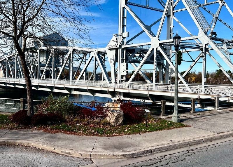
2. Main Street Bridge (Bridge 13) / Pont de la Rue Main (Pont 13) - Marker in context 2025
Photo faces south and south-west from East Main Street. King Street is on the left, the Welland recreational canal is on the right.
cmh2315fl via Flickr (CC BY-NC 2.0), July 28, 2017
3. Main Street Bridge (Bridge 13)/Pont de la Rue Main (Pont 13)
Photographed by Tim Boyd, November 18, 2024
4. Main Street Bridge (Bridge 13)/Pont de la Rue Main (Pont 13) Marker

Photographed by Kevin Westell, July 21, 2025
5. Main Street Bridge (Bridge 13) - View vertically up through the east counterweight shaft
In the photo, the "up-and-down" beams (up and down on the photo) are parallel to the road; and the left-right beams are parallel to the canal. There is a skew at an angle of 22 degrees from square.
Credits. This page was last revised on September 26, 2025. It was originally submitted on April 23, 2022, by Duane and Tracy Marsteller of Murfreesboro, Tennessee. This page has been viewed 300 times since then and 18 times this year. Last updated on September 8, 2025, by Kevin Westell of St. Catharines, Ontario. Photos: 1. submitted on April 23, 2022, by Duane and Tracy Marsteller of Murfreesboro, Tennessee. 2. submitted on July 22, 2025, by Kevin Westell of St. Catharines, Ontario. 3. submitted on April 23, 2022, by Duane and Tracy Marsteller of Murfreesboro, Tennessee. 4. submitted on November 19, 2024, by Tim Boyd of Hamilton, Ontario. 5. submitted on July 22, 2025, by Kevin Westell of St. Catharines, Ontario. • Devry Becker Jones was the editor who published this page.
