Fonthill in Niagara-on-the-Lake in Niagara Region, Ontario — Central Canada (North America)
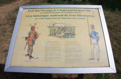
Fort Mississauga is a National Historic Site
an important part of Canada's story!
Photographed by Dale K. Benington, July 27, 2011
1. Fort Mississauga is a National Historic Site Marker
• Mississauga Point was the location of a Neutral First Nation fishing settlement by the 15th century.
• The area was under the control of the Seneca Nation during the late 17th century, and it became home to the Mississauga Nation by the 18th century.
• Fort Mississauga was begun during the War of 1812, and helped the British and Canadians defend the Niagara frontier against a powerful invading American army in 1814.
• It was completed after the War, and was a part of a defense system including Fort George, Butler's Barracks, and Fort Erie. The Niagara forts were a part of a chain of forts located along the Canadian-USA border, on the Great Lakes.
•Built as an emergency field fortification, this is the only example of a star shaped earthwork in Canada.
•The central tower was built on a foundation made from brick and stone salvaged from the rubble of the town of Newark, the first Capital of Upper Canada.
• Garrisoned by the British until 1855, Fort Mississauga was later used by the Canadian military for Summer training camps begun in the 1870's, during both World Wars, and the Korean conflict (or up
this page online
• By the late 1870's a 9 hole golf course had been laid out on Mississauga Point.
Erected by Parcs Canada.
Topics. This historical marker is listed in these topic lists: Colonial Era • Forts and Castles • War of 1812. A significant historical year for this entry is 1812.
Location. 43° 15.688′ N, 79° 4.637′ W. Marker is in Niagara-on-the-Lake, Ontario, in Niagara Region. It is in Fonthill. It can be reached from Simcoe Street just north of Front Street when traveling north. This historical marker is located on the Canadian side of the mouth of the Niagara River, where the river empties into Lake Ontario. It is situated along the river on the northern edge of the Niagara-on-the-Lake Golf Course, at the end of the Fort Mississauga footpath that leads to the site of Fort Mississauga. This historical marker is located just inside of the fort's first defensive earthwork, along the pathway leading to the entrance of the fort. Touch for map. Marker is at or near this postal address: 223 Queen St, Niagara-on-the-Lake ON L0S 1J0, Canada. Touch for directions.

Regionally, this marker is on Ontario’s
Photographed by Dale K. Benington, July 27, 2011
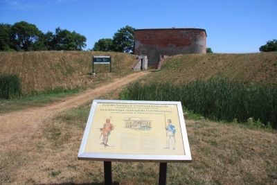
2. Fort Mississauga is a National Historic Site Marker
View of the historical marker situated along the pathway that goes to the front entrance of Fort Mississauga.
Other nearby markers. At least 8 other markers are within walking distance of this marker: A Fort Evolves (within shouting distance of this marker); A Strategic Location (within shouting distance of this marker); Fort Mississauga Trail (about 240 meters away, measured in a direct line); Richardson-Kiely House circa 1832 (approx. 0.4 kilometers away); Cottage Hospital circa 1820, 1920-1951 (approx. 0.4 kilometers away); William Kirby's Home (approx. 0.4 kilometers away); McDougal-Harrison House 1820 (approx. half a kilometer away); Rogers-Harrison House 1817 (approx. half a kilometer away). Touch for a list and map of all markers in Niagara-on-the-Lake.
Other markers no longer nearby. Fort Mississauga (was within shouting distance of this marker but has been confirmed
Photographed by Dale K. Benington, July 27, 2011
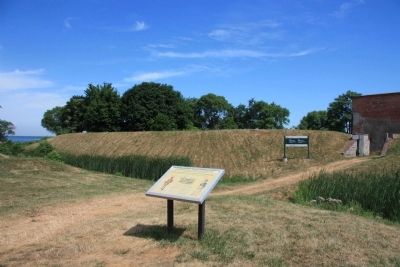
3. Fort Mississauga is a National Historic Site Marker
Another distant view of the historical marker situated along the pathway that leads to the front entrance of the fort, with a view of the northwest side of the fort and beyond that a small view of Lake Ontario.
Photographed by Dale K. Benington, July 27, 2011
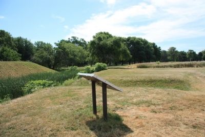
4. Fort Mississauga is a National Historic Site Marker
View of the backside of the historical marker looking south, away from the fort, along the pathway that leads to the fort.
Photographed by Dale K. Benington, July 27, 2011
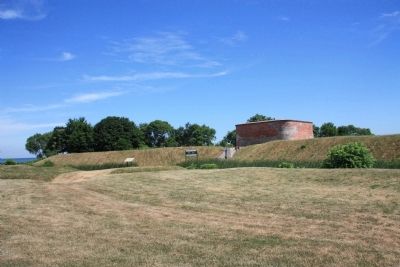
5. Fort Mississauga is a National Historic Site Marker
A very distant view, looking north along the pathway leading to the fort, of the historical marker in front of the fort, and of the west side of the fort and the fort's tower.
Credits. This page was last revised on November 10, 2025. It was originally submitted on February 4, 2012, by Dale K. Benington of Toledo, Ohio. This page has been viewed 922 times since then and 87 times this year. Last updated on September 9, 2025, by Kevin Westell of St. Catharines, Ontario. Photos: 1, 2, 3, 4, 5. submitted on February 12, 2012, by Dale K. Benington of Toledo, Ohio. • Devry Becker Jones was the editor who published this page.
