Riverdale in McLean County, North Dakota — The American Midwest (Upper Plains)
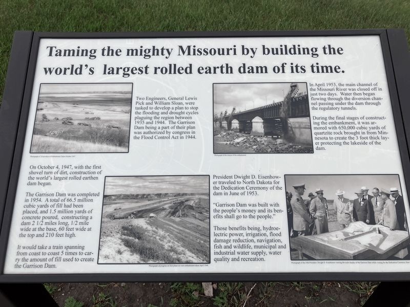
Taming the mighty Missouri by building the world's largest rolled earth dam of its time.
Photographed by Barry Swackhamer, July 23, 2025
1. Taming the mighty Missouri by building the world's largest rolled earth dam of its time. Marker
Captions: (top left) Photograph of Excavation of Embankment Taken October 1947.; (top right) Photograph of the closure of the embankment.; (bottom left) Photograph of progress on first phase on west embankment taken April 1948.; (bottom right) Photograph of the 34th President Dwight D. Eisenhower viewing the scale display of the Garrison Dam while visiting for the Dedication Ceremony June 1953.
On October 4, 1947, with the first shovel turn of dirt, construction of the world's largest rolled earthen dam began.
The Garrison Dam was completed in 1954. A total of 66.5 million cubic yards of fill had been placed, and 1.5 million yards of concrete poured. construction a dam 2 1/2 miles long, 1/2 mile wide at the base, 60 feet wide at the top and 210 feet high.
It would take a train spanning from coast to coast 5 times to carry the amount of fill used to create the Garrison Dam.
In April 1953, the main channel of the Missouri River was closed off in just two days. Water then began flowing through the diversion channel passing under the dam through the regulatory tunnels.
During the final stages of constructing the embankment, it was armored with 650,000 cubic yard of quartzite rock brought in from Minnesota to create the 3 foot thick layer
this page online
President Dwight D. Eisenhower traveled to North Dakota for the Dedication Ceremony of the Dam in June 1953.
"Garrison Dam was built with the people's money and it benefits shall go to the people." be=r Those benefits being, hydroelectric power, irrigation, flood damage reduction, navigation, fish and wildlife, municipal and industrial water supply, water quality and recreation.
Erected by US Army Corps of Engineers.
Topics. This historical marker is listed in these topic lists: Man-Made Features • Waterways & Vessels. A significant historical date for this entry is October 4, 1947.
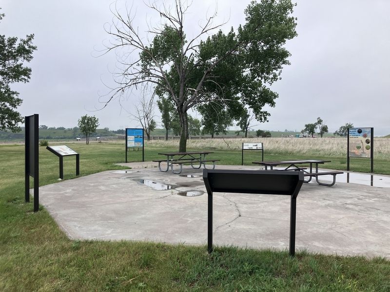
Location. 47° 29.53′ N, 101° 23.515′ W. Marker is in Riverdale, North Dakota, in McLean County. It is on State Highway 200 near West Missouri Drive. The marker is located at the Garrison Dam Overlook. Touch for map. Marker is in this post office area: Riverdale ND 58565, United States of America. Touch for directions.

Regionally, this marker is in the Mandan, Hidatsa, and Arikara Nation, in the Standing Rock Sioux Tribe, in the Drift Prairie, and on the Missouri Plateau. It is also in the American Lewis & Clark
Photographed by Barry Swackhamer, July 23, 2025
2. Taming the mighty Missouri by building the world's largest rolled earth dam of its time. Marker
Other nearby markers. At least 8 other markers are within 3 miles of this marker, measured as the crow flies: Growing out of the wheat fields and many have since returned. (here, next to this marker); Garrison Dam Overlook (within shouting distance of this marker); The Mandan, Hidatsa, and Arikara (within shouting distance of this marker); Displaced Communities (within shouting distance of this marker); The Spillway Bridge is often believed to be "the dam", (about 300 feet away, measured in a direct line); Riverdale (about 300 feet away); Powerhouse (approx. 2.2 miles away); Garrison Dam (approx. 2.2 miles away). Touch for a list and map of all markers in Riverdale.
Credits. This page was last revised on September 10, 2025. It was originally submitted on September 10, 2025, by Barry Swackhamer of Brentwood, California. This page has been viewed 115 times since then and 55 times this year. Photos: 1, 2. submitted on September 10, 2025, by Barry Swackhamer of Brentwood, California.
