
Brent in Nipissing District, Ontario — Central Canada (North America)
Brent Crater: The Discovery
La découverte
Photographed by Kevin Westell, August 28, 2017
1. Brent Crater: The Discovery - Marker

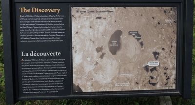
Early in 1951, John A. Roberts (president of Spartan Air Services in Ottawa) was looking at high-altitude aerial photographs taken by his company north of Brent and noticed an almost perfectly circular feature about 3 kilometres wide. Just the summer before the Royal Ontario Museum had investigated a large meteorite crater in northern Quebec and publicized the possible connection between circular markings on the Canadian Shield and meteorite impacts. Spartan Air Services alerted the Dominion Observatory of Canada in Ottawa about their discovery, and thus began extensive research on what became known as the Brent Crater.
Au début de 1951, John A. Roberts, président de la compagnie de transport aérien Spartan Air Services, à Ottawa, examinait des photos aériennes qui avaient été prises à haute altitude par sa compagnie au nord de Brent. Il remarqua tout à coup un détail cartographique d'une forme presque parfaitement circulaire, qui faisait environ 3 km de largeur. L'été précédent, le Musée royal de l'Ontario avait étudié le cratère laissé par un gros météorite dans le nord du Québec
this page online
Topics. This historical marker is listed in these topic lists: Environment • Science & Medicine. A significant historical year for this entry is 1951.
Location. 46° 3.988′ N, 78° 27.496′ W. Marker is in Brent, Ontario, in Nipissing District. It is on Brent Road, on the left when traveling south. The marker is in the north part of Algonquin Provincial Park, on the Brent Road, about 32 km (20 miles) south of Deux-Rivières and 8 km (5 miles) north of Brent, near the parking lot for the Brent Crater hiking trail, half-way up the stairs to the viewing tower. Touch for map. Marker is at or near this postal address: Brent Rd, Brent ON K0J 1R0, Canada. Touch for directions.

Regionally, this marker is in Northeastern Ontario and specifically in Northern Ontario. It is also in Central Canada.
Photographed by Kevin Westell
2. Brent Crater: The Discovery - Marker in context
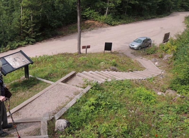
Photo faces north from the stairs to the viewing tower for the Brent Crater hiking trail. The marker (far left) is part way up the stairs.
Other nearby markers. At least 2 other markers are within 26 kilometers of this marker, measured as the crow flies: Brent Crater (a few steps from this marker); Rapids of the Upper Ottawa (approx. 24.6 kilometers away).
More about this marker. A day-use pass for Algonquin Park is required to use the Brent Crater hiking trail and its viewing tower.
Also see . . . Brent Crater, by Charles O'Dale (A geological summary). (Submitted on September 11, 2025, by Kevin Westell of St. Catharines, Ontario.)
Photographed by Kevin Westell, August 28, 2017
3. Brent Crater Viewing Tower
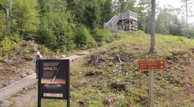
Photo faces south, from Brent Road. The marker is right, partially concealed by the tree on the hill.
Credits. This page was last revised on September 11, 2025. It was originally submitted on September 11, 2025, by Kevin Westell of St. Catharines, Ontario. This page has been viewed 89 times since then and 19 times this year. Photos: 1, 2, 3. submitted on September 11, 2025, by Kevin Westell of St. Catharines, Ontario. • Andrew Ruppenstein was the editor who published this page.
