Near Atoka in Atoka County, Oklahoma — The American South (West South Central)
Boggy Depot
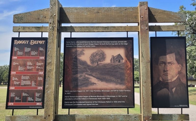
Cyrus Harris
Photographed by James Hulse, September 10, 2025
1. Boggy Depot Marker
Left Panel
1800 - 1850
1837 - Chickasaws settle at Boggy Depot Cyrus Harris among the first to arrive.
1840 - Cyrus Kingsbury & Ebenezer Hotchkin found Presybterian Mission Church at Boggy Depot
1840-1860 - Shawnee / Texas Trail also known as the Military Road stops at Boggy Depot
1849 - Post Office established at Boggy Depot
1855 - Treaty between the Choctaws & Chickasaws Establish Boggy Depot in the
this page online
1858-1860 - Boggy Depot home of Choctaw Capitol & Council
1858 - Butterfield Overland Stage & Mail Route stops at Boggy Depot
1859 - Governor Basil LeFlore holds Choctaw Council at Boggy Depot
1859 - Allen Wright Moves to Boggy Depot
1866 Allen Wright elected Principle Chief of Choctaw Nation
1866 - Treaty between Choctaws Chickasaws, and the US Government to permanently redraw land boundries.
1866 - The Choctaws and Chickasaws, in consideration of the sum of three hundred thousand dollars, hereby cede to the United States the territory west of the 98° west longitude.
1869 - Rev. J.S. Murrow establishes a Masonic Lodge at Boggy Depot
1871-1872 - MK&T Railroad Finishes tracks at nearby Atoka
1883 - Boggy Depot Post Office stops mail service
1958 - Boggy Depot recognized as an Oklahoma State Park
1972 - Boggy Depot added to the National Register for Historic Places
2010 - Future Closure of Boggy Depot State Park Announced
2011 - Choctaw & Chickasaw Nations
Photographed by James Hulse, September 10, 2025
2. Boggy Depot Marker - Reverse Side
Timeline, courtesy of the Choctaw Nation
Right Panel
Captions
(Photo #1) Governor Cyrus Harris Image courtesy: Oklahoma Historical Society
Reverse Side
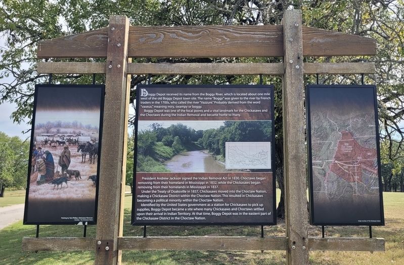
Boggy Depot received its name from the Boggy River, which is located about one mile west of the old Boggy Depot town site. The name "Boggy" was given to the river by French traders in the 1700s, who called the river "Vazzure." Probably derived from the word "vaseux," meaning miry, swampy or boggy. Boggy Depot was one of the focal points and a vital landmark for the Chickasaws and the Choctaws during the Indian Removal and became home to many.
President Andrew Jackson signed the Indian Removal Act in 1830. Choctaws began removing from their homeland in Mississippi in 1832, while the Chickasaws began removing from their homelands in Mississippi in 1837. Under the Treaty of Doaksville in 1837, Chickasaws moved into the Choctaw Nation, making a Chickasaw District within the Choctaw Nation. This resulted in Chickasaws becoming a political minority within the Choctaw Nation. Identified by the United States government as a station
Photographed by James Hulse, September 10, 2025
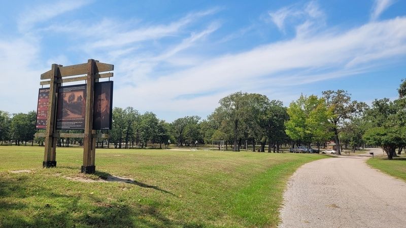
3. The view of the Boggy Depot Marker along the park road
Left Panel
Captions
(Photo #1) Painting by Tom Phillips, Chickasaw Removal. Courtesy: The Chickasaw Nation
Right Panel
Captions
(Photo #1) Image courtesy of The Chickasaw Nation
Topics. This historical marker is listed in these topic lists: Indigenous Peoples and Communities • Parks & Recreational Areas. A significant historical date for this entry is August 22, 1817.
Location. 34° 19.201′ N, 96° 18.547′ W. Marker is near Atoka, Oklahoma, in Atoka County. It is on South Park Lane 1½ miles north of W Boggy Depot Rd, on the left when traveling north. The marker is located on grounds of the Historic Boggy Depot State Park. Touch for map. Marker is at or near this postal address: 4684 S Park Ln, Atoka OK 74525, United States of America. Touch for directions.

Regionally, this marker is in the Choctaw Nation and in Southeast Oklahoma—Choctaw Country. It is also in the American South, specifically on the prairies, and on the Southern Plains. Globally, it is in North America, the Western Hemisphere, the Western World, and the Anglosphere. Historically, it finds itself in what was once the territory of the Mississippian Culture and also the Louisiana Purchase.
Other nearby markers. At least 8 other markers are within 12 miles of this marker, measured as the crow flies: Chickasaw and Choctaw Nations during the Civil War (a few steps from this marker); Chief Allen Wright (within shouting distance of this marker); Prairie Grassland (about 500 feet away, measured in a direct line); a different marker also named Boggy Depot (approx. 3½ miles away); Oklahoma's First Catholic Church (approx. 9.8 miles away); Captain Atoka (approx. 11.4 miles away); Vietnam War Memorial (approx. 11.4 miles away); 45th Infantry Division Memorial Highway (approx. 11.4 miles away). Touch for a list and map of all markers in Atoka.
Credits. This page was last revised on September 13, 2025. It was originally submitted on September 12, 2025, by James Hulse of Medina, Texas. This page has been viewed 169 times since then and 65 times this year. Photos: 1, 2, 3. submitted on September 13, 2025, by James Hulse of Medina, Texas.
