Farmington in Ontario County, New York — The American Northeast (Mid-Atlantic)
Selby Howard
Photographed by Susan A. Dalaba, September 12, 2025
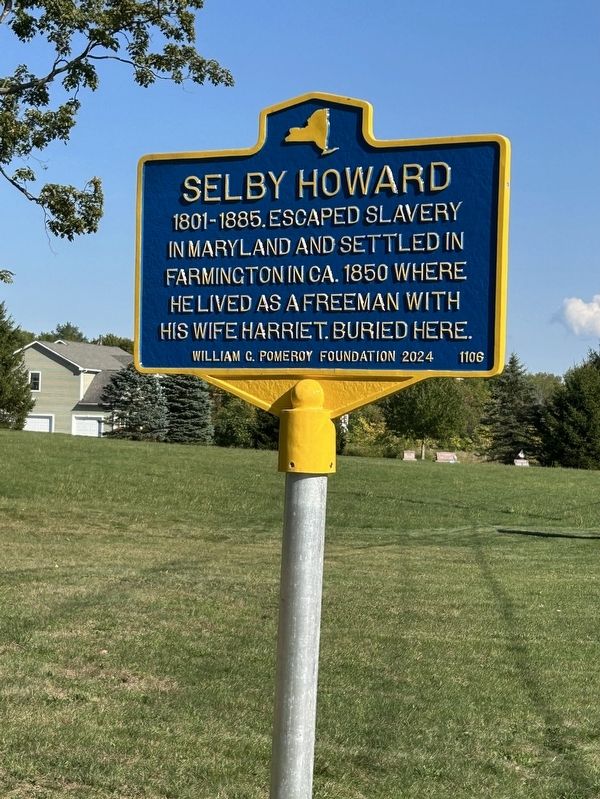
1. Selby Howard Marker
in Maryland and settled in
Farmington in ca. 1850 where
he lived as a freeman with
his wife Harriet. Buried here.
Erected 2024 by William G. Pomeroy. (Marker Number 1106.)
Topics and series. This historical marker is listed in these topic lists: Abolition & Underground RR • African Americans • Cemeteries & Burial Sites. In addition, it is included in the William G. Pomeroy Foundation series list. A significant historical year for this entry is 1801.
Location. 43° 1.623′ N, 77° 19.131′ W. Marker is in Farmington, New York, in Ontario County. It is on Sheldon Road, on the left when traveling south. Located in the North Farmington Friends Cemetery. Touch for map. Marker is at or near this postal address: 272 Sheldon Road, Macedon NY 14502, United States of America. Touch for directions.

Regionally, this marker is in Upstate New York, specifically in Western New York, in the Finger Lakes, and in the Rochester Metropolitan Area. It is also in the American Northeast and in the Mid-Atlantic. Globally, it is in North America, the Western Hemisphere, the Western World, and
this page online
Other nearby markers. At least 8 other markers are within 3 miles of this marker, measured as the crow flies: Farmington Quaker Crossroads Historic District (approx. 0.2 miles away); Friends Meeting House (approx. 0.2 miles away); Underground RR (approx. 0.6 miles away); Doty Home (approx. 1.3 miles away); Pumpkin Hook (approx. 1.3 miles away); a different marker also named Underground RR (approx. 1.6 miles away); Old Red Mill (approx. 1.9 miles away); Herendeen Homestead (approx. 2.3 miles away). Touch for a list and map of all markers in Farmington.

Photographed by Susan A. Dalaba, September 12, 2025
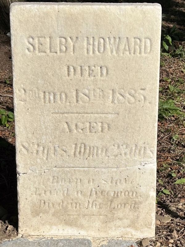
2. Selby and Harriet Howard’s Graves
Photographed by Susan A. Dalaba, September 12, 2025
3. Born a slave. Lived a freeman. Died in the Lord.

Photographed by Susan A. Dalaba, September 12, 2025
4. Cemetery located behind the meeting house.

Photographed by Susan A. Dalaba, September 12, 2025
5. Selby Howard Marker
Credits. This page was last revised on September 14, 2025. It was originally submitted on September 12, 2025, by Susan A. Dalaba of Cortland, New York. This page has been viewed 76 times since then and 24 times this year. Photos: 1, 2, 3, 4, 5. submitted on September 12, 2025, by Susan A. Dalaba of Cortland, New York. • Andrew Ruppenstein was the editor who published this page.
