Rudow in Berlin in Neukölln, Germany — Northeast German Plain (The European Plain)
Berliner Mauer
⎯⎯⎯
Berlin Wall
Photographed by Andrew Ruppenstein, September 3, 2025
1. Berliner Mauer / Berlin Wall Marker - Wall panel

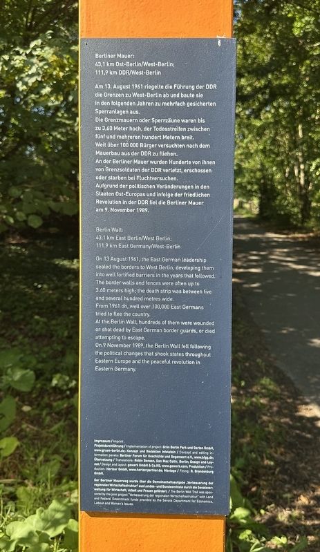
Berliner Mauer:
43,1 km Ost-Berlin/West-Berlin;
111,9 km DDR/West-Berlin
Am 13. August 1961 riegelte die Führung der DDR die Grenzen zu West-Berlin ab und baute sie in den folgenden Jahren zu mehrfach gesicherten Sperranlagen aus.
Die Grenzmauern oder Sperrzäune waren bis zu 3,60 Meter hoch, der Todesstreifen zwischen fünf und mehreren hundert Metern breit. Weit über 100 000 Bürger versuchten nach dem Mauerbau aus der DDR zu fliehen.
An der Berliner Mauer wurden Hunderte von ihnen von Grenzsoldaten der DDR verletzt, erschossen oder starben bei Fluchtversuchen.
Aufgrund der politischen Veränderungen in den Staaten Ost-Europas und infolge der friedlichen Revolution in der DDR fiel die Berliner Mauer am 9. November 1989.
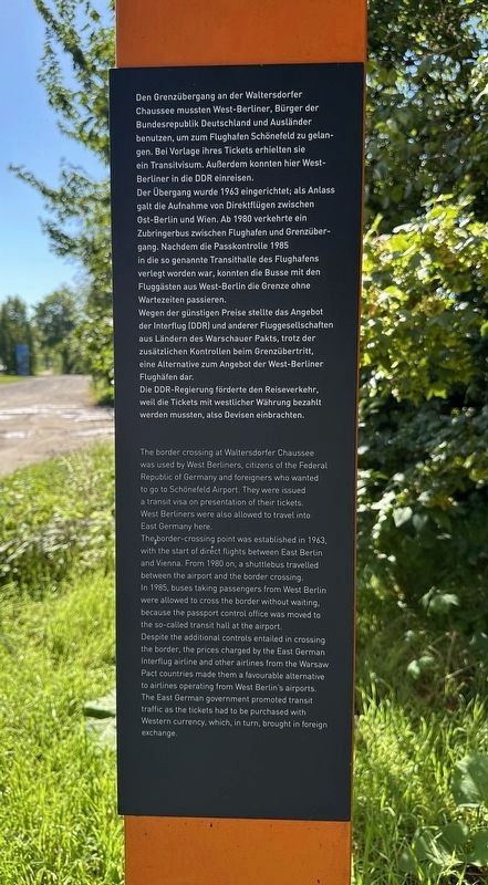
Grenzübergang Waltersdorfer Chausee
Chaussee mussten West-Berliner, Bürger der Bundesrepublik Deutschland und Ausländer benutzen, um zum Flughafen Schönefeld zu gelangen. Bei Vorlage ihres Tickets erhielten sie ein Transitvisum. Außerdem konnten hier West-Berliner in die DDR einreisen.
Der Übergang wurde 1963 eingerichtet; als Anlass galt die Aufnahme von Direktflügen zwischen Ost-Berlin und Wien. Ab 1980 verkehrte ein Zubringerbus zwischen Flughafen und Grenzübergang. Nachdem die Passkontrolle 1985 in die so genannte Transithalle des Flughafens verlegt worden war, konnten die Busse mit den Fluggästen aus West-Berlin die Grenze ohne Wartezeiten passieren.
Wegen der günstigen Preise stellte das Angebot der Interflug (DDR) und anderer Fluggesellschaften aus Ländern des Warschauer Pakts, trotz der zusätzlichen Kontrollen beim Grenzübertritt, eine Alternative zum Angebot der West-Berliner Flughäfen dar.
Die DDR-Regierung förderte den Reiseverkehr, weil die Tickets mit westlicher Währung bezahlt werden mussten, also
this page online
Berlin Wall:
43.1 km East Berlin/West Berlin;
111.9 km East Germany/West-Berlin
On 13 August 1961, the East German leadership sealed the borders to West Berlin, developing them into well fortified barriers in the years that followed. The border walls and fences were often up to 3.60 meters high; the death strip was between five and several hundred metres wide.
From 1961 on, well over 100,000 East Germans tried to flee the country.
At the, Berlin Wall, hundreds of them were wounded or shot dead by East German border guards, or died attempting to escape.
On 9 November 1989, the Berlin Wall fell following the political changes that shook states throughout Eastern Europe and the peaceful revolution in Eastern Germany.
Waltersdorfer Chaussee Border Crossing
The border crossing at Waltersdorfer Chaussee was used by West Berliners, citizens of the Federal Republic of Germany and foreigners who wanted to go to Schönefeld Airport. They were issued a transit visa on presentation of their tickets. West Berliners were also allowed to travel into East Germany here.
The
Photographed by Andrew Ruppenstein, September 3, 2025
2. Berliner Mauer / Berlin Wall Marker - Border Crossing panel
In 1985, buses taking passengers from West Berlin were allowed to cross the border without waiting, because the passport control office was moved to the so-called transit hall at the airport.
Despite the additional controls entailed in crossing the border, the prices charged by the East German Interflug airline and other airlines from the Warsaw Pact countries made them a favourable alternative to airlines operating from West Berlin's airports. The East German government promoted transit traffic as the tickets had to be purchased with Western currency, which, in turn, brought in foreign exchange.
Topics and series. This historical marker is listed in these topic lists: Air & Space • Man-Made Features • War, Cold. In addition, it is included in the Berlin Wall series list. A significant historical date for this entry is August 13, 1961.
Location. 52° 24.071′ N, 13° 30.818′ E. Marker is in Berlin, in Neukölln. It is in Rudow. It is on Waltersdorfer Chaussee, on the right when traveling south. Touch for map. Marker is at or near this postal address: Waltersdorfer Ch 197, Berlin 12355, Germany. Touch for directions.

Regionally, it is in Europe, the European Union, Atlantic Europe, Central Europe, the Schengen Area, Western Europe, and the Western World. Historically, it finds itself in what was once the Holy Roman Empire, the former West Germany, and at the Berlin Wall.
Other nearby markers. At least 8 other markers are within 14 kilometers of this marker, measured as the crow flies: Die Geschichte dahinter / The history behind (approx. 1.1 kilometers away in Brandenburg); Die Glocken der Dorfkirche Schönefeld / The Bells of the Schönefeld Village Church
Photographed by Andrew Ruppenstein, September 3, 2025
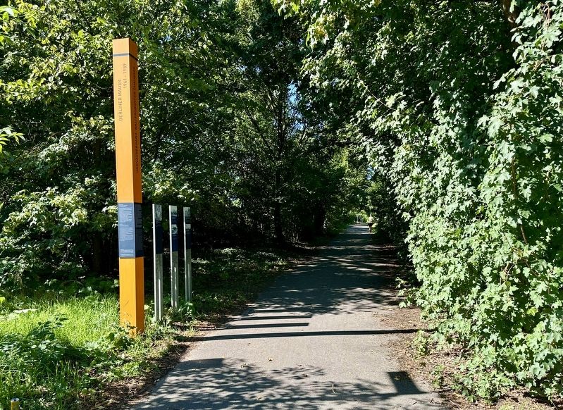
3. Berliner Mauer / Berlin Wall Marker - wide view, looking west
The marker consists of the 2 panels attached to the orange post, plus 3 additional pictorial panels (see following photos). The marker is set next to a paved pedestrian/bicycle path that follows much of the course of the former wall. The Berlin-Brandenburg border is only a few meters south of this marker.
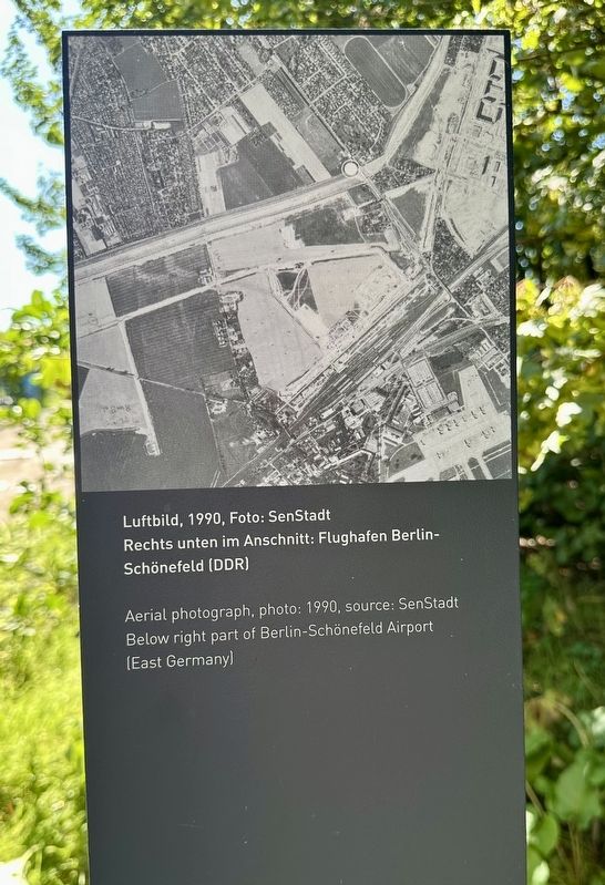
1990
4. Berliner Mauer / Berlin Wall Marker - photo stele 1
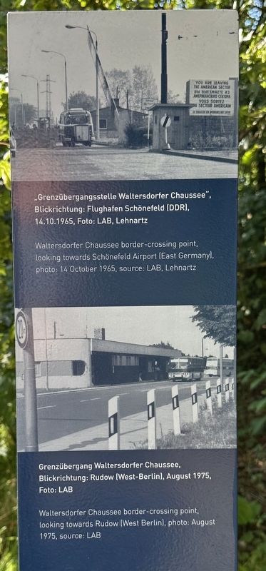
Photographed by Andrew Ruppenstein, September 3, 2025
5. Berliner Mauer / Berlin Wall Marker - photo stele 2
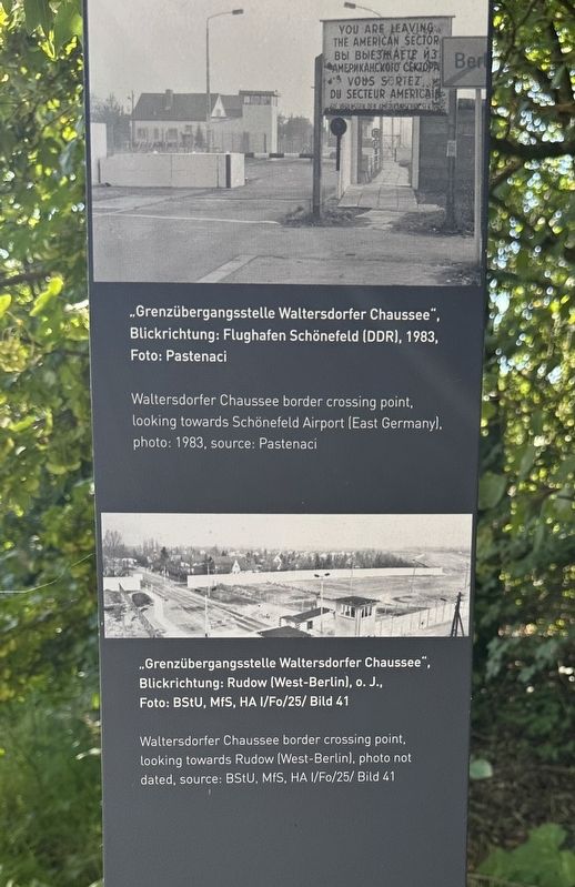
Photographed by Andrew Ruppenstein, September 3, 2025
6. Berliner Mauer / Berlin Wall Marker - photo stele 3
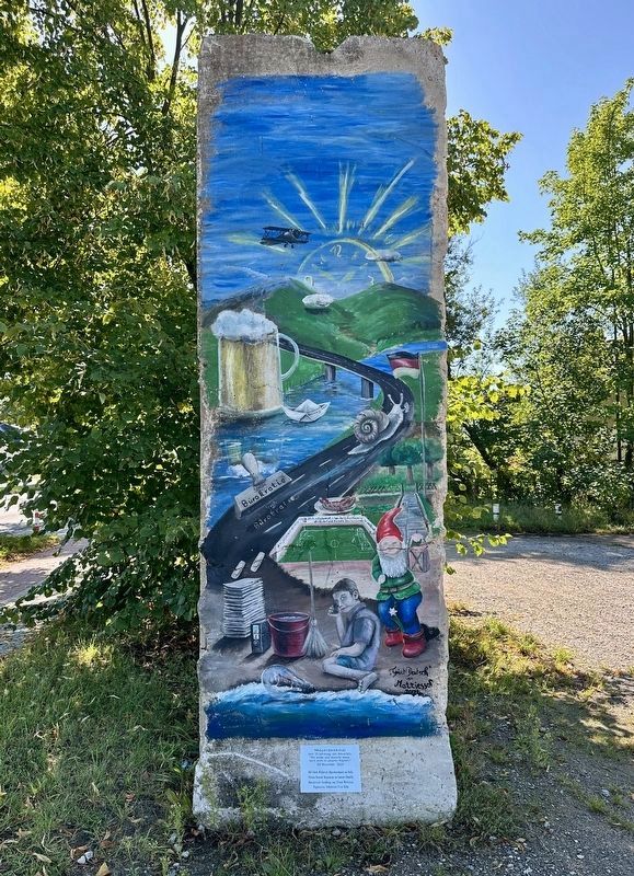
Photographed by Andrew Ruppenstein, September 3, 2025
7. Schönefeld Mauerdenkmal/Wall Memorial
Just 40 meters south of the marker is a memorial erected on the 35th anniversary of the fall of the wall (Nov. 9, 2024), whose title would translate to: Never again a wall in Germany or in our heads. The artwork is by Silvana Mattiesson.
Credits. This page was last revised on September 30, 2026. It was originally submitted on September 13, 2025, by Andrew Ruppenstein of Lamorinda, California. This page has been viewed 138 times since then and 66 times this year. Photos: 1, 2. submitted on September 13, 2025, by Andrew Ruppenstein of Lamorinda, California. 3, 4, 5, 6, 7. submitted on September 14, 2025, by Andrew Ruppenstein of Lamorinda, California.
