Near Harmon in Burleigh County, North Dakota — The American Midwest (Upper Plains)
Early Maps Illustrating Double Ditch
Double Ditch Indian Village State Historic Site
Photographed by Barry Swackhamer, July 22, 2025
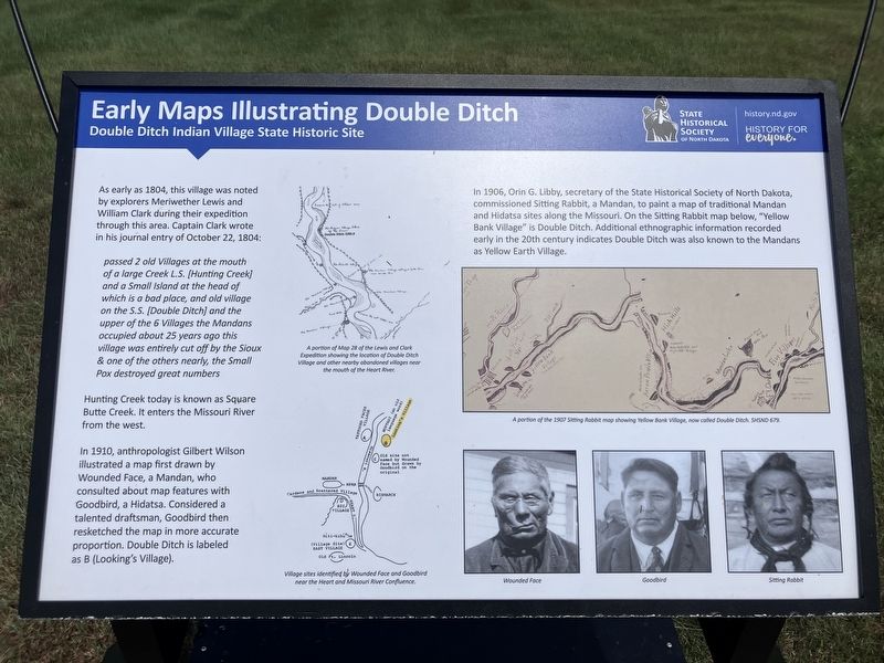
1. Early Maps Illustrating Double Ditch Marker
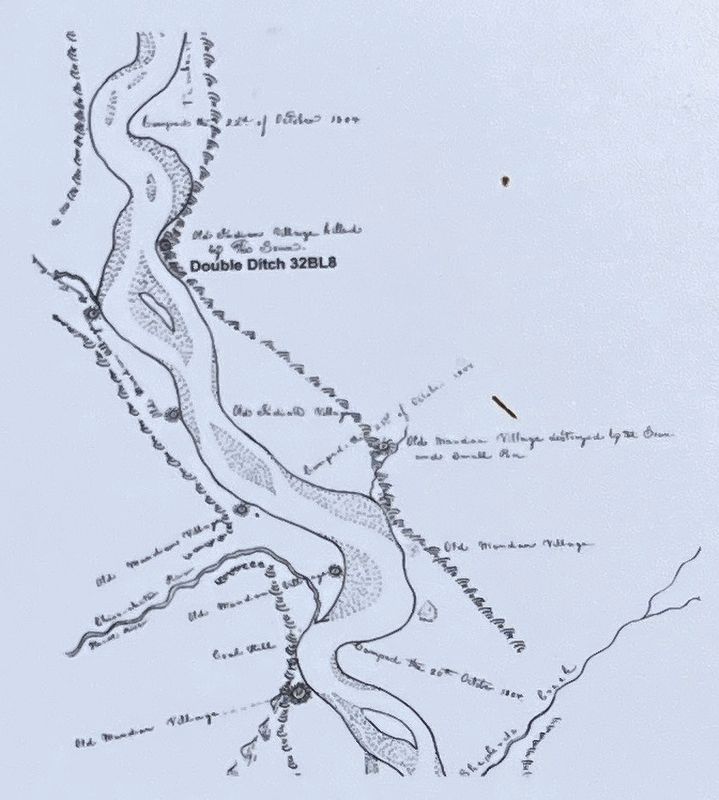
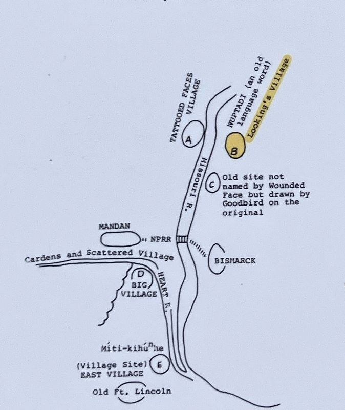
Captions: (upper center) A portion on Map 28 of the Lewis and Clark Expedition showing the location of Double Ditch Village and other nearby abandoned villages near the mouth of Heart River.; (lower center) Village sites identified by Wounded Face and Goodbird near the Heart and Missouri River Confluence.; (middle right) A portion of the 1907 Sitting Rabbit map showing Yellow Bank Village, now called Double Ditch.; (bottom right, three portraits L to R) Wounded Face, Goodbird, Sitting Rabbit.
passed 2 old villages at the mouth of a large Creek L.S, [Hunting Creek] and a Small Island at the head of which is a bad place, and old village on the S.S. [Double Ditch] and the upper of the 6 Villages the Mandans occupied about 25 years ago this village was entirely cut off by the Sioux & one of the others nearly, the Small Pox destroyed great numbers.
Hunting Creek today is known as Square Butte Creek, It enters the Missouri River from the west.
In 1910, anthropologist Gilbert Wilson illustrated a map first drawn by Wounded Face, a Mandan, who consulted about map features with Goodbird, a Hidatsa. Considered a talented draftsman, Goodbird then resketched the map in more accurate proportion. Double Ditch is labeled as B (Looking's Village).
In 1906, Orin G. Libby, secretary of the State Historical Society of North Dakota, commissioned Sitting Rabbit, a Mandan, to paint a map of traditional Mandan and Hidatsa
this page online
Erected by State Historical Society of North Dakota.
Topics and series. This historical marker is listed in these topic lists: Anthropology & Archaeology • Exploration • Indigenous Peoples and Communities • Settlements & Settlers. In addition, it is included in the Lewis & Clark Expedition series list. A significant historical date for this entry is October 22, 1804.
Location. 46° 56.045′ N, 100° 53.867′ W. Marker is near Harmon, North Dakota, in Burleigh County. It can be reached from State Highway 1804 at milepost 91 near Double Ditch Loop, on the right when traveling south. Touch for map. Touch for directions.

Regionally, this marker is on the Missouri Plateau and in Greater Bismarck Area. It is also in the American Lewis & Clark Corridor, on the prairies, and on the Northern Plains. Globally, it is in North America, the Western Hemisphere, the Western World,
Photographed by Barry Swackhamer, July 22, 2025
2. Early Maps Illustrating Double Ditch Marker (detail)
A portion on Map 28 of the Lewis and Clark Expedition showing the location of Double Ditch Village and other nearby abandoned villages near the mouth of Heart River.
Other nearby markers. At least 8 other markers are within walking distance of this marker: Geophysical Prospecting in Archaeology (within shouting distance of this marker); a different marker also named Geophysical Prospecting in Archaeology (within shouting distance of this marker); Double Ditch State Historic Site (within shouting distance of this marker); Missouri River Resources (within shouting distance of this marker); Ditch 2 (within shouting distance of this marker); Ditch 3 (about 400 feet away, measured in a direct line); Final Occupation of Double Ditch (about 400 feet away); Midden Mounds (Trash Heaps) (about 500 feet away).
Photographed by Barry Swackhamer, July 22, 2025
3. Early Maps Illustrating Double Ditch Marker (detail)
Village sites identified by Wounded Face and Goodbird near the Heart and Missouri River Confluence
Credits. This page was last revised on September 15, 2025. It was originally submitted on September 14, 2025, by Barry Swackhamer of Brentwood, California. This page has been viewed 100 times since then and 36 times this year. Photos: 1. submitted on September 14, 2025, by Barry Swackhamer of Brentwood, California. 2, 3. submitted on September 15, 2025, by Barry Swackhamer of Brentwood, California.
