
Near Kinston in Lenoir County, North Carolina — The American South (South Atlantic)
North Carolina
Civil War Trails
Photographed by Kevin W., October 20, 2009
1. North Carolina Civil War Trails Marker
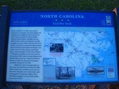
North Carolina's Civil War stories are as diverse as its landscape. The Outer Banks and coastal rivers saw action early in the war, as Union forces occupied the region. Stories abound of naval battles, blockade running, Federal raids, and the Confederacy's struggle to supply its armies. Other tales are told in the western mountains, a sometimes-lawless region where Unionists and Confederates fought a war within a war. In the rolling central piedmont, memories linger of Union Gen. William T. Sherman's relentless march north early in the spring of 1865, when his army defeated the Confederates under Gen. Joseph E. Johnston. Finally, on April 26, Johnston surrendered, essentially ending the Civil War.
Experience these and many more stories as you tour the North Carolina Civil War Trails. Please drive carefully as you visit the sites where ironclads and wooden ships, spies and smugglers, heroes and villains, slaves and soldiers engaged in the greatest conflict in American history.
Erected by North Carolina Civil War Trails.
Topics. This historical marker is listed in this topic list: War, US Civil.
Location. 35° 13.078′ N,
this page online

Regionally, this marker is in North Carolina’s Coastal Plain. It is also in the American South and specifically in the Upper South. Globally, it is in North America, the Western Hemisphere, the Western World, and the Anglosphere. Historically, it finds itself in what was once the territory of the Mississippian Culture, one of the original Thirteen Colonies, one of the Confederate States of America, and the Antebellum South.
Other nearby markers. At least 8 other markers are within 5 miles of this marker, measured as the crow flies: Battle of Wyse Fork (here, next to this marker); a different marker also named Battle of Wyse Fork (approx. 1.1 miles away); General Robert Hoke Monument (approx. 1.1 miles away); a different marker also named Battle of Wyse Fork (approx. 1.6 miles away); Confederate Headquarters (approx. 2½ miles away); Battle of Kinston (approx. 4.2 miles away); Lenoir County Confederate Memorial (approx. 4.2 miles away); In Honor and Remembrance (approx. 4.2 miles away). Touch for a list and map of all markers in Kinston.
More about this marker. This is Wyse Fork Battle Tour Stop #9.
Credits. This page was last revised on September 17, 2025. It was originally submitted on September 17, 2025, by Bernard Fisher of Richmond, Virginia. This page has been viewed 96 times since then and 33 times this year. Photo 1. submitted on October 29, 2009, by Kevin W. of Stafford, Virginia.
