St. Davids in Niagara-on-the-Lake in Niagara Region, Ontario — Central Canada (North America)
Lowrey Park
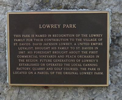
Photographed by Kevin Westell, September 17, 2025
1. Lowrey Park - Marker
Topics. This historical marker is listed in these topic lists: Agriculture • Charity & Public Work • Industry & Commerce. A significant historical year for this entry is 1867.
Location. 43° 9.512′ N, 79° 6.53′ W. Marker is in Niagara-on-the-Lake, Ontario, in Niagara Region. It is in St. Davids. It is at the intersection of York Road (Route 81) and Tanbark Rd, on the right when traveling west on York Road. Touch for map. Marker is at or near this postal address: 245 Tanbark Road, Niagara-on-the-Lake ON L0S 1P0, Canada. Touch for directions.

Regionally, this marker is on the Golden Horseshoe and in Niagara Canada. It is also in Central Canada.
this page online
Other nearby markers. At least 8 other markers are within 3 kilometers of this marker, measured as the crow flies: S.S. No. 5 St. Davids School Bell (about 180 meters away, measured in a direct line); Woodbourne House 1839 (approx. half a kilometer away); The Burning of St. Davids 1814 (approx. half a kilometer away); Headquarters of DeRottenberg (approx. 0.7 kilometers away); Secord Mill 1782-83 (approx. 0.8 kilometers away); St. David's - Queenston United Church - War Memorial Plaque (approx. 0.8 kilometers away); Sheaffe's Path to Victory (approx. 2.1 kilometers away); Indian Ossuary (approx. 2.3 kilometers away). Touch for a list and map of all markers in Niagara-on-the-Lake.
Also see . . . Ravine Vineyard Estate Winery - David Lowrey's descendants continuing to farm. (Submitted on September 19, 2025, by Kevin Westell of St. Catharines, Ontario.)
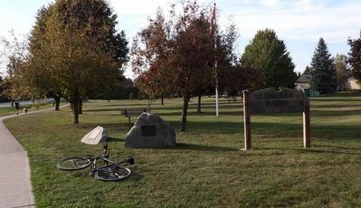
Photographed by Kevin Westell, September 17, 2025
2. Lowrey Park
Photo faces north-west from near York Rd and Tanbark Rd. The road on the left is Queenston Road. The historical plaque and a related dedication plaque are on low rocks, in the south-east corner of the park.
Credits. This page was last revised on September 19, 2025. It was originally submitted on September 19, 2025, by Kevin Westell of St. Catharines, Ontario. This page has been viewed 64 times since then and 20 times this year. Photos: 1, 2. submitted on September 19, 2025, by Kevin Westell of St. Catharines, Ontario. • Andrew Ruppenstein was the editor who published this page.
