Pawhuska in Osage County, Oklahoma — The American South (West South Central)
Osage Buffalo Hunting Trails
Photographed by James Hulse, September 12, 2025
1. Osage Buffalo Hunting Trails Marker
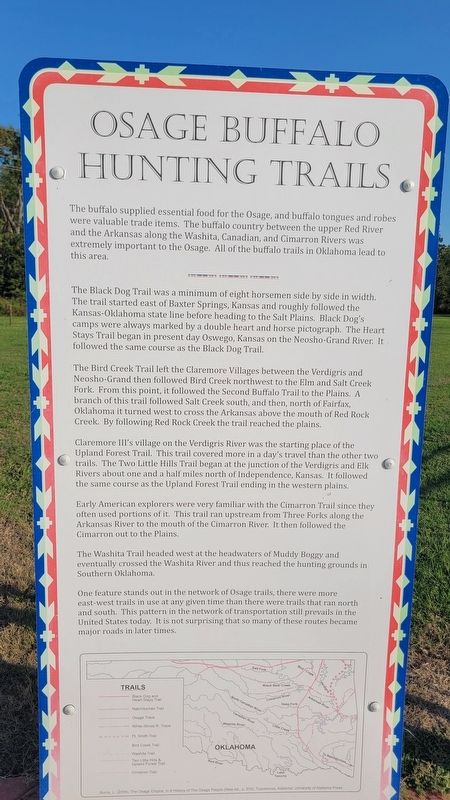
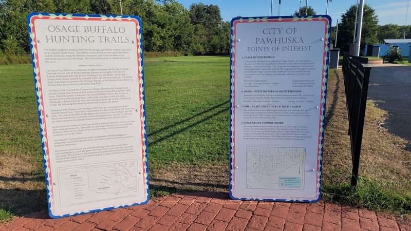
The Black Dog Trail was a minimum of eight horsemen side by side in width. The trail started east of Baxter Springs, Kansas and roughly followed the Kansas-Oklahoma state line before heading to the Salt Plains. Black Dog's camps were always marked by a double heart and horse pictograph. The Heart Stays Trail began in present day Oswego, Kansas on the Neosho-Grand River. It followed the same course as the Black Dog Trail.
The Bird Creek Trail left the Claremore Villages between the Verdigris and Neosho-Grand then followed Bird Creek northwest to the Elm and Salt Creek Fork. From this point, it followed the Second Buffalo Trail to the Plains. A branch of this trail followed Salt Creek south, and then, north of Fairfax, Oklahoma it turned west to cross the Arkansas above the mouth of Red Rock Creek. By following Red Rock Creek the trail reached the plains.
Claremore III's village on the Verdigris River was the starting place of the Upland Forest Trail. This trail covered more in a day's travel than the other two trails. The Two Little Hills Trail began at the junction of the Verdigris and Elk Rivers about one and a half miles north of Independence, Kansas. It followed the same course as the Upland Forest Trail ending in the western plains.
Early American explorers were very familiar with the Cimarron Trail since they often used portions of it. This trail ran upstream from Three Forks along the Arkansas River to the mouth of the Cimarron River. It then followed the Cimarron out to the Plains.
The
this page online
One feature stands out in the network of Osage trails, there were more east-west trails in use at any given time than there were trails that ran north and south. This pattern in the network of transportation still prevails in the United States today. It is not surprising that so many of these routes became major roads in later times.
Captions
(Diagram #1) Trails
Black Dog and Heart Stays Trail • Natchitoches Trail • Osage Trace • White-Illinois R. Trace • Ft. Smith Trail • Bird Creek Trail • Washita Trail • Two Little Hills & Upland Forest Trail • Cimaron Trail
Burma, L. (2004), The Osage Empire, In A History of The Osage People (New ed., p. 576), Tuscaloosa, Alabama. University of Alabama Press
Topics. This historical marker is listed in these topic lists: Animals • Indigenous Peoples and Communities • Roads & Vehicles.
Location. 36° 39.736′ N, 96° 19.864′ W. Marker is in Pawhuska, Oklahoma, in Osage
Photographed by James Hulse, September 12, 2025
2. Osage Buffalo Hunting Trails Marker (left side)

Regionally, this marker is in the Osage Nation, in Northeast Oklahoma—Green Country, and in Greater Tulsa. It is also in the American South, specifically on the prairies, and on the Southern Plains. Globally, it is in North America, the Western Hemisphere, the Western World, and the Anglosphere. Historically, it finds itself in what was once the territory of the Mississippian Culture and also the Louisiana Purchase.
Other nearby markers. At least 8 other markers are within walking distance of this marker: Deep Ford (here, next to this marker); Veterans Memorial (within shouting distance of this marker); Pawhuska (within shouting distance of this marker); a different marker also named Pawhuska (within shouting distance of this marker); a different marker also named Pawhuska (within shouting distance of this marker); First Boy Scout Troop in America
Photographed by James Hulse, September 12, 2025
3. Osage Buffalo Hunting Trails Marker
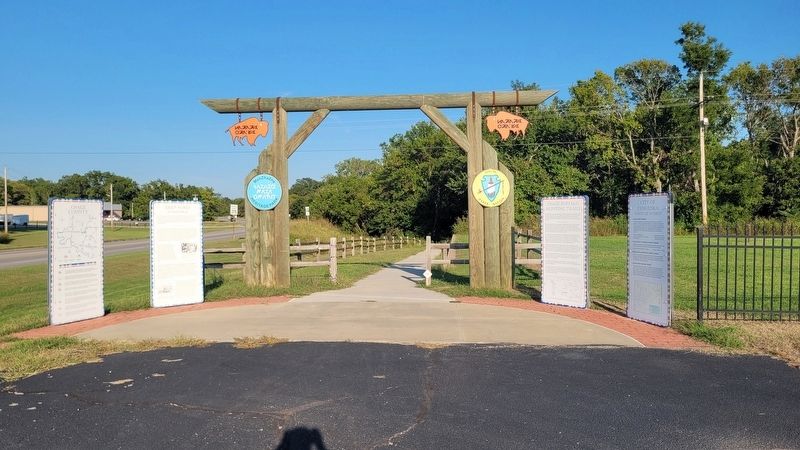
The view of the entrance to the hiking trail
Credits. This page was last revised on September 20, 2025. It was originally submitted on September 20, 2025, by James Hulse of Medina, Texas. This page has been viewed 178 times since then and 130 times this year. Photos: 1, 2, 3. submitted on September 20, 2025, by James Hulse of Medina, Texas.
