Wainfleet in Niagara Region, Ontario — Central Canada (North America)
Welcome to the Wainfleet Bog Conservation Area
Photographed by Kevin Westell, September 1, 2018
1. Welcome to the Wainfleet Bog Conservation Area - Marker Close Up
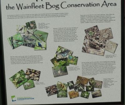
You are about to embark on a journey through one of the largest, least disturbed, and species-rich peatlands in Southern Ontario. The "Wainfleet Bog Conservation Area" spans more than 800 hectares (almost 2,000 acres), encompassing a geological history stretching back more than 10,000 years when the glaciers still covering this region from the last Ice Age began retreating.
Between 12,000 and 5,000 years ago, the lands you are now standing on were underwater and part of the Lake Eric basin that has since receded to its present shores south of this site. The Onondaga Escarpment formed a drainage barrier for the retreating waters, leaving a pocket of marshland where decomposing plant life produced thick, rich layers of peat and a domed bog. Its sponge-like qualities and low nutrients are what make this bog irreplaceable for certain plants and animals.
Peat was widely used by early setters for garden material and fuel. Mining peat from the Wainfleet Bog can traced back to the 1800's. This process continued through to 1985 when the final private owner of these lands harvesting. Remnants of the
this page online
Bogs make up less than 5% of the earth's land mass. Part of these rare peatlands were acquired by the Niagara Peninsula Conservation Authority in 1995 with the support of many generous public and private partners. This remains a natural treasure for generations to come, providing a vital lifeline for a variety of plants, songbirds, mammals and reptiles, a number of which are rare, threatened or endangered.
Peat harvesting, bog fires, agriculture and development have altered the bog, reducing it from its original extent of over 21,000 hectares (52,000 acres). Despite these disturbances, the Wainfleet Bog remains home to a rich diversity of plants and wildlife including rare species like the Massasauga Rattlesnake, Whip-poor-will, Cotton grass and Labrador tea . It also contains preserved pollen, wooden debris and charcoal remnants, that provide an historic record of plant communities, human activity, carbon storage and climatic patterns. Work continues to
Photographed by Kevin Westell, September 1, 2018
2. Welcome to the Wainfleet Bog Conservation Area - Marker wide view
Erected by Niagara Peninsula Conservation Authority.
Topics. This historical marker is listed in these topic lists: Environment • Horticulture & Forestry • Industry & Commerce • Natural Features. A significant historical year for this entry is 1985.
Location. 42° 54.597′ N, 79° 17.756′ W. Marker is in Wainfleet, Ontario, in Niagara Region. It can be reached from Erie Peat Road, on the left when traveling east. The marker is beside (west of) the parking lot for Wainfleet Bog Conservation Area, which is a loop at the end of Erie Peat Road. Touch for map. Marker is at or near this postal address: 20489 Erie Peat Road, Wainfleet ON L3K 5V4, Canada. Touch for directions.

Regionally, this marker is on the Golden Horseshoe and in Niagara Canada. It is also in Central Canada. Globally, it is in North America, on the Great Lakes, in the Western Hemisphere, in the Western World, and in the Anglosphere. Historically, it finds itself in what was once a British colony, the Viceroyalty of New France,
Photographed by Kevin Westell, September 1, 2018
3. Welcome to the Wainfleet Bog Conservation Area - Marker in context
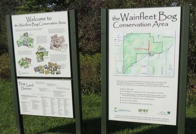
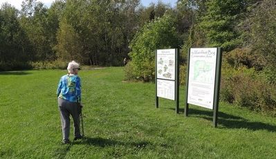
The two panels are in an open grass area, west of the parking lot and on the way to the two plain walking paths through the bog.
Other nearby markers. At least 8 other markers are within 5 kilometers of this marker, measured as the crow flies: Prisoner of War Camp August 1943 - November 1945 (here, next to this marker); Village of Humberstone Cenotaph (approx. 3.8 kilometers away); Augustine House (approx. 3.9 kilometers away); Humberstone Hall (approx. 4 kilometers away); The Ott House (approx. 4.1 kilometers away); Derek Point (approx. 4.1 kilometers away); Old Meets New - A Walk Across History (approx. 4.1 kilometers away); Knights of Columbus Gazebo (approx. 4.2 kilometers away).
Regarding Welcome to the Wainfleet Bog Conservation Area. Wainfleet bog consists of two blocks of government-owned land:
"Wainfleet Bog Conservation Area" is the disturbed land that was a former peat "mine". East of the conservation area (Google maps has it in the wrong place), the less advertised provincial "Wainfleet Bog Conservation Reserve" is virgin bog, little disturbed by Europeans.
These lands are surrounded by farms, which are excellent at artificially draining the land, which somewhat impacts the bog.
Photographed by Kevin Westell, June 13, 2026
4. Welcome to the Wainfleet Bog Conservation Area - Marker in context
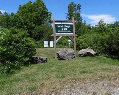
Photo faces north from Peat Bog Road, at its right turn into the parking lot for Wainfleet Bog Conservation Area. The plaque (distant centre) is in line with other markers. The west end of the parking lot is 10 metres east of the eastern-most of these signs.
Wainfleet bog has a tiny population (maybe 70 snakes) of massasauga rattlesnakes, Ontario's only rattlesnake. This shy snake avoids people, and even when it bites a human (which is extremely rare), it only injects enough venom for its typical prey - small rodents and frogs - just enough to give a human a bad day. Ontario's last snake bite death was in 1962. (Massasaugas are common on the Bruce Peninsula, near Lake Huron.)
Also see . . .
1. Wainfleet Bog Conservation Area, by Niagara Peninsula Conservation Authority. (Submitted on September 22, 2025, by Kevin Westell of St. Catharines, Ontario.)
2. Wainfleet Bog Conservation Reserve, by Ontario Parks. (Submitted on September 22, 2025, by Kevin Westell of St. Catharines, Ontario.)
3. Massasauga Rattlesnake, by the Ontario Ministry of the Environment, Conservation and Parks. (Submitted on September 22, 2025, by Kevin Westell of St. Catharines, Ontario.)
Photographed by Kevin Westell, September 1, 2018
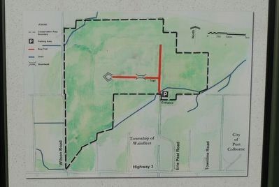
5. Wainfleet Bog Conservation Area - Map
Missing: the provincial "conservation reserve" is just east (where the map scale bar is). I walked both the red-marked trails in September 2018. The western trail was mined of peat, vegetation was bone-dry and showed fire damage from the 2016 fire. The northern trail was wilder, green grass with trees and soggy bits; and had plenty of frogs (leopard frogs and green frogs, I think), toads and plenty of enthusiastic deer flies. (I'm sure mosquitos would thrive in the cooler morning hours.)
Credits. This page was last revised on July 9, 2026. It was originally submitted on September 22, 2025, by Kevin Westell of St. Catharines, Ontario. This page has been viewed 169 times since then and 90 times this year. Photos: 1, 2, 3. submitted on September 22, 2025, by Kevin Westell of St. Catharines, Ontario. 4. submitted on June 15, 2026, by Kevin Westell of St. Catharines, Ontario. 5. submitted on September 22, 2025, by Kevin Westell of St. Catharines, Ontario. • Andrew Ruppenstein was the editor who published this page.
