
Garrison in McLean County, North Dakota — The American Midwest (Upper Plains)
Nightwalker's Butte
Indian Hills
Photographed by Barry Swackhamer
1. Nightwalker's Butte Marker
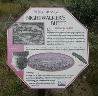
Captions: (upper left them counter-clockwise) 1952 excavation by the Smithsonian Institute as part of the Missouri River Basin Survey.; Rimsherd fragment a typical Hidarsa ceramic pot.; Stone circles are common across the plains. They are believed to have been for weighing down teepee covers and for ceremonial purposes.; Bone effigy of a salamander.
Nightwalker's Village was extensively excavated by archaeologists from the Smithsonian Institute in the 1950s, as part of the Missouri River Basin Surveys. Low circular mounds and depressions in the grass hinted at the locations of earthlodges. The excavations of the small circular houses (rarely exceeding 20 feet in diameter) exposed timber post holes, fireplaces, trenches, pit openings, deep roasting pits, and cultural materials such as stone tools, chipped stone debris, and pottery fragments. Artifacts were abundant and included hoes and knives made from the shoulder blades of bison, bone and antler fleshers, short sled-runners of bison rib, and shell objects. Very few metal objects were found, such as arrow points and knife blades, suggesting that village occupation came before frequent contact with white traders, perhaps during the latter part of the 1700s.
Archaeologists found a great number of small fragments of food bones. These fragments suggest the villagers shared the Northern Plains practice of boiling and pounding bones to extract grease and marrow. A surprisingly high proportions
this page online
Erected by Indian Hills Resort.
Topics. This historical marker is listed in these topic lists: Anthropology & Archaeology • Indigenous Peoples and Communities • Settlements & Settlers.
Location. 47° 35.965′ N, 102° 5.689′ W. Marker is in Garrison, North Dakota, in McLean County. It can be reached from the intersection of 73rd Avenue NorthWest and 14th Street NorthWest.
Photographed by Barry Swackhamer
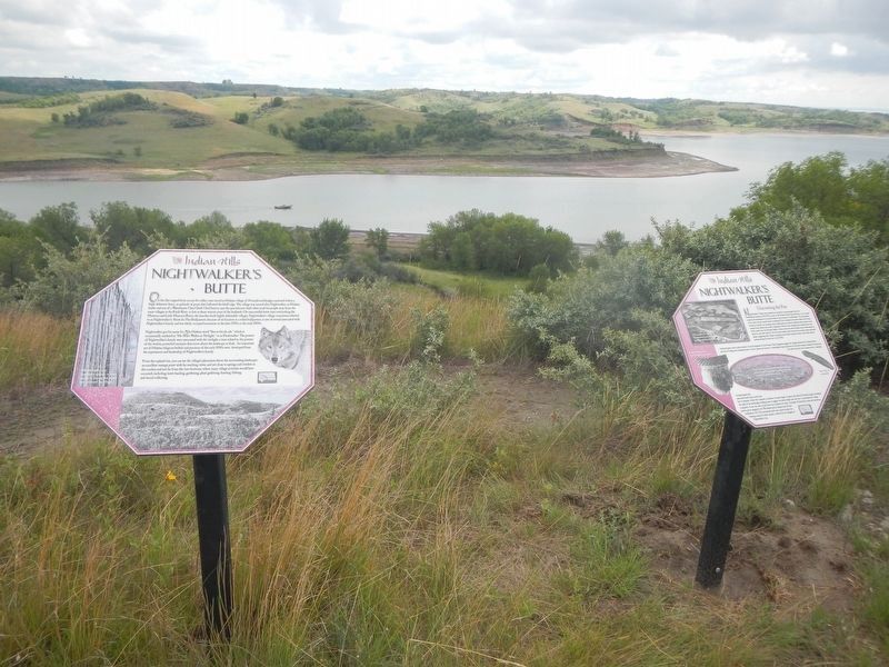
2. Nightwalker's Butte Marker, on the right

Regionally, this marker is in North Dakota’s Mandan, Hidatsa, and Arikara Nation, in the Standing Rock Sioux Tribe, in the Drift Prairie, and on the Missouri Plateau. It is also in the American Lewis & Clark Corridor, on the prairies, and on the Northern Plains. Globally, it is in North America, the Western Hemisphere, the Western World, and the Anglosphere. Historically, it finds itself in what was once Rupert’s Land and also the Louisiana Purchase.
Other nearby markers. At least 8 other markers are within walking distance of this marker: A different marker also named Nightwalker's Butte (here, next to this marker); Lake Sakakawea (about 500 feet away, measured in a direct line); Sakakawea (about 500 feet away); Lewis & Clark (about 500 feet away); Geology (about 600 feet away); Contemporary Towns (approx. 0.2 miles away); Encampments (approx. 0.2 miles away); Four Bears Bridge (approx. 0.2 miles away). Touch for a list and map of all markers in Garrison.
Credits. This page was last revised on September 24, 2025. It was originally submitted on September 24, 2025, by Barry Swackhamer of Brentwood, California. This page has been viewed 71 times since then and 42 times this year. Photos: 1, 2. submitted on September 24, 2025, by Barry Swackhamer of Brentwood, California.
