Marker Logo
THE HISTORICAL
MARKER DATABASE
“Bite-Size Bits of Local, National, and Global History”
Near Bearcreek in Carbon County, Montana — The American West (Mountains)
 

Bear Creek Cemetery
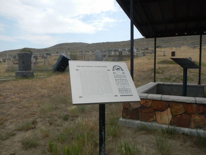
 
 
Bear Creek Cemetery Marker image. Click for full size.
Photographed by Barry Swackhamer, July 21, 2021
1. Bear Creek Cemetery Marker
Inscription. A large red granite monument commemorates the 75 miners who died in the 1943 explosion at the Smith Mine. The United Mine Workers of America installed this memorial in 1947 to memorialize Montana’s worst coal mining disaster. Twenty-two of the Smith Mine’s victims are buried here in family plots. The death date—February 27, 1943—carved onto their grave markers recalls the tragedy. Other headstones express other, individual losses. Of the 473 people buried here, 107 are children, including the first person interred in the cemetery in 1909, six-year-old Helen Markovich. Marble tombstones decorated with carved lambs and other tokens of innocence mark many of the children’s graves. They communicate parents’ great grief, while also suggesting the toll poverty, infant mortality, and childhood diseases historically took on families. Grouped in the cemetery’s southeastern corner are headstones marked with Cyrillic lettering, many displaying photographs, burned into porcelain to produce a permanent image of the deceased. These markers reflect the Eastern European roots of many Bearcreek miners and their families. At the community’s
Paid Advertisement
Click or scan to see
this page online
height, in 1920, a third of its residents were immigrants while another third were the children of immigrants. Headstones marked with Croatian, Montenegrin, Slavic, Italian, Scottish, German, Finnish, French, and English surnames attest to Bearcreek’s ethnic diversity. After the Smith Mine disaster, Bearcreek became a near ghost town as many residents departed, fleeing bad memories. They left behind this simple rural cemetery, whose sandstone, granite, and marble headstones provide mute testimony to Bearcreek’s coal mining heritage and to the people buried here.
 
Erected by Montana Historical Society.
 
Topics and series. This historical marker is listed in these topic lists: Cemeteries & Burial SitesDisastersImmigrationIndustry & Commerce. In addition, it is included in the Montana National Register Sign Program series list. A significant historical date for this entry is February 27, 1943.
 
Location. 45° 9.491′ N, 109° 8.356′ W. Marker is near Bearcreek, Montana, in Carbon County. It is on State Highway 308 one mile east of South 6th Street, on the left when traveling west. The cemetery is at the end of an unsigned, gravel
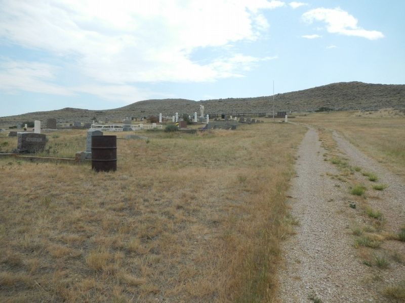
Bear Creek Cemetery image. Click for full size.
Photographed by Barry Swackhamer, July 21, 2021
2. Bear Creek Cemetery

road south of Montana State Highway 308. Touch for map. Marker is in this post office area: Bearcreek MT 59007, United States of America. Touch for directions.

Regionally, this marker is in Montana’s Yellowstone Country. It is also in the American Mountain West and in the Lewis & Clark Corridor. Globally, it is in North America, the Rocky Mountains, the Western Hemisphere, the Western World, and the Anglosphere. Historically, it finds itself in what was once Rupert’s Land and also the Louisiana Purchase.

Other nearby markers. At least 8 other markers are within 6 miles of this marker, measured as the crow flies: Bearcreek (approx. 0.9 miles away); Bearcreek Bank (approx. one mile away); Black Gold (approx. 2.4 miles away); Smith Mine Historic District (approx. 2.4 miles away); The Smith Mine Disaster (approx. 2.4 miles away); The Red Lodge Country (approx. 5½ miles away); Red Lodge (approx. 5½ miles away); The Beartooth Plateau (approx. 5½ miles away). Touch for a list and map of all markers in Bearcreek.
 
Smith Mine Disaster Memorial image. Click for full size.
Photographed by Barry Swackhamer, July 21, 2021
3. Smith Mine Disaster Memorial
 
 
Credits. This page was last revised on October 2, 2025. It was originally submitted on January 12, 2022, by Barry Swackhamer of Brentwood, California. This page has been viewed 748 times since then and 41 times this year. Last updated on September 27, 2025, by Robert McGee of Uniontown, Pennsylvania. Photos:   1, 2, 3. submitted on January 12, 2022, by Barry Swackhamer of Brentwood, California. • Devry Becker Jones was the editor who published this page.

m=285122

CeraNet Cloud Computing sponsors the Historical Marker Database.
This website earns income from purchases you make after using our links to Amazon.com. We appreciate your support.
Paid Advertisement
Jul. 6, 2026