Near Sanger in Oliver County, North Dakota — The American Midwest (Upper Plains)
The Missouri : A Landscape Altered
Photographed by Barry Swackhamer, July 22, 2025
1. The Missouri : A Landscape Altered Marker
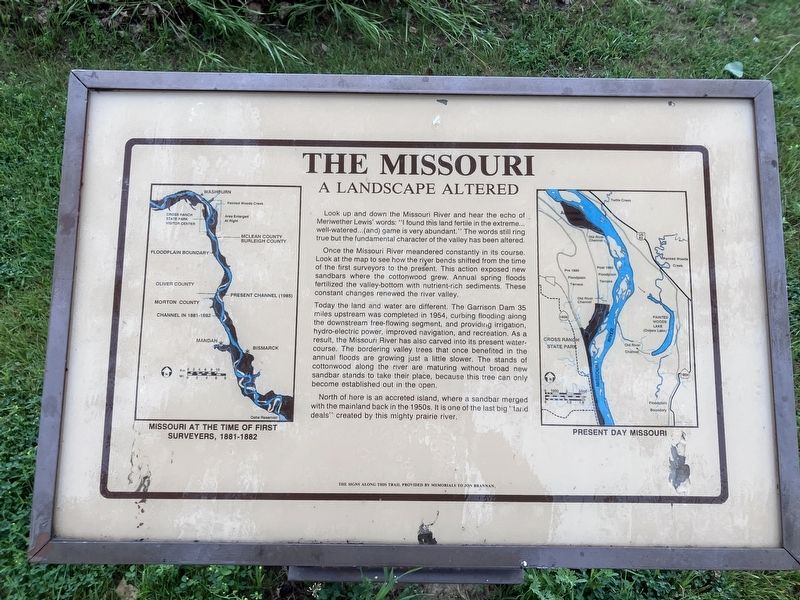
Once the Missouri River meandered constantly in its course. Look at the map to see how the river bends shifted from the time of the first surveyors to the present. This action exposed new sandbars where the cottonwood grew. Annual spring floods fertilized the valley-bottom with nutrient-rich sediments. These constant changes renewed the river valley.
Today the land and water are different. The Garrison Dam 35 miles upstream was completed in 1954, curbing flooding along the downstream free-flowing segment, and provided irrigation, hydro-electric power, improved navigation, and recreation. As a result, the Missouri River has also carved into its present water-course. The bordering valley trees that once benefitted in the annual floods are growing just a little slower. The stands of cottonwood along the river are maturing without broad new sandbar stands to take
this page online
North of here is an accreted island, where a sandbar merged with the mainland back in the 1950s. It is one of the last big "land-deals" created by this mighty prairie river.
Erected by North Dakota Parks & Recreation Department.
Topics. This historical marker is listed in these topic lists: Man-Made Features • Waterways & Vessels. A significant historical year for this entry is 1954.
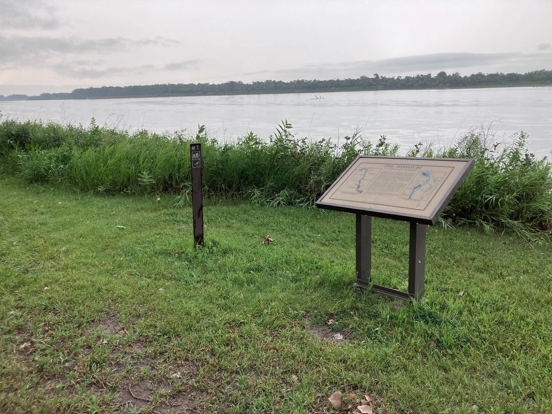
Location. 47° 12.932′ N, 100° 59.611′ W. Marker is near Sanger, North Dakota, in Oliver County. It can be reached from 22nd Avenue SouthWest (aka River Road) near 16th Street SouthWest. The maker is located in Cross Ranch State Park where the campground fronts the Missouri River. Touch for map. Marker is in this post office area: Center ND 58530, United States of America. Touch for directions.

Regionally, this marker is in the Standing Rock Sioux Tribe, on the Missouri Plateau, and in Greater Bismarck Area. It is also in the American Lewis & Clark Corridor, on the prairies, and on the Northern Plains. Globally, it is in North America, the Western Hemisphere,
Photographed by Barry Swackhamer, July 22, 2025
2. The Missouri : A Landscape Altered Marker
Other nearby markers. At least 8 other markers are within 6 miles of this marker, measured as the crow flies: The Missouri: An Early Highway (approx. 0.3 miles away); The Missouri: Origin and History (approx. 0.4 miles away); The Story of Painted Woods (approx. 1.3 miles away); Painted Woods (approx. 1.3 miles away); Cross Ranch (approx. 2.1 miles away); "A Buitifull Countrey" (approx. 2.2 miles away); Taylor Cabin (approx. 5.2 miles away); Soo Line Railroad & Depot (approx. 5.2 miles away). Touch for a list and map of all markers in Sanger.
Credits. This page was last revised on September 27, 2025. It was originally submitted on September 27, 2025, by Barry Swackhamer of Brentwood, California. This page has been viewed 34 times since then and 15 times this year. Photos: 1, 2. submitted on September 27, 2025, by Barry Swackhamer of Brentwood, California.
