Thurmont in Frederick County, Maryland — The American Northeast (Mid-Atlantic)
Thurmont Attractions
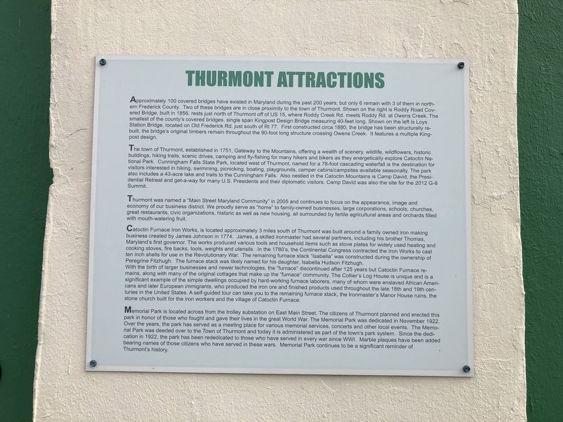
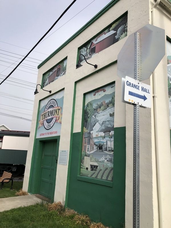
Approximately 100 covered bridges have existed in Maryland during the past 200 years, but only 6 remain with 3 of them in northern Frederick County. Two of these bridges are in close proximity to the town of Thurmont. Shown on the right is Roddy Road Covered Bridge, built in 1856, rests just north of Thurmont off of US 15, where Roddy Creek Rd. meets Roddy Rd. at Owens Creek. The smallest of the county's covered bridges, single span Kingpost Design Bridge measuring 40-feet long. Shown on the left is Loys Station Bridge, located on Old Frederick Rd, just south of Rt 77. First constructed circa 1880, the bridge has been structurally rebuilt the bridge's original timbers remain throughout the 90-foot long structure crossing Owens Creek. It features a multiple Kingpost design.
The town of Thurmont, established in 1751, Gateway to the Mountains, offering a wealth of scenery, wildlife, wildflowers, historic buildings, hiking trails, scenic drives, camping and fly-fishing for many hikers and bikers as they energetically explore Catoctin National Park. Cunningham Falls State Park, located west of Thurmont, named for a 78-foot
this page online
Thurmont was named a "Main Street Maryland Community” in 2005 and continues to focus on the appearance, image and economy of our business district. We proudly serve as "home" to family-owned businesses, large corporations, schools, churches, great restaurants, civic organizations, historic as well as new housing, all surrounded by fertile agricultural areas and orchards filled with mouth-watering fruit.
Catoctin Furnace lron Works, is located approximately 3 miles south of Thurmont was built around a family owned iron making business created by James Johnson in 1774. James, a skilled ironmaster had several partners, including his brother Thomas, Maryland's first governor. The works produced various
With the birth of larger businesses and newer technologies, the "furnace" discontinued after 125 years but Catoctin Furnace remains, along with many of the original cottages that make up the "furnace" community. The Collier's Log House is unique and is a significant example of the simple dwellings occupied by hard-working furnace laborers, many of whom were enslaved African Americans and later European immigrants, who produced the iron ore and finished products used throughout the late 18th and 19th centuries in the United States. A self-guided tour can take you to the remaining furnace stack, the Ironmaster's Manor House ruins, the stone church built for the iron workers and the village of Catoctin Furnace.
Memorial Park is located across from the trolley substation on East Main Street. The citizens of Thurmont planned and erected this park in honor of those who fought and gave their lives in the great World War. The Memorial Park was dedicated in November 1922. Over the years, the park has served as a meeting place for various memorial services, concerts and other local events. This Memorial Park was deeded over to the Town of Thurmont and today it is administered as part of the town's park system. Since the dedication in 1922, the park has been rededicated to those who have served in every war since WWI. Marble plaques have been added bearing names of those citizens who have served in these wars. Memorial Park continues to be a significant reminder of Thurmont's history.
Topics. This historical marker is listed in these topic lists: Bridges & Viaducts • Colonial Era • Industry & Commerce • Parks & Recreational Areas. A significant historical month for this entry is November 1922.
Location. 39° 37.374′ N, 77° 24.49′ W. Marker is in Thurmont, Maryland, in Frederick County. It is on East Main Street (Maryland Route 77) east of Alley 5, on the right when traveling west. Touch for map. Marker is at or near this postal address: 125 East Main Street, Thurmont MD 21788, United States of America. Touch for directions.

Regionally, this marker is in the Washington Metropolitan Area and in Central Maryland. It is also in the American Mid-Atlantic. Globally, it is in North America, the Western Hemisphere, the Western World, and the Anglosphere. Historically, it finds itself in what was once one of the original Thirteen Colonies and also the Antebellum South.
Other nearby markers. At least 8 other markers are within walking distance of this marker: Thurmont Rail History — The End of an Era (here, next to this marker); Historic Buildings—Past and Present (a few steps from this marker); A Walk Along the Trolley Trail (within shouting distance of this marker); Welcome to The Thurmont Trolley Trail! (within shouting distance of this marker); History of the Trolley Trail (within shouting distance of this marker); Thurmont Memorial Park (within shouting distance of this marker); Veterans Memorial (approx. 0.2 miles away); Thurmont (approx. 0.2 miles away). Touch for a list and map of all markers in Thurmont.
Credits. This page was last revised on October 10, 2025. It was originally submitted on April 6, 2019, by Devry Becker Jones of Washington, District of Columbia. This page has been viewed 463 times since then and 35 times this year. Last updated on October 1, 2025, by Carl Gordon Moore Jr. of North East, Maryland. Photos: 1, 2. submitted on April 6, 2019, by Devry Becker Jones of Washington, District of Columbia.
