Boulder City in Clark County, Nevada — The American Mountains (Southwest)
Find Solid Ground with Surveys & Tests
Journeys & Heros
| — | Mike O'Callaghan-Pat Tillman Memorial Bridge | — |
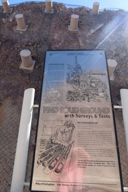
Photographed by Sandra Hughes Tidwell, September 9, 2025
1. Find Solid Ground with Surveys & Tests Marker
Land Surveying Above
The bridge engineers needed accurate measurements of the land surface to help them fit the River Bridge perfectly into the rugged canyon.
Land surveyors carefully drew topographic maps to record the width of the canyon and the height and width of the cliffs where the road meets the bridge. These contour maps were used to determine the location for placing the foundations on the canyon face.
For the roadways approaching the River Bridge, the landform maps and cross sections showed the civil (highway) engineers where to cut the hills, fill the valleys, and bridge the canyons. Their goal was to balance the amount of rock that they had to move within the project area. They tried to avoid the great expense of moving rock from the site. Engineers used computer models of many possible earthwork designs to find the most practical and economical placement of the new roadways.
Rock Core Boring Below
Geotechnical (rock and soil) engineers bored deep into the earth searching for solid bedrock upon which to build the River Bridge foundations. In some places, the upper layer of rock was not strong enough to support the heavy foundations.
In some places, the upper layer of rock was not strong enough to support the heavy foundations. Only deeper solid bedrock could bear the structural loads. Large boring machines drilled deep into the earth to pull up rock cores. These two-and-one-half-inch-round rock cores were sometimes over thirty feet long. They showed the depths where layers change from fragile to firm. Dozens of borings were needed to cover the foundation locations because the strength of the rock can vary just yards apart.
Engineers boxed and labeled the rock core segments as they removed them from the earth. They sent cores to the laboratory for strength testing. The geotechnical
this page online
The rock cores displayed nearby are actual samples bored from the River Bridge foundation sites. These cores were used for guiding the design of excavations and foundations.
Topics. This historical marker is listed in these topic lists: Bridges & Viaducts • Natural Features • Natural Resources • Roads & Vehicles.
Location. 36° 0.893′ N, 114° 44.69′ W. Marker is in Boulder City, Nevada, in Clark County. It can be reached from Hoover Dam Access Road east of Great Basin Highway / Hoover Dam Bypass (Interstate 11), on the right when traveling east. Located near the Boulder Dam Bridge Parking Lot. Touch for map. Marker is at or near this postal address: 81 Hoover Dam Access Rd, Boulder City NV 89005, United States of America. Touch for directions.

Regionally, this marker is in the Colorado River Valley, in the Mojave Desert, and in Greater Las Vegas. It is also in the American Southwest and in the Mountain West. Globally, it is in North America, the Western Hemisphere, the Western World, and the Anglosphere. Historically, it finds itself in what was once New Spain and also Mexico’s Alta California.
Other nearby markers. At least 8 other markers are within walking distance of this marker: Get Good Footing with Anchors & Foundations (a few steps from this marker); Lay the Path with Cut & Fill (within shouting distance of this marker); Choose the Site for Crossing & Bridge (within shouting distance of this marker); Clear the Way of Switchyard & Towers (within shouting distance of this marker); Span The Gap with Cables 7 Arch (within shouting distance of this marker); Protecting the Place of Nature & History (within shouting distance of this marker); Design the Dream with Science & Art (within shouting distance of this marker); Raise the Road on Columns & Deck (within shouting distance of this marker). Touch for a list and map of all markers in Boulder City.
Credits. This page was last revised on October 3, 2026. It was originally submitted on October 2, 2025, by Sandra Hughes Tidwell of Killen, Alabama, USA. This page has been viewed 63 times since then and 33 times this year. Photo 1. submitted on October 2, 2025, by Sandra Hughes Tidwell of Killen, Alabama, USA. • Devry Becker Jones was the editor who published this page.
Editor’s want-list for this marker. A wide view photo of the marker and it’s surroundings showing its location. • Can you help?
