
Elk River in Sherburne County, Minnesota — The American Midwest (Upper Plains)
Corn Country
Photographed by McGhiever, June 27, 2025
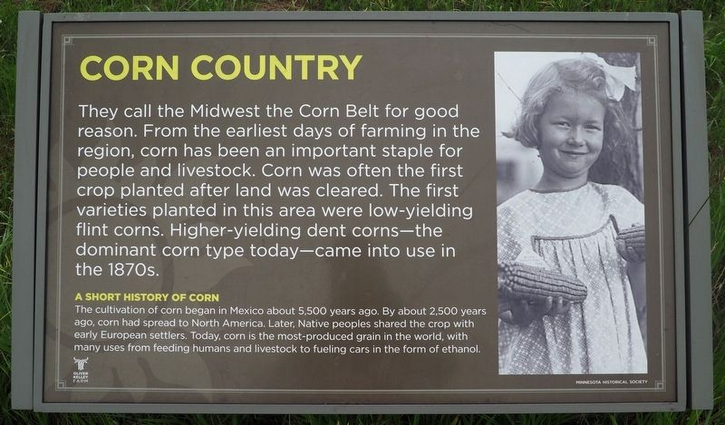
1. Corn Country Marker
They call the Midwest the Corn Belt for good reason. From the earliest days of farming in the region, corn has been an important staple for people and livestock. Corn was often the first crop planted after land was cleared. The first varieties planted in this area were low-yielding flint corns. Higher-yielding dent corns—the dominant corn type today—came into use in the 1870s.
A Short History of Corn
The cultivation of corn began in Mexico about 5,500 years ago. By about 2,500 years ago, corn had spread to North America. Later, Native peoples shared the crop with early European settlers. Today, corn is the most-produced grain in the world, with many used from feeding humans and livestock to fueling cars in the form of ethanol.
Erected by Minnesota Historical Society.
Topics. This historical marker is listed in these topic lists: Agriculture • Indigenous Peoples and Communities.
Location. 45° 15.563′ N, 93° 32.348′ W. Marker is in Elk River, Minnesota, in Sherburne County. It is on Kelly Farm Road Northwest. The marker is at the Oliver Kelley Farm (fee area)
this page online

Regionally, this marker is in the Twin Cities Metropolitan Area. It is also in the American Midwest, in the Corn Belt, and in the Great River Road Region. Globally, it is in North America, the Western Hemisphere, the Western World, and the Anglosphere. Historically, it finds itself in what was once Rupert’s Land and also the territory of the Mississippian Culture.
Other nearby markers. At least 8 other markers are within walking distance of this marker: What's a Farm without a Cow? (here, next to this marker); Harvest Time (here, next to this marker); Oak Woods—A Changing Forest (about 700 feet away, measured in a direct line); Mississippi River & Woodlands Trail (approx. 0.2 miles away); The River Highway (approx. 0.2 miles away); Relaxing on the River (approx. 0.2 miles away); In Memory of Lucy Earle Kelley (approx. 0.2 miles away); Grange Shrine (approx. 0.4 miles away). Touch for a list and map of all markers in Elk River.
Photographed by McGhiever, June 27, 2025
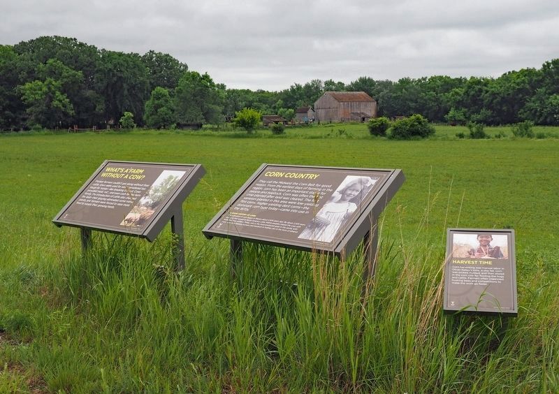
2. Corn Country Marker (center) overlooking the Oliver Kelley Farm
Credits. This page was last revised on October 2, 2025. It was originally submitted on October 2, 2025, by McGhiever of Minneapolis, Minnesota. This page has been viewed 53 times since then and 24 times this year. Photos: 1. submitted on October 2, 2025, by McGhiever of Minneapolis, Minnesota. 2. submitted on August 23, 2025, by McGhiever of Minneapolis, Minnesota.
