Oregon City in Clackamas County, Oregon — The American West (Northwest)
Abernethy Green
Photographed by Douglass Halvorsen, August 1, 2020
1. Abernethy Green Marker
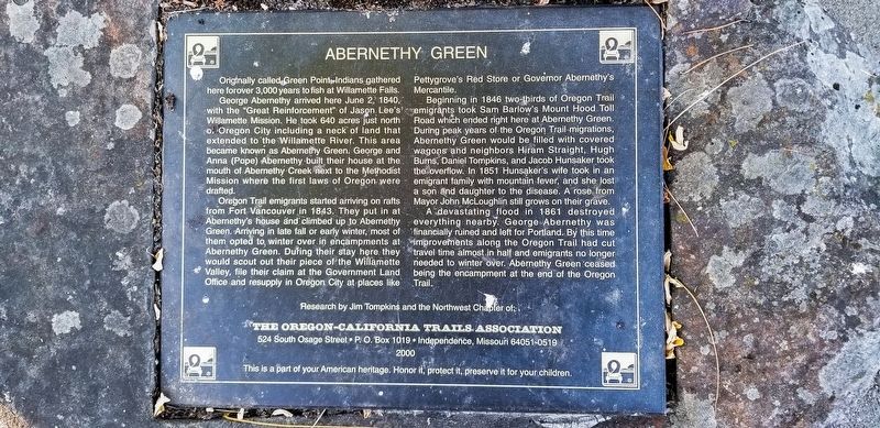
Originally called Green Point, Indians gathered here for over 3,000 years to fish at Willamette Falls.
George Abernethy arrived here June 2, 1840, with the "Great Reinforcement" of Jason Lee's Willamette Mission. He took 640 acres just north of Oregon City including a neck of land that extended to the Willamette River. This area became known as Abernethy Green. George and Anna (Pope) Abernathy built their house at the mouth of Abernathy Creek next to the Methodist Mission where the first laws of Oregon were drafted.
Oregon Trail emigrants started arriving on rafts from Fort Vancouver in 1843. They put in at Abernethy's house and climbed up to Abernethy Green. Arriving in late fall or early winter, most of them opted to winter over in encampments at Abernethy Green. During their stay they would scout out their piece of the Willamette Valley, file their claim at the Government Land Office and resupply in Oregon City at places like Pettygrove's Red Store or Governor Abernathy's Mercantile.
Beginning in 1846 two-thirds of Oregon Trail emigrants took Sam Barlow's Mount Hood Toll Road which ended right here at Abernethy
this page online
A devastating flood in 1861 destroyed everything nearby. George Abernethy was financially ruined and left for Portland. By this time improvements along the Oregon Trail had cut travel time almost in half and emigrants no longer needed to winter over. Abernethy Green ceased being the encampment at the end of the Oregon Trail.
Research by Jim Tompkins and the Northwest Chapter of The Oregon-California Trails Association.
This is part of your American heritage. Honor it, protect it, preserve it for your children.
Erected 2000 by The Oregon-California Trails Association.
Topics and series. This historical marker is listed in these topic lists: Indigenous Peoples and Communities • Roads & Vehicles • Settlements & Settlers. In

Photographed by Douglass Halvorsen, August 1, 2020
2. Abernethy Green Marker
Abernethy Green is a large grassy area and can be seen behind the grove of trees in the photo.
Location. 45° 21.879′ N, 122° 35.666′ W. Marker is in Oregon City, Oregon, in Clackamas County. It can be reached from Washington Street. Touch for map. Marker is at or near this postal address: 1726 Washington Street, Oregon City OR 97045, United States of America. Touch for directions.

Regionally, this marker is in the Willamette Valley and in Greater Portland Area. It is also on the American Pacific Coast, in the Pacific Northwest, and in the Lewis & Clark Corridor. Globally, it is in North America, in the Cascade Range, on the Ring of Fire, on the Pacific Rim, in the Western Hemisphere, in the Western World, and in the Anglosphere.
Other nearby markers. At least 8 other markers are within walking distance of this marker: Abigail Scott Duniway (a few steps from this marker); Fishing At Tumwater (a few steps from this marker); Lot Whitcomb (within shouting distance of this marker); Willamette Falls, circa 1880 (within shouting distance of this marker); End of the Oregon Trail (within shouting distance of this marker); Historic Oregon City (within shouting distance of this marker); Earthquakes and Mountain Fog (within shouting distance of this marker); Sidney W. Moss (within shouting distance of this marker). Touch for a list and map of all markers in Oregon City.
Credits. This page was last revised on October 22, 2025. It was originally submitted on October 12, 2025, by Douglass Halvorsen of Klamath Falls, Oregon. This page has been viewed 80 times since then and 50 times this year. Photos: 1, 2. submitted on October 12, 2025, by Douglass Halvorsen of Klamath Falls, Oregon. • Andrew Ruppenstein was the editor who published this page.
