Rockville Centre in Nassau County, New York — The American Northeast (Mid-Atlantic)
Native American Greenway
| — | Mill River Green Way Trail | — |
Photographed by Ian Lefkowitz, October 4, 2025
1. Native American Greenway Marker
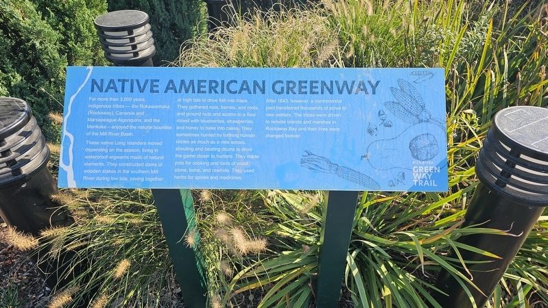
For more than 3,000 years, Indigenous tribes—the Rokawanhaka (Rockaway), Canarsie and Marsapeague Algonquins, and the Merikoke—enjoyed the natural bounties of the Mill River Basin.
These native Long Islanders moved depending on the season, living in waterproof wigwams made of natural elements. They constructed dams of wooden stakes in the southern Mill River during low tide, joining together at high tide to drive fish into traps. They gathered nuts, berries, and roots, and ground nuts and acorns, flour mixed with blueberries, strawberries, and honey to bake into cakes. They sometimes hunted by forming human circles as much as a mile across, shouting and beating drums to drive the game closer to hunters. They made pots for cooking and tools of wood, stone, bone, and rawhide. They used herbs for spices and medicines.
After 1643, however, a controversial pact transferred thousands of acres to new settlers. The tribes were driven to remote islands and marshes in Rockaway Bay and their lives were changed forever.
Topics. This historical marker is listed in these topic lists: Colonial Era • Indigenous Peoples and Communities. A significant historical year for this entry is 1643.
Location. 40° 39.095′ N,
this page online

Regionally, this marker is in the New York City Metropolitan Area and on Long Island. It is also in the American Northeast, in the Mid-Atlantic, and on the Eastern Seaboard. Globally, it is in the North Atlantic Region, North America, the Western Hemisphere, the Western World, and the Anglosphere. Historically, it finds itself in what was once New Netherland and also one of the original Thirteen Colonies.
Other nearby markers. At least 8 other markers are within walking distance of this marker: The Living Shoreline of Lister Park (here, next to this marker); A Longtime Local Delicacy (about 300 feet away, measured in a direct line); a different marker also named The Living Shoreline of Lister Park
Photographed by Ian Lefkowitz, October 4, 2025
2. Native American Greenway Marker
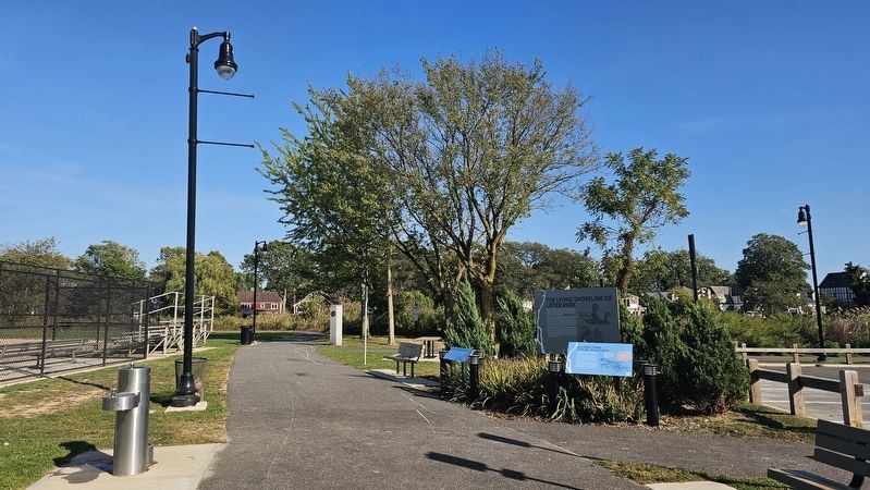
The marker is found among a series of three markers and a trail blaze at the Lister Park entrance to the Mill River Green Way Trail.
Also see . . . History of the Town (of Hempstead).
In 1643, two emissaries ― Robert Fordham and John Carman, Fordham's son-in-law ― were sent across the Long Island Sound to the Dutch-held westerly part of Long Island to obtain town rights from William Kieft (Director General) and to purchase title from the Indians. In December of 1643, Carman and Fordham met with tribal representation of the Reuckowacky, the Merockes, Matinecock, and Massapequas and a land deed was negotiated on December 13, 1643. The deed failed to specify boundaries of the vast land tract that was to become Hempstead. Nor did it mention any form of compensation for the tribes. The Deed that Fordham and Carman had concluded with the Indians in 1643 was not confirmed until July 4, 1657.(Submitted on October 13, 2025, by Ian Lefkowitz of New York, New York.)
Credits. This page was last revised on October 15, 2025. It was originally submitted on October 13, 2025, by Ian Lefkowitz of New York, New York. This page has been viewed 66 times since then and 28 times this year. Photos: 1, 2. submitted on October 13, 2025, by Ian Lefkowitz of New York, New York. • Devry Becker Jones was the editor who published this page.
