Brooklyn Heights in Kings County, New York — The American Northeast (Mid-Atlantic)
Hillside Dog Park
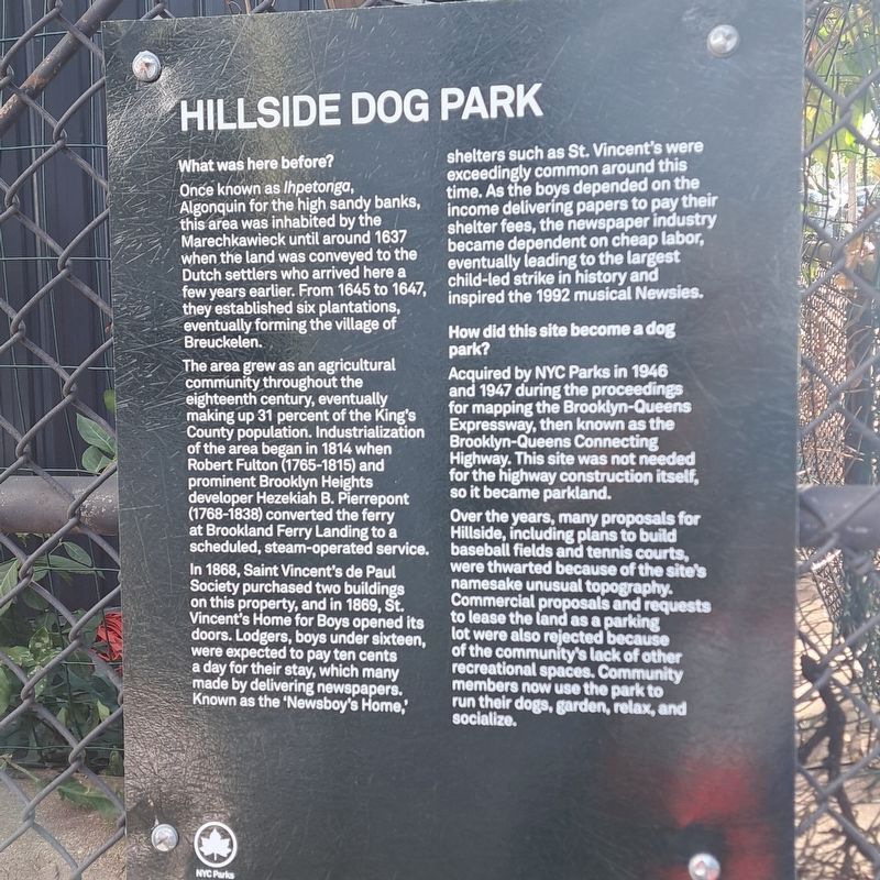
Photographed by Jack DePalma, October 4, 2025
1. Hillside Dog Park Marker
What was here before?
Once known as Ihpetonga, Algonquin for the high sandy banks, this area was inhabited by the Marechkawieck until around 1637 when the land was conveyed to the Dutch settlers who arrived here a few years earlier. From 1645 to 1647, they established six plantations, eventually forming the village of Breuckelen.
The area grew as an agricultural community throughout the eighteenth century, eventually making up 31 percent of the King's County population. Industrialization of the area began in 1814 when Robert Fulton (1765-1815) and prominent Brooklyn Heights developer Hezekiah B. Pierrepont (1768-1838) converted the ferry at Brookland Ferry Landing to a scheduled, steam-operated service.
In 1868, Saint Vincent's de Paul Society purchased two buildings on this property, and in 1869, St. Vincent's Home for Boys opened its doors. Lodgers, boys under sixteen, were expected to pay ten cents a day for their stay, which many made by delivering newspapers. Known as the 'Newsboy's Home,' shelters such as St. Vincent's were exceedingly common around this time. As the boys depended on the income delivering papers
this page online
How did this site become a dog park?
Acquired by NYC Parks in 1946 and 1947 during the proceedings for mapping the Brooklyn-Queens Expressway, then known as the Brooklyn-Queens Connecting Highway. This site was not needed for the highway construction itself, so it became parkland.
Over the years, many proposals for Hillside, including plans to build baseball fields and tennis courts, were thwarted because of the site's namesake unusual topography. Commercial proposals and requests to lease the land as a parking lot were also rejected because of the community's lack of other recreational spaces. Community members now use the park to run their dogs, garden, relax, and socialize.
Erected by NYC Parks.
Topics and series. This historical marker is listed in these topic lists: Animals • Indigenous Peoples and Communities • Parks & Recreational Areas. In addition, it is included in the NYC Parks series list. A significant historical year for this entry is 1637.
Location. 40° 42.077′ N,

Photographed by Jack DePalma, November 14, 2025
2. Hillside Dog Park Marker
Wide view of marker.

Regionally, this marker is in New York City and on Long Island. It is also in the American Northeast, in the Mid-Atlantic, and on the Eastern Seaboard. Globally, it is in the North Atlantic Region, North America, the Western Hemisphere, the Western World, and the Anglosphere. Historically, it finds itself in what was once New Netherland and also one of the original Thirteen Colonies.
Other nearby markers. At least 8 other markers are within walking distance of this marker: History in the Park (within shouting distance of this marker); Virginia Travell Weeks (within shouting distance of this marker); Edward Robinson Squibb (within shouting distance of this marker); Brooklyn Heights Historic District (about 300 feet away, measured in a direct line); Mott Bedell House (about 400 feet away); The Willows (about 400 feet away); GreenThumb (about 400 feet away); John W. Rhonden (1918-2001) and Richarda Rhonden, nee Phillips (1917-2016) (about 500 feet away). Touch for a list and map of all markers in Brooklyn.
Credits. This page was last revised on November 19, 2025. It was originally submitted on October 13, 2025, by Jack DePalma of Brooklyn,NY, New York. This page has been viewed 80 times since then and 32 times this year. Photos: 1. submitted on October 13, 2025, by Jack DePalma of Brooklyn,NY, New York. 2. submitted on November 14, 2025, by Jack DePalma of Brooklyn,NY, New York. • Michael Herrick was the editor who published this page.
