Kittanning in Armstrong County, Pennsylvania — The American Northeast (Mid-Atlantic)
Armstrong Trail
⎯⎯⎯
Kittanning

Photographed by Bradley Owen, October 3, 2025
1. Armstrong Trail / Kittanning Marker
(Panel 1)
(Panel 1):
The Armstrong Trail is located along the eastern bank of the Allegheny River in Armstrong and Clarion Counties. Currently, the trail has 36 miles of a relatively flat, compressed surface and runs from Rosston to East Brady.
It links the towns of Ford City, Kittanning, and East Brady with the villages of Mosgrove, Templeton, Rimer, Redbank, and Phillipston. The Brady Tunnel, currently closed, will one day provide a link to the much longer Erie to Pittsburgh Trail. The Redbank Valley Trail connects to the Armstrong Trail at the mouth of the Redbank Creek along the Allegheny River and adds 42 more miles to the business district in Brookville, along with a 9-mile spur to Sligo. The trails are for non-motorized use only.
The Armstrong Trail connects more populated areas to the natural beauty, sights, and sounds of the Allegheny River Valley. Trail users pass historic sites including a train turntable, railroad tunnel, coaling tower, coke ovens, and river locks and dams. Waterfalls, wildlife, birds, and wild flowers are part of the natural beauty along the trail. It is an ideal place to bicycle, walk, jog,
this page online
The Armstrong Trail is owned by the Allegheny Valley Land Trust. Volunteers from the Armstrong Rails to Trails Association and the communities along the trail assist with maintenance and upkeep of the trail.
www.ArmstrongRailsToTrails.org
www.AlleghenyValleyLandTrust.org
The Redbank Valley Trail
The Redbank Valley Trail is a 51-mile, nearly-level trail, which parallels Redbank Creek for approximately 42 miles from mile 0 at the Allegheny River to New Bethlehem at mile 20 to the Depot Street trailhead in Brookville. It includes a nine-mile spur, with a 3-4% grade from Lawsonham at mile six to Sligo. Pennsylvania's 2014 Trall of the Year features few road crossings, seventeen bridges, three tunnels, and historic sites.
www.RedbankValleyTrails.org
Erie To Pittsburgh Trail
The Erie to Pittsburgh Trail connects the Bayfront of Lake Erie to "The Point" in Pittsburgh. When finished, it will be approximately 270 miles long, through two states and seven counties. The Erie to Pittsburgh Trail will connect to the Great Allegheny Passage in Pittsburgh

Photographed by Bradley Owen, October 3, 2025
2. Armstrong Trail / Kittanning Marker
(Panel 2)
www.EriePittsburghTrail.org
EAST BRADY
Established: 1854
Population: 907
Elevation: 960'
County: Clarion
BRADY TUNNEL
This 2,468 that tunnel was built to bypass Brady's Bend. It shortened the train trip by over five miles. It opened May 28, 1910 and is closed pending repair.
NEW BETHLEHEM
Established: 1853
Population: 931
Elevation: 1077'
County: Clarion
COALING TOWER
Fuel for steam locomotives, which were powered by coal, was loaded at this double track site. The coaling tower was placed into service on February 8, 1930.
LOCK & DAM 8
This lock was opened in 1931 as part of the Allegheny River Navigation System. Lock chambers are used to transition boats from one river pool to the other and, at one time, carried extensive downriver trade.
MONTICELLO IRON FURNACE
The furnace was built in 1859 by Robert E. Brown of Kittanning to extract iron from iron ore. This furnace, at one time, employed as many as 200 people.
KITTANNING
Established: 1804
Population: 3,846
Elevation: 750'
County: Armstrong
FORD CITY PARK
Ford City Park features a gazebo and a war memorial

Photographed by Bradley Owen, October 3, 2025
3. Armstrong Trail / Kittanning Marker
(Panel 3)
FORD CITY
Established: 1887
Population: 2,847
Elevation: 794'
County: Armstrong
(Panel 2):
The Armstrong Trail is located along the eastern bank of the Allegheny River in Armstrong and Clarion Counties. Currently, the trail has 36 miles of a relatively flat, compressed surface and runs from Rosston to East Brady.
It links the towns of Ford City, Kittanning, and East Brady with the villages of Mosgrove, Templeton, Rimer, Redbank, and Phillipston. The Brady Tunnel, currently closed, will one day provide a link to the much longer Erie to Pittsburgh Trail. The Redbank Valley Trail connects to the Armstrong Trail at the mouth of the Redbank Creek along the Allegheny River and adds 42 more miles to the business district in Brookville, along with a 9-mile spur to Sligo. The trails are for non-motorized use only.
The Armstrong Trail connects more populated areas to the natural beauty, sights, and sounds of the Allegheny River Valley.
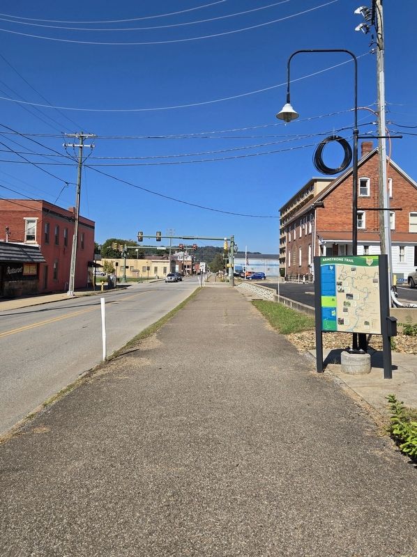
Photographed by Bradley Owen, October 3, 2025
4. Armstrong Trail / Kittanning Marker
View is looking north.
The Armstrong Trail is owned by the Allegheny Valley Land Trust. Volunteers from the Armstrong Rails to Trails Association and the communities along the trail assist with maintenance and upkeep of the trail.
www.ArmstrongRailsToTrails.org
www.AlleghenyValleyLandTrust.org
The Redbank Valley Trail
The Redbank Valley Trail is a 51-mile, nearly-level trail, which parallels Redbank Creek for approximately 42 miles from mile 0 at the Allegheny River to New Bethlehem at mile 20 to the Depot Street trailhead in Brookville. It includes a nine-mile spur, with a 3-4% grade from Lawsonham at mile six to Sligo. Pennsylvania's 2014 Trall of the Year features few road crossings, seventeen bridges, three tunnels, and historic sites.
www.RedbankValleyTrails.org
Erie To Pittsburgh Trail
The Erie to Pittsburgh Trail connects the Bayfront of Lake Erie to "The Point" in Pittsburgh. When finished, it will be approximately 270 miles long, through two states and seven counties. The Erie to Pittsburgh Trail will connect to the Great Allegheny Passage in Pittsburgh that extends to Washington, D.C.
www.EriePittsburghTrail.org
FORD CITY
Established: 1887
Population: 2,847
Elevation: 794'
County: Armstrong
FORD CITY PARK
Ford City Park features a gazebo and a war memorial dedicated to the men and women of Ford City who served in the United States military. Also featured is an 1891 bronze statue of Ford City founder John B. Ford that faces the Armstrong Trail.
KITTANNING
Established: 1804
Population: 3,846
Elevation: 750'
County: Armstrong
MONTICELLO IRON FURNACE
The furnace was built in 1859 by Robert E. Brown of Kittanning to extract iron from iron ore. This furnace, at one time, employed as many as 200 people.
LOCK & DAM 8
This lock was opened in 1931 as part of the Allegheny River Navigation System. Lock chambers are used to transition boats from one river pool to the other and, at one time, carried extensive downriver trade.
COALING TOWER
Fuel for steam locomotives, which were powered by coal, was loaded at this double track site. The coaling tower was placed into service on February 8, 1930.
EAST BRADY
Established: 1854
Population: 907
Elevation: 960'
County: Clarion
NEW BETHLEHEM
Established: 1853
Population: 931
Elevation: 1077'
County: Clarion
BRADY TUNNEL
This 2,468 that tunnel was built to bypass Brady's Bend. It shortened the train trip by over five miles. It opened May 28, 1910 and closed pending repair.
(Panel 3):
Adventure on the Allegheny
Nestled along the banks of the Allegheny River sits the town of Kittanning, the county seat of Armstrong County. The town was once the site of the Delaware and Shawnee Native American village of Kit-Han-Ne, meaning "On the Main River". Colonel John Armstrong attacked this village in September of 1756 in retaliation for the Native American raids on Pennsylvania settlers.
Almost 50 years later, in 1803, Kittanning was surveyed and incorporated, just 3 years after the formation of Armstrong County. In 1856, the Allegheny Valley Railroad became an important transportation link from Pittsburgh to Kittanning. Camp Orr, located north of Kittanning, was used as the training grounds for the 78th PA Volunteer Regiment during the Civil War.
By the early 1900s, Kittanning was a prosperous town with significant industries, including steelmaking, sawmills, china factories, foundries, and brickworks. The first modern typewriter, The Daugherty Visible Typewriter, was invented and produced in 1891.
Today, Kittanning remains a vibrant community with a rich history. The Allegheny River and the Armstrong Trail draws visitors from all over the world.
Allegheny River and Riverfront Park
The Kittanning Riverfront Park features pavilions, walkways, scenic river views, the 1000 seat Murtha Amphitheatre, and dock and boat launch.
Armstrong Trail
The Armstrong Trail runs on the east side bank of the Allegheny River. The 36 mile relatively flat compressed surface trail links the towns of East Brady, Templeton, Kittanning, and Ford City. The trail is for non-motorized use.
Home to Kit-Han-Ne
During the French and Indian War, the village of Kit-Han-Ne was the center for Indian raids on white settlements in western Pennsylvania and parts of Maryland and Virginia.
Armstrong County Courthouse
The Armstrong County Courthouse was listed on the National Register of Historic Places in 1981. Adjoining the Courthouse is the old jail, which is a stone castle versions of a prison in the Gothic Revival style.
Citizens Bridge into Downtown Kittanning
The Citizens Bridge spans the Allegheny River at Kittanning and serves as a gateway to the town.
Grace Presbyterian Church
Located at 155 North Jefferson Street, this church is a Richardson Romanesque structure that was built in 1910 and is known for its Louis Tiffany stained glass windows.
Erected by Towns & Trails Program and ACMH Foundation.
Topics. This historical marker is listed in these topic lists: Indigenous Peoples and Communities • Industry & Commerce • Parks & Recreational Areas • Settlements & Settlers. A significant historical year for this entry is 2014.
Location. 40° 48.913′ N, 79° 31.017′ W. Marker is in Kittanning, Pennsylvania, in Armstrong County. It is on South Grant Avenue south of Market Street, on the left when traveling south. Touch for map. Marker is at or near this postal address: 115 South Grant Avenue, Kittanning PA 16201, United States of America. Touch for directions.

Regionally, this marker is in Greater Pittsburgh. It is also in the American Northeast, in the Mid-Atlantic, in Appalachia, and specifically in Northern Appalachia. Globally, it is in North America, the Western Hemisphere, the Western World, and the Anglosphere. Historically, it finds itself in what was once the Haudenosaunee (Iroquois) Confederacy and also one of the original Thirteen Colonies.
Other nearby markers. At least 8 other markers are within walking distance of this marker: Armstrong County (about 300 feet away, measured in a direct line); Captain Jacobs (about 400 feet away); In Memory of General John Armstrong (about 400 feet away); Armstrong County Courthouse (about 400 feet away); Armstrong County Vietnam Veterans Memorial (approx. ¼ mile away); World War II Tree Memorial (approx. ¼ mile away); Kittanning or Attiqué Indian Town (approx. ¼ mile away); Kittanning Citizens Bridge (approx. ¼ mile away). Touch for a list and map of all markers in Kittanning.
Credits. This page was last revised on October 29, 2025. It was originally submitted on October 15, 2025, by Bradley Owen of Morgantown, West Virginia. This page has been viewed 68 times since then and 32 times this year. Photos: 1, 2, 3, 4. submitted on October 16, 2025, by Bradley Owen of Morgantown, West Virginia.
