Township of Trescott near Lubec in Washington County, Maine — The American Northeast (New England)
Huckins Beach and Trail
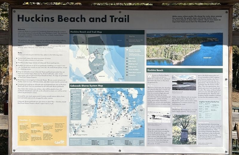
Photographed by Steve Stoessel, October 4, 2025
1. Huckins Beach and Trail Marker
While many critters prefer life along the rocky shore among the seaweed, the gentle slope and sandy bottom here at Huckins Beach is ideal clam habitat. Clams have been an important food source here for thousands of years.
Welcome
Cobscook Shores is a system of 15 parklands dispersed along the southern and western shores of Cobscook Bay from Whiting to Lubec. The parklands are privately owned by Cobscook Shores Inc., a family funded Maine charitable foundation.
The parklands offer public access and recreational use including walking, picnicking, hiking, biking, camping, and paddling in Cobscook Bay.
The name "Cobscook" is derived from Kapskuk, a Passamaquoddy word meaning "place where the water looks like it is boiling."
Welcome to Huckins Beach, where you can have a picnic on a sandy beach, and local harvesters dig clams as they have for generations.
The Bay
With its 24-foot tides, the shoreline of Cobscook Bay has a varied and productive intertidal zone. Areas that are covered at high tide and exposed at low tide are home to a thriving, diverse population of invertebrates - clams, mussels, crabs, periwinkles,
this page online
[ Photo: ] Digging clams in Maine, ca. 1930. Courtesy of the Maine Historical Society.
While many critters prefer life along the rocky shore among the seaweed, the gentle slope and sandy bottom in South Bay is ideal clam habitat. Soft-shell (Mya arenaria) and hard-shell (Mercenaria mercenaria) clams have been an important food source here for thousands of years.
[ Photos: ]
- Huckins Beach at low tide. Photograph by Brad Woodworth.
- Family cemetery at Huckins Beach. Photograph by Brad Woodworth.
Today, many Mainers rely on income from digging clams. The threat of the invasive green crab to native clam populations is a major concern up and down the coast.
The People
Nestled into the woods here, you will find a small cemetery. This peaceful spot is the final resting place of several members of the Leighton and Huckins families who have lived around Cobscook Bay for generations. The headstones give a glimpse into the history of the place. Over five generations, husbands and wives were buried side by side. The names of three babies and a six-year
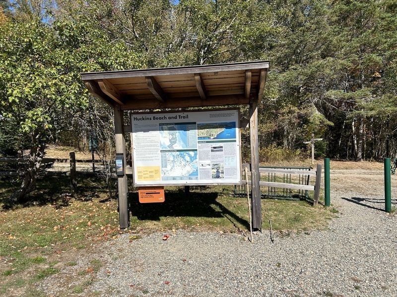
Photographed by Steve Stoessel, October 4, 2025
2. Huckins Beach and Trail Marker
Conservation
An important part of protecting and preserving the special nature of Cobscook Bay is providing access for traditional land use. Clam harvesting at Huckins Beach has been important to the livelihoods of generations of local people, and Cobscook Shores is committed to preserving public access.
[ Map legends and rules were not transcribed. ]
Erected by Cobscook Shores.
Topics. This historical marker is listed in these topic lists: Environment • Industry & Commerce • Parks & Recreational Areas • Settlements & Settlers. A significant historical year for this entry is 1930.
Location. 44° 53.08′ N, 67° 5.618′ W. Marker is near Lubec, Maine, in Washington County. It is in Township of Trescott. It can be reached from the intersection of Straight Bay Road and Kell Kinney Farms, on the right when traveling north. Marker is at the end of a 1/2 mile road from Straight Bay Road. Touch for map. Marker is in this post office area: Lubec ME 04652, United States of America. Touch for directions.

Regionally,
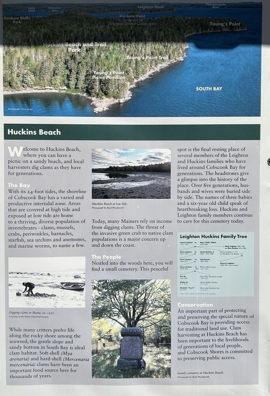
Photographed by Steve Stoessel, October 4, 2025
3. Huckins Beach and Trail Marker Close Up
Other nearby markers. At least 8 other markers are within 5 miles of this marker, measured as the crow flies: Arthur Smallidge Campground (a few steps from this marker); Morrison Cove (approx. half a mile away); Pike Lands Cove (approx. 2.3 miles away); Black Duck Cove (approx. 4 miles away); Klondike Mountain Preserve (approx. 4.1 miles away); U.S.S. Richmond (approx. 4.2 miles away); USS Wabash / USS Franklin (approx. 4.2 miles away); Civil War Ships Burned at Cony Beach (approx. 4.2 miles away). Touch for a list and map of all markers in Lubec.
Credits. This page was last revised on February 26, 2026. It was originally submitted on October 17, 2025, by Steve Stoessel of Niskayuna, New York. This page has been viewed 48 times since then and 13 times this year. Photos: 1, 2, 3. submitted on October 17, 2025, by Steve Stoessel of Niskayuna, New York.
