Fergus in Centre Wellington in Wellington County, Ontario — Central Canada (North America)
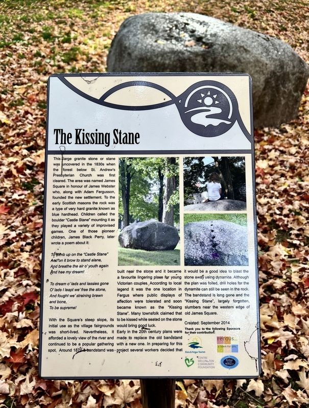
The Kissing Stane
Photographed by Tim Boyd, October 18, 2025
1. The Kissing Stane Marker
To climb up on the "Castle Stane"With the Square's steep slope, its initial use as the village fairgrounds was short-lived. Nevertheless, it afforded a lovely view of the river and continued to be a popular gathering spot. Around 1870 a bandstand was built near the stone and it became a favourite lingering place for young Victorian couples. According to local legend it was the
And on it brow to stand alane,
And breathe the air o' youth again
And hae my dream!
To dream o'lads and lassies gone
O’lads I leapt we free the stone,
And fought we' straining brawn
and bone,
To be supreme!
this page online
Early in the 20th century plans were made to replace the old bandstand with a new one. In preparing for this project several workers decided that it would be a good idea to blast the stone away using dynamite. Although the plan was foiled, drill holes for the dynamite can still be seen in the rock. The bandstand is long gone and the "Kissing Stane", largely forgotten, slumbers near the western edge of old James Square.
Erected 2014 by Heritage Centre Wellington.
Topics. This historical marker is listed in these topic lists: Natural Features • Parks & Recreational Areas. A significant historical year for this entry is 1870.
Location. 43° 42.251′ N, 80° 22.882′ W. Marker is in Centre Wellington, Ontario, in Wellington County. It is in Fergus. It is at the intersection of Tower Street North and St. George Street West, on the right when traveling south on Tower Street North. Touch for map. Marker is at or near this postal

Photographed by Tim Boyd, October 18, 2025
2. The Kissing Stane and marker

Regionally, this marker is in the Huron-Perth-Waterloo-Wellington Area and in Southwestern Ontario. It is also in Central Canada. Globally, it is in North America, the Western Hemisphere, the Western World, and the Anglosphere. Historically, it finds itself in what was once a British colony, the Viceroyalty of New France, the Haudenosaunee (Iroquois) Confederacy, and Rupert’s Land.
Other nearby markers. At least 8 other markers are within walking distance of this marker: St. Andrew’s Presbyterian Church (within shouting distance of this marker); Weigh Scale Building (about 180 meters away, measured in a direct line); 212 St. Andrew Street W (about 210 meters away); Templin Gardens (about 210 meters away); The Fergus Curling Club / Club de Curling de Fergus (about 240 meters away); The Founders of Fergus (approx. 0.3 kilometers away); St. David Street Bridge (approx. 0.4 kilometers away); Fergus Swimming Pool (approx. 0.4 kilometers away). Touch for a list and map of all markers in Centre Wellington.

Photographed by Tim Boyd, October 18, 2025
3. The Kissing Stane Marker
Facing northwest from Tower Street
Credits. This page was last revised on October 21, 2025. It was originally submitted on October 20, 2025, by Tim Boyd of Hamilton, Ontario. This page has been viewed 47 times since then and 20 times this year. Photos: 1, 2, 3. submitted on October 20, 2025, by Tim Boyd of Hamilton, Ontario. • Andrew Ruppenstein was the editor who published this page.
