Near Blackstone in Dinwiddie County, Virginia — The American South (Mid-Atlantic)
Nottoway County
⎯⎯⎯
Dinwiddie County
Photographed by Bernard Fisher, June 13, 2010
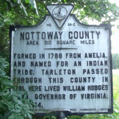
1. Nottoway County Marker (obverse)
Nottoway County. Area 310 Square Miles. Formed in 1788 from Amelia, and named for an Indian tribe. Tarleton passed through this county in 1781. Here lived William Hodges Mann, Governor of Virginia 1910-14.
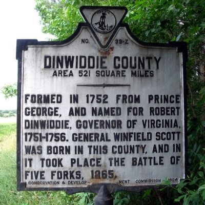
Dinwiddie County. Area 521 Square Miles. Formed in 1752 from Prince George, and named for Robert Dinwiddie, Governor of Virginia 1751-56. General Winfield Scott was born in this county, and in it took place the battle of Five Forks, 1865.
Erected 1928 by Conservation & Development Commission. (Marker Number Z-39.)
Topics and series. This historical marker is listed in these topic lists: Indigenous Peoples and Communities • Political Subdivisions • War, US Civil • War, US Revolutionary. In addition, it is included in the Virginia Department of Historic Resources (DHR) series list. A significant historical year for this entry is 1788.
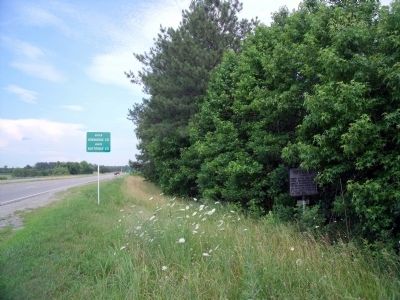
Location. 37° 7.945′ N, 77° 53.986′ W. Marker is near Blackstone, Virginia, in Dinwiddie County. It is on Cox Road (U.S. 460) 0.8 miles east of Rocky Hill Road (Virginia Route 153), on the right when traveling east. Touch for map. Marker is at or near this postal address:
this page online

Regionally, this marker is in the Piedmont, in Southside Virginia, and specifically in Central Virginia. It is also in the American South and specifically in the Upper South. Globally, it is in North America, the Western Hemisphere, the Western World, and the Anglosphere. Historically, it finds itself in what was once the territory of the Mississippian Culture, one of the original Thirteen Colonies, one of the Confederate States of America, and the Antebellum South.
Other nearby markers. At least 8 other markers are within 7 miles of this marker, measured as the crow flies: A different marker also named Nottoway County / Dinwiddie County (approx. 4.1 miles away); Fort Pickett (approx. 4.4 miles away); The Burning of White Oak Methodist Church (approx. 4.6 miles away); Butterwood Chapel (approx. 4.7 miles away); Creation of Camp Pickett (approx. 5.2 miles away); Black’s and White’s Station (approx. 6.4 miles away); Veterans Memorial (approx. 6.4 miles away); Nottoway Training School (approx. 6.4 miles away). Touch for a list and map
Photographed by Bernard Fisher, June 13, 2010
2. Dinwiddie County Marker (reverse)
Also see . . .
1. Nottoway County, Virginia. (Submitted on June 14, 2010, by Bernard Fisher of Richmond, Virginia.)
2. Dinwiddie County, Virginia. (Submitted on June 14, 2010, by Bernard Fisher of Richmond, Virginia.)
Photographed by Bernard Fisher, June 13, 2010
3. Cox Rd (facing east)
Credits. This page was last revised on October 24, 2025. It was originally submitted on June 14, 2010, by Bernard Fisher of Richmond, Virginia. This page has been viewed 997 times since then and 31 times this year. Last updated on October 23, 2025, by Caleb Kemplin of Virginia Beach, Virginia. Photos: 1, 2, 3. submitted on June 14, 2010, by Bernard Fisher of Richmond, Virginia. • Devry Becker Jones was the editor who published this page.
