Somerset in Columbus in Franklin County, Ohio — The American Midwest (Great Lakes)
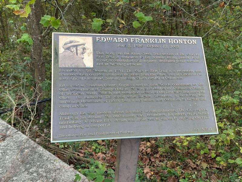
Edward Franklin Honton
June 5 1930, - October 12, 2005
Photographed by Mark Moxley-Knapp
1. Edward Franklin Honton Marker
This bridge on the Alum Creek Trail section of The Ohio to Erie Trail is dedicated to Ed Honton: loving parent; loyal friend, accomplished civil engineer, dedicated public servant, ardent bicycling advocate.
Founded by Ed Honton in 1991, The Ohio to Erie Trail is a recreation and transportation corridor spanning the state from the Ohio River at Cincinnati to Lake Erie at Cleveland, passing through Ohio's capital at Columbus.
Ed served as Franklin County Engineer and the first Bicycle Coordinator for the Ohio Department of Transportation. He was president of the Columbus Council of American Youth Hostels and published several of the first bicycling maps for Ohio. He launched The Great Ohio Bicycle Adventure, a week long tour attracting thousands of riders from many states and countries to bicycle and camp in Ohio.
Although Ed was modest about his many accomplishments, The Ohio to Erie Trail was his dream. His enthusiasm was boundless, his efforts on its behalf unstinting. We share Ed's dream and invite you to join us by enjoying the Trail and helping to support it.
Erected 2011 by The Ohio to Erie Trail Fund
this page online
Topics. This historical marker is listed in these topic lists: Bridges & Viaducts • Parks & Recreational Areas • Roads & Vehicles. A significant historical year for this entry is 1991.
Location. 40° 1.824′ N, 82° 56.045′ W. Marker is in Columbus, Ohio, in Franklin County. It is in Somerset. It is on Ohio to Erie Trail 0.2 miles north of Agler Road, on the right when traveling south. Marker is on Alum Creek Multi-Use Trail, part of the Ohio to Erie Trail, south of Innis Park. Touch for map. Marker is at or near this postal address: 2894 Sunbury Rd, Columbus OH 43219, United States of America. Touch for directions.

Regionally, this marker is in the Scioto Valley. It is also in the American Midwest and in the Corn Belt. Globally, it is in North America, the Western Hemisphere, the Western World, and the Anglosphere. Historically, it finds itself in what was once the Haudenosaunee (Iroquois) Confederacy, the territory of the Mississippian Culture, and the Northwest Territory.
Other nearby markers. At least 8 other markers are within 3 miles of this marker, measured as the crow flies: Alum Creek & The Underground Railroad / The Underground Railroad

Photographed by Mark Moxley-Knapp, October 23, 2025
2. Edward Franklin Honton Marker
Credits. This page was last revised on October 27, 2025. It was originally submitted on October 23, 2025, by Mark Moxley-Knapp of Columbus, Ohio. This page has been viewed 77 times since then and 48 times this year. Photos: 1, 2. submitted on October 23, 2025, by Mark Moxley-Knapp of Columbus, Ohio. • Devry Becker Jones was the editor who published this page.
