Belmar Park in Lakewood in Jefferson County, Colorado — The American Mountains (Southwest)
Belmar Park
Photographed by Leslie Eudy
1. Belmar Park Marker
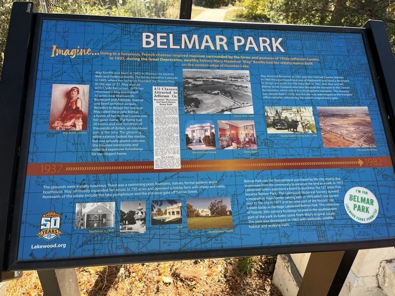
May Bonfils was born in 1883 in Missouri to parents Belle and Frederick Bonfils. The family moved to Colorado in 1895, where her father co-founded the Denver Post. At the age of 21, May eloped with Clyde Berryman. With her inheritance May purchased 10 acres near Wadsworth Boulevard and Alameda Avenue and hired architect Jacques Benedict to design her mansion. May called her estate Belmar, a fusion of her mother’s name and her given name. The home had 20 rooms and cost hundreds of thousands of dollars, an enormous sum at the time. The gleaming white exterior looked like marble but was actually glazed concrete. She traveled extensively and collected expensive furnishings for the elegant home.
The grounds were equally luxurious. There was a swimming pool fountains, statues, formal gardens and a boathouse. May ultimately expanded her estate to
this page online
May divorced Berryman in 1947 and later married Charles Stanton. In 1960 they purchased land east of Wadsworth and hired a developer to design and build the Villa Italia Mall. In 1962, May died and left Belmar to her husband who later donated the mansion to the Denver Archdiocese, which sold it to a development company. The mansion was demolished in 1970, and the site was redeveloped as the Irongate office complex, referencing the estate’s original entry gate.
Belmar Park was the first parkland purchased by the city, mainly due to pressure from the community to preserve the land as a park. In 1973 Lakewood voters approved a bond to purchase the 127 acres that became Belmar Park. The Lakewood Historical Society opened a museum in May’s former calving barn in 1976 which was turned over to the city in 1977 and became part of the historic site known today as Heritage Lakewood Belmar Park. This collection of historic 20th century buildings located in the southeastern part of the park includes some
Photographed by Leslie Eudy, October 21, 2025
2. Belmar Park Marker
Topics. This historical marker is listed in these topic lists: Architecture • Parks & Recreational Areas • Settlements & Settlers • Women. A significant historical year for this entry is 1937.
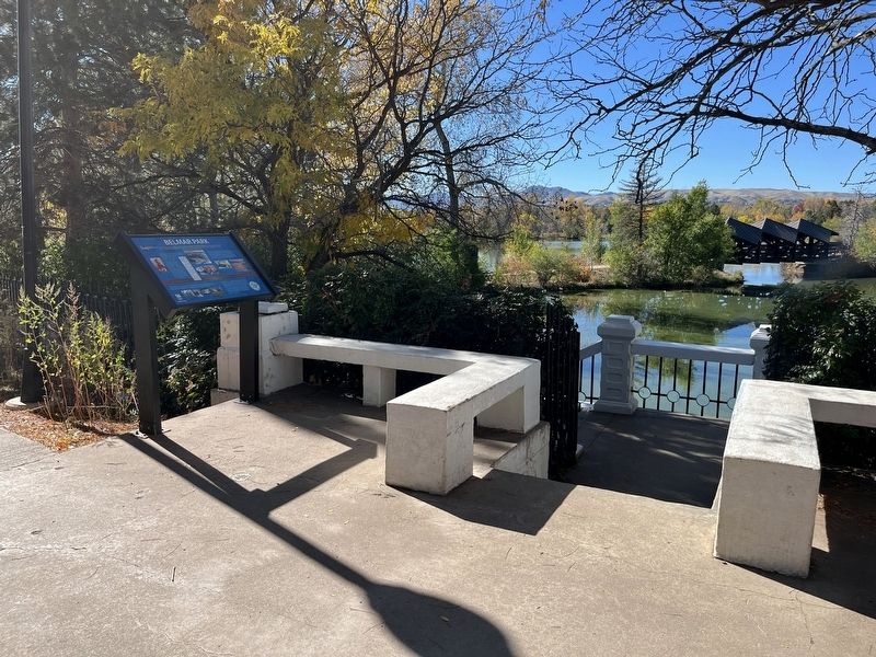
Location. 39° 42.236′ N, 105° 5.118′ W. Marker is in Lakewood, Colorado, in Jefferson County. It is in Belmar Park. It can be reached from Yarrow Street. Marker is in Lakewood Colorado, Jefferson County, in Belmar Park. South of Alameda Avenue and West of S Wadsworth Blvd. Traveling South on S Wadsworth past Alameda Ave, take a right on W Ohio Ave, Left on Yarrow. Touch for map. Marker is in this post office area: Denver CO 80226, United States of America. Touch for directions.

Regionally, this marker is in the Front Range. It is also in the American Mountain West. Globally, it is in North America, the Rocky Mountains, the Western Hemisphere, the Western World, and the Anglosphere. Historically, it finds itself in what was once the Louisiana Purchase.
Other nearby markers. At least 8 other markers are within walking
Photographed by Leslie Eudy, October 21, 2025
3. Kountze Lake
Credits. This page was last revised on October 26, 2025. It was originally submitted on October 26, 2025, by Leslie Eudy of Golden, Colorado. This page has been viewed 103 times since then and 75 times this year. Photos: 1, 2, 3. submitted on October 26, 2025, by Leslie Eudy of Golden, Colorado. • Andrew Ruppenstein was the editor who published this page.
