
Wilshire in Annapolis in Anne Arundel County, Maryland — The American Northeast (Mid-Atlantic)
Carr's Beach

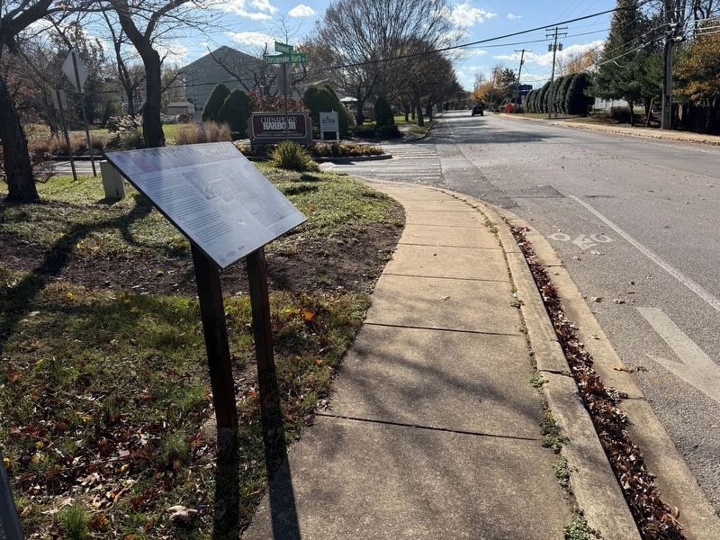
Carr's Beach was the summer place to be from 1927 into the 1970s. Along with its sister Sparrow's Beach, Black Americans flocked to these Chesapeake Bay resorts. Unable to visit traditional white places of amusement during the segregated Jim Crow Era, they claimed these beaches as their own.
Owned by sisters Elizabeth Carr Smith and Florence Carr Sparrow, the beaches signaled a progressive spirit in early 20th century Annapolis. Just 75 years after slavery, and during a time when the country was divided by racial prejudice, they became part of the cultural fabric that has shaped Annapolis.
Carr's Beach was a safe environment for African American performers and spectators, and was a major regional economic force. Many teachers and youths worked there, and tourism revenues rolled in from Washington and Baltimore visitors. Cars lined up for miles to get into the beaches, shutting down traffic in Annapolis every Sunday during the summer…just like now!
By 1970s Blacks began to visit integrated recreational venues so the Baltimore leaseholders moved on to better investments. In 1984, Jerome J. Parks bought Carr's
this page online
You can still gather on the sandy beaches of Chesapeake Harbour, and, if you listen with your heart, you can hear the excitement and the music that throbbed from Carr's Beach. Like the sands of time, its heyday may have washed away, but its memories linger in the hearts of many Annapolitans.
[Caption:]
Sunday Afternoons were family time, a place for church, day camp, cook-outs, but 3 o'clock brought on DJ Hoppy Adams. Adams became so famous that his name and Carr's Beach have become synonymous. A major venue on the "Chitlin Circuit," all the big name acts—Ella Fitzgerald, Fats Domino, Ruth Brown, Jackie Wilson, Otis Redding, and Aretha Franklin—entertained here.
It was the Six Flags of its time. A carousel, Ferris wheel, and pony rides gave families plenty to do. Carr's had its own club, restaurant, clothing store, lodgings and even its own police force led by Deputy George Phelps, the first Black law enforcement officer in the county.
Erected by City of Annapolis; Annapolis Community Foundation; Maryland Heritage Areas Authority; Annapolis,
Topics. This historical marker is listed in these topic lists: African Americans • Entertainment • Parks & Recreational Areas • Waterways & Vessels. A significant historical year for this entry is 1927.
Location. 38° 57.469′ N, 76° 28.884′ W. Marker is in Annapolis, Maryland, in Anne Arundel County. It is in Wilshire. It is at the intersection of Edgewood Road and Chesapeake Harbour Drive, on the right when traveling north on Edgewood Road. Touch for map. Marker is at or near this postal address: 1030 Chesapeake Harbour Dr, Annapolis MD 21403, United States of America. Touch for directions.

Regionally, this marker is in Central Maryland. It is also in the American Mid-Atlantic, in the Chesapeake Bay Region, and on the Eastern Seaboard. Globally, it is in the North Atlantic Region, North America, the Western Hemisphere, the Western World, and the Anglosphere. Historically, it finds itself in what was once one of the original Thirteen Colonies and also the Antebellum South.
Other nearby markers. At least 8 other markers are within walking distance of this marker: Skipjack Lydia D (approx. 0.3 miles away); CBOS Buoy - Smart Buoys to Save the Bay (approx. 0.3 miles away); A History of 'The Beach' (approx. half a mile away); Hoppy Adams & WANN (approx. half a mile away); Carr's and Sparrow's Beach (approx. half a mile away); Chitlin' Circuit (approx. half a mile away); Ecosystem Restoration (approx. 0.6 miles away); The Watermen of Back Creek (approx. 0.8 miles away). Touch for a list and map of all markers in Annapolis.
Credits. This page was last revised on November 16, 2025. It was originally submitted on October 26, 2025, by Devry Becker Jones of Washington, District of Columbia. This page has been viewed 45 times since then and 24 times this year. Photos: 1, 2. submitted on November 16, 2025, by Devry Becker Jones of Washington, District of Columbia.
