Lawrence Cultural District in Douglas County, Kansas — The American Midwest (Upper Plains)
Iⁿ'zhúje'waxóbe
Sacred Red Rock
Photographed by Jason Voigt, October 30, 2025
1. Iⁿ'zhúje'waxóbe: Return of the Sacred Red Rock Marker
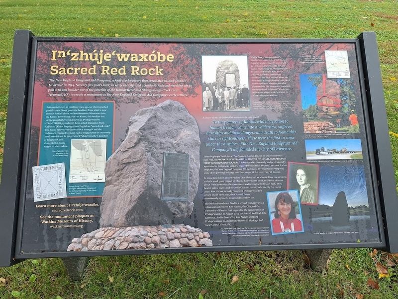
The New England Emigrant Aid Company, a joint-stock venture that speculated in land, founded Lawrence in 1854. Seventy-five years later, in 1929, the city used a Santa Fe Railroad wrecking car to pull a 28-ton boulder out of the junction of the Kansas River and Shunganunga Creek (near Tecumseh, KS) to create a monument to the New England Emigrant Aid Company's early settlers.
Between 600,000 to 1 million years ago, ice sheets pushed glacial erratic Sioux quartzite boulders from what is now eastern South Dakota and southwestern Minnesota into the Kansas River valley. For the Kanza, this boulder is a sacred grandfather rock, known as Iⁿ'zhúje'waxóbe (ee(n) zhoo-jay wah-ho-bay), which translates from Kaáⁿze Íe (Kanza language) into English as "sacred red rock." The Kanza revere Iⁿ'zhúje'waxóbe's strength and the endurance required to make such a long journey in extremely harsh conditions. In prayers for Iⁿ'zhúje'waxóbe's qualities of toughness and strength, the Kanza sought to also endure.
Within days of the monument's installation, a speech by a well-known historian and attended by prominent
this page online
A plaque affixed to the boulder monument in 1929 stated:
To the pioneers of Kansas who in devotion to human freedom came into a wilderness, suffered hardships and faced dangers and death to found this state in righteousness. These were the first to come under the auspices of the New England Emigrant Aid Company. They founded the City of Lawrence.
Then the plaque listed the settlers' names. A small plaque on the monument's base read, "Robinson Park named in honor of Charles Robinson, First Governor of Kansas." Robinson also personally and professionally speculated in Indigenous land. He secured the land that became Lawrence for his employer, the New England Emigrant Aid Company. Eventually he repurposed some of his personal holdings into the campus

Photographed by Jason Voigt, October 30, 2025
2. Iⁿ'zhúje'waxóbe Marker
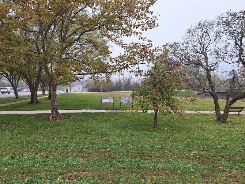
Marker (on the right of the two markers) is located at Robinson Park.
IN 2019, Kaw Nation citizen Pauline Eads Sharp and local artist Dave Loewenstein co-led a small grant project to educate Lawrencians and Kaw Nation citizens about Iⁿ'zhúje'waxóbe, the monument, and reimagine Robinson Park. They hosted public events and met with City and County officials. By the end of 2020, Kaw Nation formally requested Iⁿ'zhúje'waxóbe's return and in early 2021, the City and County unanimously agreed to an unconditional return.
The Mellon Foundation funded a second grand project, a collaboration between Kaw Nation, the City, and the University of Kansas, that supported the rematriation of Iⁿ'zhúje'waxóbe. In August 2023, the Sacred Red Rock left Lawrence. And in June 2024, Kaw Nation installed Iⁿ'zhúje'waxóbe in Allegawaho Memorial Heritage Park (near Council Grove, KS).
(select photo captions:)
·Photograph of the October 11, 1929 dedication of the Early Settlers' Monument in Robinson Park. The plaque pictured here is on display at Watkins Museum of History.
·In 2023, a construction crew removed Iⁿ'zhúje'waxóbe from the monument base in Robinson
Photographed by Jason Voigt, October 30, 2025
3. Iⁿ'zhúje'waxóbe Marker
·Lucy Tayiah Eads was the first woman elected chief of the Kaw Nation and served from 1922-1934. Her granddaughter Pauline Eads Sharp co-led the effort to raise awareness about Iⁿ'zhúje'waxóbe's history and rematriation.
Erected by City of Lawrence, the Mellon Foundation and Watkins Museum & History.
Topics. This historical marker is listed in these topic lists: Indigenous Peoples and Communities • Parks & Recreational Areas. A significant historical year for this entry is 1854.
Location. 38° 58.404′ N, 95° 14.186′ W. Marker is in Lawrence, Kansas, in Douglas County. It is in the Lawrence Cultural District. It is at the intersection of U.S. 59 and East 6th Street, on the left when traveling east on U.S. 59. Marker is located at Robinson Park, which is between US 59, going north and south. Touch for map. Marker is at or near this postal address: 4 US-59, Lawrence KS 66044, United States of America. Touch for directions.

Regionally, this marker is in Eastern Kansas and specifically in Bleeding Kansas Border War Country. It is also in the American Midwest, in the Corn Belt, on the prairies, on the Southern Plains, and on the Santa Fe Trail Corridor. Globally, it is in North America, the Western Hemisphere, the Western World, and the Anglosphere. Historically, it finds itself in what was once the Louisiana Purchase.
Other nearby markers. At least 8 other markers are within walking distance of this marker: Indigenous Lands (here, next to this marker); Lynching in America / Lynching in Douglas County (within shouting distance of this marker); John Brown and the Siege of Lawrence, September 14-15, 1856 (about 600 feet away, measured in a direct line); Santa Fe Steam Locomotive 1073 (about 700 feet away); Lawrence (about 800 feet away); Liberty Hall (about 800 feet away); Historic Pinckney Neighborhood (approx. 0.2 miles away); The First Lawrence U.S. Post Office (approx. 0.2 miles away). Touch for a list and map of all markers in Lawrence.
Also see . . .
1. Sacred Red Rock. (Submitted on October 30, 2025, by Jason Voigt of Glen Carbon, Illinois.)
2. Watkins Museum of History (official website). (Submitted on October 31, 2025, by Jason Voigt of Glen Carbon, Illinois.)
Credits. This page was last revised on October 31, 2025. It was originally submitted on October 30, 2025, by Jason Voigt of Glen Carbon, Illinois. This page has been viewed 78 times since then and 29 times this year. Photos: 1, 2, 3. submitted on October 30, 2025, by Jason Voigt of Glen Carbon, Illinois.
