
Near Fort Calhoun in Washington County, Nebraska — The American Midwest (Upper Plains)
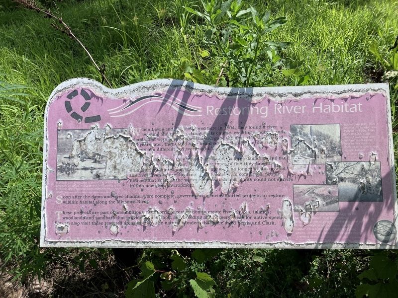
Restoring River Habitat
Photographed by Barry Swackhamer, July 16, 2025
1. Restoring River Habitat Marker
Captions: (middle left) The American River Otter is one of the animal species observed by Lewis and Clark that is returning to the wetlands of the Missouri River, thanks to restoration efforts; (upper right) Hidden Lake (left) near Belleviue, Nebraska, was restored in 1996. More than 200,000 cubic yards of sediment were dredged from a mile long former river channel to restore river aquatic habitat.; (bottom right) DeSoto (missing) National Wildlife Refuge (in the two photos above), near Fort Calhoun, Nebraska, is one of several projects designed to (?) restorations of Missouri River wildlife habitat. It is a 10,000 acre haven for native species, as well as, a place where people enjoy observing them.
(missing) by the 1960's they would have found six large dams holding back (missing) a shorter, deeper river. Many of the types of fish they caught, animals they hunted, and plants they ate were no longer in and around the river . Even before the dams and channels were completed, people noticed that some of the native animals, fish and plants could not survive in this new environment.
Soon after the dams and river channels were complete, government agencies started projects to restore wildlife habitat along the Missouri River.
These projects are part of an ambitious river corridor restoration to create river shuts, islands, woodlands and sandbars that provide (missing) food, and breeding and nursery areas for native species. We can also visit there restored areas to enjoy the natural wonders that once awed Lewis
this page online
Erected by Back to the River, National Park Service, City of Omaha, Papio-Missouri River Natural Resources District.
Topics. This historical marker is listed in these topic lists: Man-Made Features • Natural Features. A significant historical year for this entry is 1804.
Location. 41° 27.092′ N, 95° 57.029′ W. Marker is near Fort Calhoun, Nebraska, in Washington County. It can be reached from County Highway 34 near Road 51. The marker is located at the Boyer Chute National Wildlife Refuge. Touch for map. Marker is in this post office area: Fort Calhoun NE 68023, United States of America. Touch for directions.

Regionally, this marker is in Eastern Nebraska and in Greater Omaha. It is also in the American Midwest, in the Lewis & Clark Corridor, in the Corn Belt, and on the prairies. Globally, it is in North America, the Western Hemisphere, the Western World, and the Anglosphere. Historically, it finds itself in what was once the Louisiana Purchase.
Other nearby markers. At least 8 other markers are within 4 miles of this marker, measured as the crow flies: Tamed River Trade-off (here, next to this marker);

Photographed by Barry Swackhamer, July 16, 2025
2. Restoring River Habitat Marker
Credits. This page was last revised on October 31, 2025. It was originally submitted on October 31, 2025, by Barry Swackhamer of Brentwood, California. This page has been viewed 47 times since then and 16 times this year. Photos: 1, 2. submitted on October 31, 2025, by Barry Swackhamer of Brentwood, California.
