Lookout Valley in Tiftonia in Hamilton County, Tennessee — The American South (East South Central)
Wauhatchie
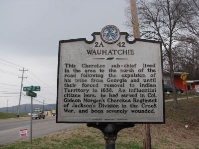
Photographed by Lee Hattabaugh, March 17, 2010
1. Wauhatchie Marker
Erected by Tennessee Historical Commission. (Marker Number 2A 42.)
Topics and series. This historical marker is listed in these topic lists: Indigenous Peoples and Communities • Wars, US Indian. In addition, it is included in the Tennessee Historical Commission series list. A significant historical year for this entry is 1838.
Location. 35° 1.148′ N, 85° 22.428′ W. Marker is in Tiftonia, Tennessee, in Hamilton County. It is in Lookout Valley. It is at the intersection of Cummings Highway (U.S. 11) and Myrtle Avenue, on the right when traveling west on Cummings Highway. in front of Wauhatchie United Methodist Church. Touch for map. Marker is at or near this postal address: 3401 Cummings Hwy, Chattanooga TN 37419, United States of America. Touch for directions.

Regionally, this marker is in
this page online
Other nearby markers. At least 8 other markers are within 2 miles of this marker, measured as the crow flies: Battle of Wauhatchie (approx. 0.4 miles away); Brown's Ferry (approx. half a mile away); Greene's New York Brigade (approx. 0.7 miles away); Union Soldiers Passed Here (approx. ¾ mile away); New York Troops - 11th Corps (approx. one mile away); Battle of Lookout Mountain (approx. 1.1 miles away); Lookout Creek (approx. 1.1 miles away); Wiedrich's New York Battery (approx. 1.2 miles away). Touch for a list and map of all markers in Tiftonia.
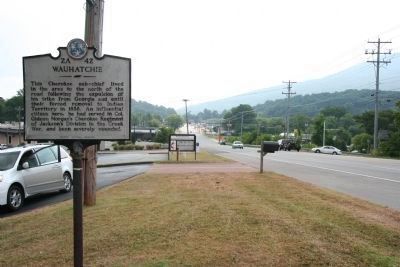
Photographed by Dale K. Benington, July 9, 2010
2. Wauhatchie Marker
View of historical marker looking northeast along the Cummings Highway (US 11, US 41, & US 72).
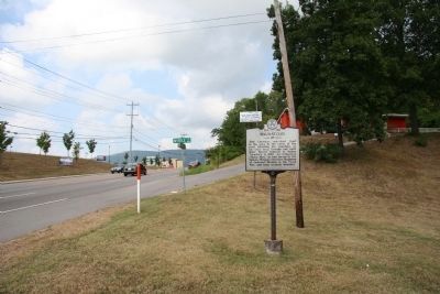
Photographed by Dale K. Benington, July 9, 2010
3. Wauhatchie Marker
View of historical marker looking southwest along Cummings Highway.
Credits. This page was last revised on February 7, 2023. It was originally submitted on March 18, 2010, by Lee Hattabaugh of Capshaw, Alabama. This page has been viewed 2,274 times since then and 121 times this year. Photos: 1. submitted on March 18, 2010, by Lee Hattabaugh of Capshaw, Alabama. 2, 3. submitted on December 29, 2010, by Dale K. Benington of Toledo, Ohio. • Bill Pfingsten was the editor who published this page.
