Upper Sandusky in Wyandot County, Ohio — The American Midwest (Great Lakes)
Departure of the Wyandot Indians
Ohio Historical Marker
Photographed by Dale K. Benington, August 6, 2008
1. Departure of the Wyandot Indians Marker
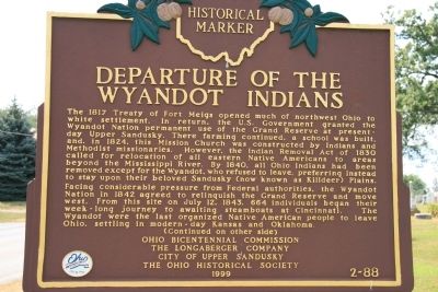
View of the front side of the historical marker.
The 1817 Treaty of Fort Meigs opened much of northwest Ohio to white settlement. In return, the U.S. Government granted the Wyandot Nation permanent use of the Grand Reserve at present-day Upper Sandusky. There farming continued, a school was built, and, in 1824, this Mission Church was constructed by Indians and Methodist missionaries. However, the Indian Removal Act of 1830 called for relocation of all eastern Native Americans to areas beyond the Mississippi River. By 1840, all Ohio Indians had been removed except for the Wyandot, who refused to leave, preferring instead to stay upon their beloved Sandusky (now known as Killdeer) Plains.
Facing considerable pressure from Federal authorities, the Wyandot Nation in 1842 agreed to relinquish the Grand Reserve and move west. From this site on July 12, 1843, 664 individuals began their week-long journey to awaiting steamboats at Cincinnati. The Wyandot were the last organized Native American people to leave Ohio, settling in modern-day Kansas and Oklahoma.
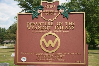
In remembrance of the Wyandot Indians.
The branding iron design used by the Wyandot Nation, late 1700s.
Erected 1999
this page online
Topics and series. This historical marker is listed in these topic lists: Indigenous Peoples and Communities • Notable Events. In addition, it is included in the Ohio Historical Society / The Ohio History Connection series list. A significant historical month for this entry is July 1863.
Location. Marker has been permanently removed. It was located near 40° 50.136′ N, 83° 16.696′ W. Marker was in Upper Sandusky, Ohio, in Wyandot County. It was at the intersection of East Church Street and North 4th Street, on the left when traveling east on East Church Street. To view this historic marker, when traveling on US 23, take the exit for state routes 53 and 67 and head south towards the village of Upper Sandusky, Ohio, for approximately 1.6 miles. Then look to turn left (east) on East Church Street. Upon turning onto East Church Street, head east for approximately 0.2 miles and the marker should be readily seen on the left (north) side of the street, the side of the street where the cemetery is located, about
Photographed by Dale K. Benington, August 6, 2008
2. Departure of the Wyandot Indians Marker
View of the reverse side of the historic marker.
We have been informed that this marker is no longer there and will not be replaced. This page is an archival view of what was.
Regionally, this marker was in the Till Plains. It was also in the American Midwest and in the Corn Belt. Globally, it was in North America, the Western Hemisphere, the Western World, and the Anglosphere. Historically, it found itself in what was once the Viceroyalty of New France, the Haudenosaunee (Iroquois) Confederacy, the territory of the Mississippian Culture, and the Northwest Territory.

Other nearby markers. At least 8 other markers are within walking distance of this location: The Wyandot Removal Trail / Upper Sandusky (July 11, 1843) (here, next to this marker); Wyandott Indian Mission (within shouting distance of this marker); John Stewart (within shouting distance of this marker); Wyandot Mission Church (within shouting distance of this marker); a different marker also named Wyandot Mission Church (within shouting
Photographed by Dale K. Benington, August 6, 2008
3. Departure of the Wyandot Indians Marker
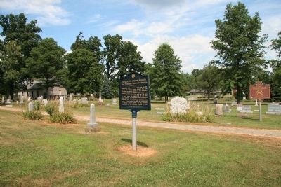
View of historic marker in the far right side of this photo, with the cemetery in the foreground and the Wyandot Indian Mission in the distant left background.
Credits. This page was last revised on November 10, 2025. It was originally submitted on January 16, 2010, by Dale K. Benington of Toledo, Ohio. This page has been viewed 4,395 times since then and 131 times this year. Last updated on November 3, 2025, by Craig Doda of Napoleon, Ohio. Photos: 1, 2, 3. submitted on January 16, 2010, by Dale K. Benington of Toledo, Ohio. • Devry Becker Jones was the editor who published this page.
