Upper Sandusky in Wyandot County, Ohio — The American Midwest (Great Lakes)
Wyandot Mission Church
| — | United Methodist Church Registered Historic Shrine | — |
Photographed by Dale K. Benington, August 6, 2008
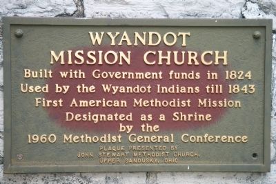
1. Wyandot Mission Church Marker
Used by the Wyandot Indians till 1843
First American Methodist Mission
Designated as a Shrine
by the
1960 Methodist General Conference
Erected by John Stewart Methodist Church, Upper Sandusky, Ohio.
Topics and series. This historical marker is listed in these topic lists: Cemeteries & Burial Sites • Indigenous Peoples and Communities • Religion & Religious Structures. In addition, it is included in the United Methodist Church Historic Sites series list. A significant historical year for this entry is 1824.
Location. 40° 50.169′ N, 83° 16.693′ W. Marker is in Upper Sandusky, Ohio, in Wyandot County. It is at the intersection of East Church Street and North 4th Street, on the left when traveling east on East Church Street. To view this historic marker, when traveling on US 23, take the exit for state routes 53 and 67 and head south towards the village of Upper Sandusky, Ohio, for approximately 1.6 miles. Then look to turn left (east) on East Church Street. Upon turning onto East Church Street, head east for approximately 0.2 miles and then on the left, between two historic
this page online

Regionally, this marker is in the Till Plains. It is also in the American Midwest and in the Corn Belt. Globally, it is in North America, the Western Hemisphere, the Western World, and the Anglosphere. Historically, it finds itself in what was once the Viceroyalty of New France, the Haudenosaunee (Iroquois) Confederacy, the territory of the Mississippian Culture, and the Northwest Territory.
Other nearby markers. At least 8 other markers are within walking distance of this marker: John Stewart (a few steps from this marker); a different marker also named Wyandot Mission Church (a few steps from this marker); The Wyandot Removal Trail / Upper Sandusky (July 11, 1843) (within shouting distance of this marker); Wyandott Indian Mission (within shouting distance of this marker); Wyandot County World War I Memorial
Photographed by Dale K. Benington, August 6, 2008
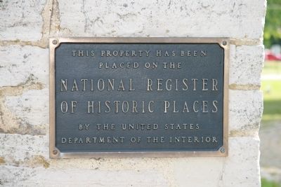
2. Wyandot Mission Church
View of a marker affixed to the side of the Wyandot Mission Church showing that this structure has been placed on the National Register of Historic Places.
Another marker is no longer nearby. Departure of the Wyandot Indians (was within shouting distance of this marker but has been permanently removed).
Photographed by Dale K. Benington, August 6, 2008
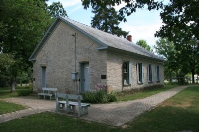
3. Wyandot Mission Church
Photographed by Dale K. Benington, August 6, 2008
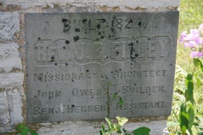
4. Wyandot Mission Church
View of the cornerstone of the Wyandot Mission Church, showing that it was built in 1824 when the Reverend J. B. Finley was leading the mission.
Photographed by Dale K. Benington, August 6, 2008
5. Wyandot Mission Church
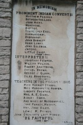
View of a memorial stone, affixed to an outside wall of the church, listing prominent individuals involved in the Wyandot Indian Mission.
Photographed by Dale K. Benington, August 6, 2008
6. Wyandot Mission Church
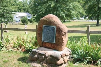
View of the grave of the missionary to the Wyandots, John Stewart, which is located just south of the mission building. The plaque on the stone reads:1816 — 1916
JOHN STEWART
Apostle to the Wyandot Indians
Father of missions of the Methodist Episcopal Church
JOHN STEWART
Apostle to the Wyandot Indians
Father of missions of the Methodist Episcopal Church
Photographed by Craig Doda, February 26, 2022
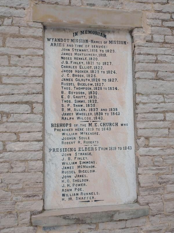
7. Wyandot Mission Church Leaders Tablet
Photographed by Craig Doda, February 26, 2022
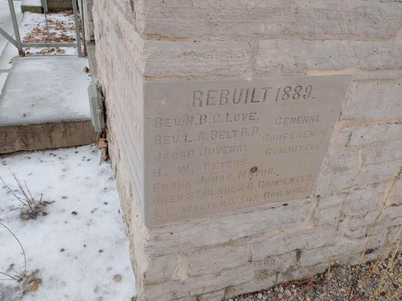
8. Wyandot Mission Church Cornerstone
Credits. This page was last revised on November 10, 2025. It was originally submitted on January 18, 2010, by Dale K. Benington of Toledo, Ohio. This page has been viewed 2,175 times since then and 68 times this year. Last updated on November 3, 2025, by Craig Doda of Napoleon, Ohio. Photos: 1, 2, 3, 4, 5, 6. submitted on January 18, 2010, by Dale K. Benington of Toledo, Ohio. 7, 8. submitted on March 3, 2022, by Craig Doda of Napoleon, Ohio. • Devry Becker Jones was the editor who published this page.
