
Near Saluda in King and Queen County, Virginia — The American South (Mid-Atlantic)
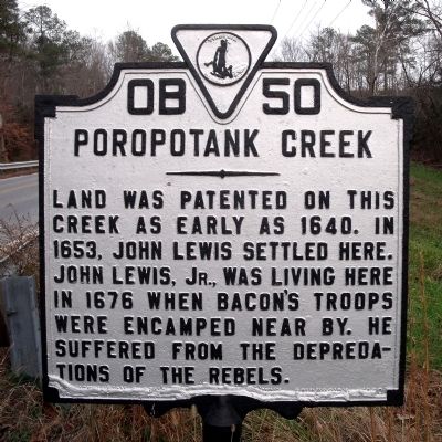
Poropotank Creek
Photographed by Bernard Fisher, December 6, 2009
1. Poropotank Creek Marker
Erected 1930 by Conservation & Development Commission. (Marker Number OB-50.)
Topics and series. This historical marker is listed in these topic lists: Colonial Era • Settlements & Settlers • Waterways & Vessels. In addition, it is included in the Virginia Department of Historic Resources (DHR) series list. A significant historical year for this entry is 1640.
Location. 37° 30.002′ N, 76° 39.152′ W. Marker is near Saluda, Virginia, in King and Queen County. It is on Buena Vista Road (Virginia Route 14) half a mile east of Poropotank Drive, on the right when traveling east. Touch for map. Marker is at or near this postal address: 2948 Adner Rd, Saluda VA 23149, United States of America. Touch for directions.

Regionally, this marker is on Virginia’s Middle Peninsula. It is also in the American South, specifically in the Upper South, in the Tidewater, in the Chesapeake Bay Region, and
this page online
Other nearby markers. At least 8 other markers are within 7 miles of this marker, measured as the crow flies: King and Queen County / Gloucester County (here, next to this marker); The Indentured Servants' Plot (a few steps from this marker); Gravesite of John Lewis (approx. half a mile away); Gloucester Hall (approx. 2 miles away); Poplar Spring Church (approx. 3.6 miles away); a different marker also named King and Queen County / Gloucester County (approx. 4.1 miles away); Marlfield (approx. 4½ miles away); Middlesex County / Gloucester County (approx. 6½ miles away). Touch for a list and map of all markers in Saluda.
Another marker is no longer nearby. Poplar Spring Church (was approx. 3.6 miles away but has been replaced with another marker now near it).
Photographed by Bernard Fisher, December 6, 2009
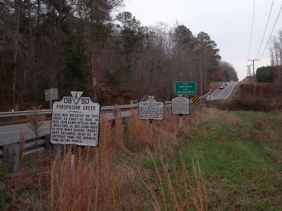
2. Buena Vista Road (facing east)
Photographed by Bernard Fisher, December 6, 2009
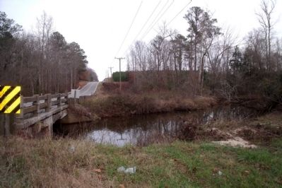
3. Poropotank Creek
Credits. This page was last revised on November 10, 2025. It was originally submitted on December 8, 2009, by Bernard Fisher of Richmond, Virginia. This page has been viewed 3,910 times since then and 189 times this year. Last updated on November 8, 2025, by Caleb Kemplin of Virginia Beach, Virginia. Photos: 1, 2, 3. submitted on December 8, 2009, by Bernard Fisher of Richmond, Virginia. • Devry Becker Jones was the editor who published this page.
