Billings in Yellowstone County, Montana — The American West (Mountains)
The Place Where the White Horse Went Down
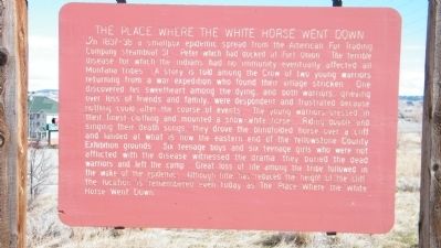
Photographed by Rich Pfingsten, March 22, 2009
1. The Place Where the White Horse Went Down Marker
this page online
Topics. This historical marker is listed in these topic lists: Animals • Indigenous Peoples and Communities • Notable Events.
Location. Marker has been permanently removed. It was located near 45° 48.145′ N, 108° 28.85′ W. Marker was in Billings, Montana, in Yellowstone County. It was on 6th Avenue Bypass 0.1 miles south of East Airport Road, on the left when traveling south. Located at the Boothill Cemetery near the junction of Montana 3 and U.S 87 near Billings Heights, just north of the parking lot to Applebee's Neighborhood Grill off of East Alkali Creek Road. Touch for map. Marker was in this post office area: Billings MT 59105, United States of America.
We have been informed that this marker is no longer there and will not be replaced. This page is an archival view of what was.
Regionally, this marker was in Montana’s Yellowstone Country. It was also in the American Mountain West and in the Lewis & Clark Corridor. Globally, it was in North America, the Western Hemisphere, the Western World, and the Anglosphere. Historically, it found

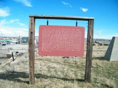
Photographed by Rich Pfingsten, March 22, 2010
2. The Place Where the White Horse Went Down Marker
Photograph of entire marker and posts holding marker.
Other nearby markers. At least 8 other markers are within walking distance of this location: Boothill Cemetery (a few steps from this marker); Lewis and Clark Yellowstone River Journey (approx. 0.2 miles away); Skeleton Cliff (approx. ¼ mile away); a different marker also named The Place Where the White Horse Went Down (approx. 0.4 miles away); Where the River Meets the Rims (approx. 0.4 miles away); The Nomadic Experience (approx. half a mile away); Luther Sage "Yellowstone" Kelly (approx. half a mile away); Yellowstone Kelly's Grave (approx. half a mile away). Touch for a list and map of all markers in Billings.
More about this marker. There did not appear to be any cliffs in the vicinity of the marker, but this area has undergone considerable commercial development over the years, so it is possible the cliff that the horse was driven off has been re-graded.
Regarding The Place Where the White Horse Went Down. According to Montana's Historical Highway Markers by Robert Fletcher (revised and expanded fourth edition by Jon Axline, 2008), there is a "Behind

Photographed by Cosmos Mariner, July 4, 2024
3. Former marker location; looking east from Boothill Cemetery
This marker has been replaced by a new and updated one with the same title. The new one is located about ½ east of Boothill Cemetery, along the Jim Dutcher Trail in Earl Guss Park.
"This marker originated as one of the Indian Historical Markers in 1989. Here is described an event for which most Montanans can feel sympathy and respect but that seems so incongruous in the middle of one of the fastest-growing cities in Montana. In fact, this areas is one of the most historical places in the state. Native Americans lived in and around Alkali Creek for thousands of years, camping in the valley and utilizing buffalo jumps on the adjacent cliffs to acquire food and other necessities of life. A few years before the event described in the marker, in 1823, Missouri Fur Company traders Michael Immel and Robert Jones, along with five others, were ambushed and killed by Blackfeet Indians very near here. In 1877, a group of entrepreneurs established a small steamboat port called Coulson about a mile east of here. That town was legendary for its lawlessness and the many violent deaths of its citizens - all of whom are buried in Boot Hill Cemetery adjacent to this historical marker. Things settled down considerably with the arrival of the Northern Pacific Railway in 1882 and the concurrent establishment of a new community, called Billings. Since then, the city has been extending east and west along the Yellowstone River and eventually encompassed this area."
Credits. This page was last revised on August 1, 2024. It was originally submitted on March 20, 2010, by Rich Pfingsten of Forest Hill, Maryland. This page has been viewed 3,863 times since then and 116 times this year. Photos: 1, 2. submitted on March 20, 2010, by Rich Pfingsten of Forest Hill, Maryland. 3. submitted on August 1, 2024, by Cosmos Mariner of Cape Canaveral, Florida. • Bill Pfingsten was the editor who published this page.
