Near Golden in Jefferson County, Colorado — The American Mountains (Southwest)
Recreation: Past to Present
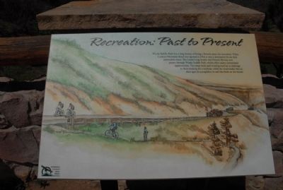
Photographed by Charles T. Harrell, July 3, 2011
1. Recreation: Past to Present Marker
Erected by Jefferson County Open Space.
Topics. This historical marker is listed in these topic lists: Parks & Recreational Areas • Roads & Vehicles • Sports. A significant historical year for this entry is 1914.
Location. Marker has been permanently removed. It was located near 39° 44.196′ N, 105° 14.726′ W. Marker was near Golden, Colorado, in Jefferson County. It was on Lariat Loop Road, on the right when traveling south. Marker is at overlook. Touch for map. Marker was in this post office area: Golden CO 80401, United States of America.
We have been informed that this marker is no longer there and will not be replaced. This page is an archival view of what was.
Regionally,
this page online

Other nearby markers. At least 8 other markers are within walking distance of this location: Windy Saddle Park / Connecting to the Past (here, next to this marker); Our Changing Landscape-From Sea Floor to Mountain Top (approx. 0.4 miles away); What You Can See From Here Today (approx. 0.4 miles away); Who Was Buffalo Bill? (approx. 0.4 miles away); Lariat Loop Byway: Buffalo Bill Museum (approx. 0.4 miles away); Lariat Loop Byway: Denver Mountain Parks (approx. 0.4 miles away); Buffalo Bill's Grave — Frequently Asked Questions (approx. half a mile away); Buffalo Bill's Grave — Why is Buffalo Bill Buried Here? (approx. half a mile away). Touch for a list and map of all markers in Golden.
Other markers no longer nearby. Water Carves Canyons (was here, next to this marker but has been permanently removed); Play in the Wind (was here, next to this marker but has been permanently removed); In Memory of Charles E. Kirk (was approx. half a mile away but has been confirmed missing).
Credits. This page was last revised on November 13, 2025. It was originally submitted on August 16, 2011, by Charles T. Harrell of Woodford, Virginia. This page has been viewed 854 times since then and 18 times this year. Last updated on November 11, 2025, by Leslie Eudy of Golden, Colorado. Photo 1. submitted on August 16, 2011, by Charles T. Harrell of Woodford, Virginia. • Devry Becker Jones was the editor who published this page.
