Near Laclede in Linn County, Missouri — The American Midwest (Upper Plains)
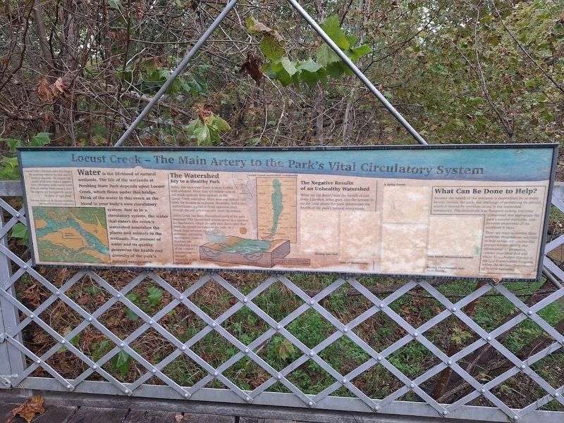
Locust Creek - The Main Artery to the Park's Vital Circulatory System
Photographed by Jason Voigt, October 26, 2025
1. Locust Creek - The Main Artery to the Park's Vital Circulatory System Marker
Water is the lifeblood of natural wetlands. The life of the wetlands at Pershing State Park depends upon Locust Creek, which flows under this bridge. Think of the water in this creek as the blood in your body's own circulatory system. Just as in a circulatory system, the water that enters the creek's watershed nourishes the plants and animals in the wetlands. The amount of water and its quality determine the health and diversity of the park's natural ecosystems.
The Watershed
Key to a Healthy Park
Today, this once-clear water is often loaded with sediment. More than 4.6 million tons of soil erode annually from uplands in the Locust Creek watershed. More than one million tons enter the streams as sediment. Pesticides, herbicides, and fertilizers applied to fields upstream filter through the soil and eventually enter the stream.
Locust Creek has been channelized north of the park boundary. This channelized stream serves as a raceway for floodwaters, which abruptly slow down once they reach the stream meanders in the park. As a result, large amounts of sediment, containing agricultural chemical residues, are smothering
this page online
The Negative Results of an Unhealthy Watershed
What we eat determines the health of our body. Likewise, what goes into the stream or on the land above the park determines the health of the park's natural ecosystems.
What Can Be Done to Help?
Because the health of the wetlands is determined by so many factors outside the park, the challenge of protecting its natural assets is shared by everyone living in the watershed community. This boardwalk was designed to help everyone understand and appreciate the park's natural wetlands, and increase awareness of the problems it faces.
There are ways to combat these problems. Programs are available to help reduce soil erosion and protect stream quality. For information or assistance, contact your local Soil and Water Conservation District or the Soil Conservation Program within the Missouri Department of Natural Resources.
(map caption:)
Locust Creek is the main artery that brings life-sustaining water to the park, and its quality is important. The original high quality of the area's water is apparent from
Photographed by Jason Voigt, October 26, 2025
2. Locust Creek - The Main Artery to the Park's Vital Circulatory System Marker
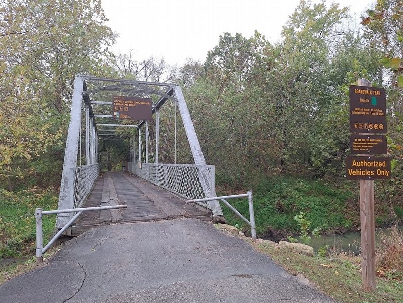
Marker is attached to the bridge (on the right) at Locust Creek Boardwalk Trailhead.
Topics. This historical marker is listed in these topic lists: Environment • Waterways & Vessels. A significant historical year for this entry is 1820.
Location. 39° 45.298′ N, 93° 13.021′ W. Marker is near Laclede, Missouri, in Linn County. It can be reached from Ellen Road west of Missouri Route 130. Marker is located at Pershing State Park, at the Locust Creek Boardwalk Trailhead. Touch for map. Marker is at or near this postal address: Ellen Rd, Meadville MO 64659, United States of America. Touch for directions.

Regionally, this marker is in North Missouri. It is also in the American Midwest, in the Lewis & Clark Corridor, and in the Corn Belt. Globally, it is in North America, the Western Hemisphere, the Western World, and the Anglosphere. Historically, it finds itself in what was once the territory of the Mississippian Culture, the Louisiana Purchase, and the Antebellum South.
Other nearby markers. At least 8 other markers are within 4 miles of this marker, measured as the crow flies: Pershing State Park (within shouting distance of this marker); Locust Creek Covered Bridge (approx. 2.7 miles away); [Covered Bridge] Truss Structures and Truss Variations (approx. 2.7 miles away); World War II Memorial (approx. 3 miles away); Phil Kearny Post No. 19 G.A.R. Memorial (approx. 3 miles away); Laclede (approx. 3.3 miles away); a different marker also named Laclede (approx. 3.3 miles away); a different marker also named Laclede (approx. 3.4 miles away). Touch for a list and map of all markers in Laclede.
Also see . . . Pershing State Park (Missouri State Parks). (Submitted on November 13, 2025, by Jason Voigt of Glen Carbon, Illinois.)
Credits. This page was last revised on November 13, 2025. It was originally submitted on November 13, 2025, by Jason Voigt of Glen Carbon, Illinois. This page has been viewed 53 times since then and 17 times this year. Photos: 1, 2. submitted on November 13, 2025, by Jason Voigt of Glen Carbon, Illinois.
