
Colonial Heights, Virginia — The American South (Mid-Atlantic)
Early Grave Markers
Photographed by Evan Dwyer, June 14, 2025
1. Early Grave Markers Marker
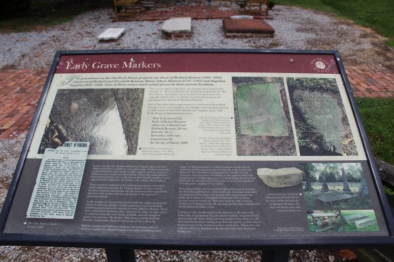
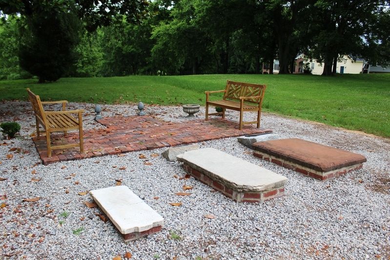
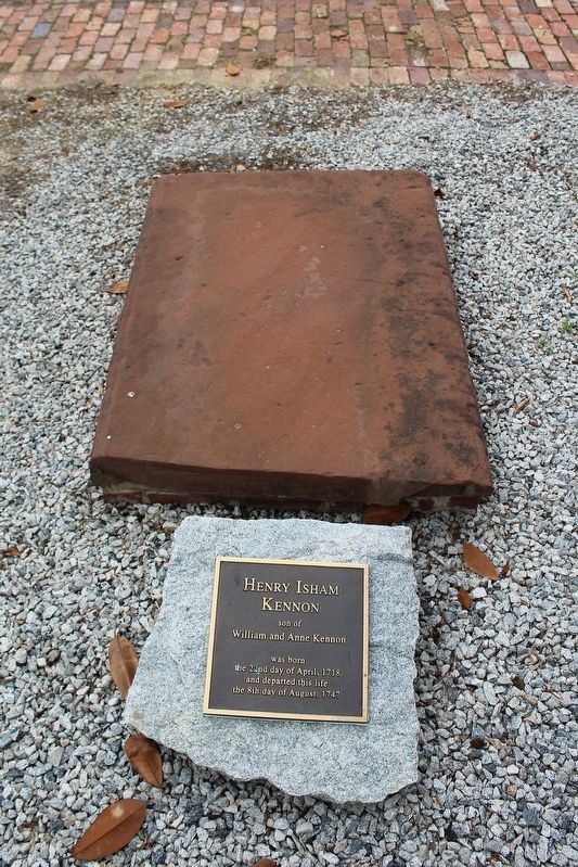
The gravestones on the Old Brick House property are those of Richard Kennon (1684-1688), oldest son of Richard and Elizabeth Kennon; Henry Isham Kennon (1718-1747); and Angelina Vaughan (1826-1848). None of these stones mark actual graves in their current locations.
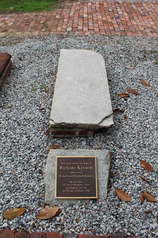
The younger Richard Kennon, who died just short of his fourth birthday in 1688, was likely the first burial associated with the Old Brick House. According to local tradition, his gravestone was originally placed where it could be seen from the house by his grieving mother, Elizabeth Worsham Kennon.
One of the oldest known gravestones in what is now Chesterfield County, it bears an inscription, now illegible, that was transcribed in an 1888 article in The Critic (Richmond, Virginia) and a 1936 Works Progress Administration survey:
Here lyeth interred theIn the early days of colonial settlement in Virginia, there were few skilled stonecutters available to carve gravestones. Settlers
Body of Richard Kennon
eldest son of Richard and
Elizabeth Kennon. He was
Born the 5th of
December, 1684 and
departed this life
the 8th day of March, 1688.
this page online
These practices continued as the colonists moved away from their initial settlements and into the Virginia frontier. At these remote locations, burial in churchyards was often impractical because of the distance to the nearest churches, giving rise to the custom of plantation burials.
As the number of stone artisans increased in this region, monuments adorned with long epitaphs, ornate engravings, and even heraldic emblems gained popularity among the more affluent colonists. These were crafted from sandstone, slate, limestone or schist, to name a few - whatever materials were locally available and soft enough to quarry, cut and carve. By the late 18th century, marble had also become a fashionable choice for the tombs of the well-to-do.
Besides wooden and fieldstone markers, two common styles of funerary markers in colonial Virginia were tablet
Photographed by Evan Dwyer, June 14, 2025
2. Early Grave Markers at Old Brick House
Prominent families also constructed table tombs and chest tombs for their deceased relatives. Table tombs are horizontal stone slabs elevated several feet above the ground with supporting plinths, while chest tombs are rectangular stone boxes that sit above ground, over the burial site. Still other types of early funerary markers in Virginia include tall, tapering obelisks and underground burial chambers called crypts.
Christians were usually buried with their feet to the east in the belief that, on Judgment Day, the dead would be resurrected and arise to face the dawn. Early funerary markers were often set with their inscribed surfaces facing away from the graves, so that visitors need
Photographed by Evan Dwyer, June 14, 2025
3. Early Grave Markers Marker
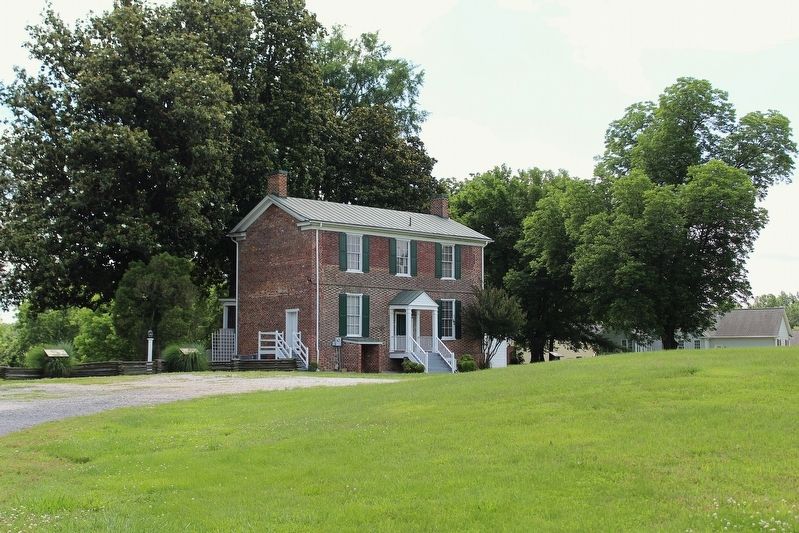
The marker is just visible to the right of the house in this photo, taken from the road at the beginning of the house's driveway.
(captions)
Richard Kennon's gravestone as it appeared in autumn, 2015. Photo courtesy of Leonard David Kennon III.
(right) The gravestone of Henry Isham Kennon, son of William and Anne Eppes Kennon. William inherited the Conjurer's Neck estate from his mother, Elizabeth Worsham Kennon, in 1711. Photo courtesy of Leonard David Kennon III.
(far right) The gravestone of Angelina Vaughan (September 15, 1826 - March 1, 1848). Her relationship to the Old Brick House is unknown at this time. Photo courtesy of Rachel Lipowicz/Chesterfield Historical Society of Virginia
The Critic, Volume 2, Number 9, 5 November 1888
(clockwise from top) A fieldstone marker from the Bermuda District; box tombs, obelisks and headstones at Eppington Plantation; chest tombs near Ettrick; and a table tomb in the Chester area. Photos courtesy of Rachel Lipowicz/Chesterfield Historical Society of Virginia.
Erected by The Old Brick House Foundation.
Topics. This historical marker is listed in these topic

Photographed by Evan Dwyer, June 14, 2025
4. Angelina Vaughan Slab Marker
Location. 37° 17.112′ N, 77° 21.952′ W. Marker is in Colonial Heights, Virginia. It can be reached from Waterfront Drive 0.1 miles east of Dunston Point Parkway, on the right when traveling east. Touch for map. Marker is at or near this postal address: 131 Waterfront Drive, Colonial Heights VA 23834, United States of America. Touch for directions.

Regionally, this marker is in Central Virginia. It is also in the American South and specifically in the Upper South. Globally, it is in the North Atlantic Region, North America, the Western Hemisphere, the Western World, and the Anglosphere. Historically, it finds itself in what was once the territory of the Mississippian Culture, one of the original Thirteen Colonies, one of the Confederate States of America, and the Antebellum South.
Other nearby markers. At least 8 other markers are within 3 miles of this marker, measured as the crow flies: The Old Brick (Kennon) House (within shouting distance of this marker); Conjurer's Field Prehistoric Native American Village (within
Photographed by Evan Dwyer, June 14, 2025
5. Richard Kennon Slab Marker
With tablet added to the display on a new piece of stone.
Photographed by Evan Dwyer, June 14, 2025
6. Henry Isham Kennon Slab Marker
with tablet added to the display on a new piece of stone.
Credits. This page was last revised on November 17, 2025. It was originally submitted on November 17, 2025, by Evan Dwyer of Richmond, Virginia. This page has been viewed 74 times since then and 34 times this year. Photos: 1, 2, 3, 4, 5, 6. submitted on November 17, 2025, by Evan Dwyer of Richmond, Virginia. • Bernard Fisher was the editor who published this page.
