Cadillac in Wise Creek No. 77, Saskatchewan — The Prairie Region (North America)
Fort Walsh
Fort Qu'Appelle Trail
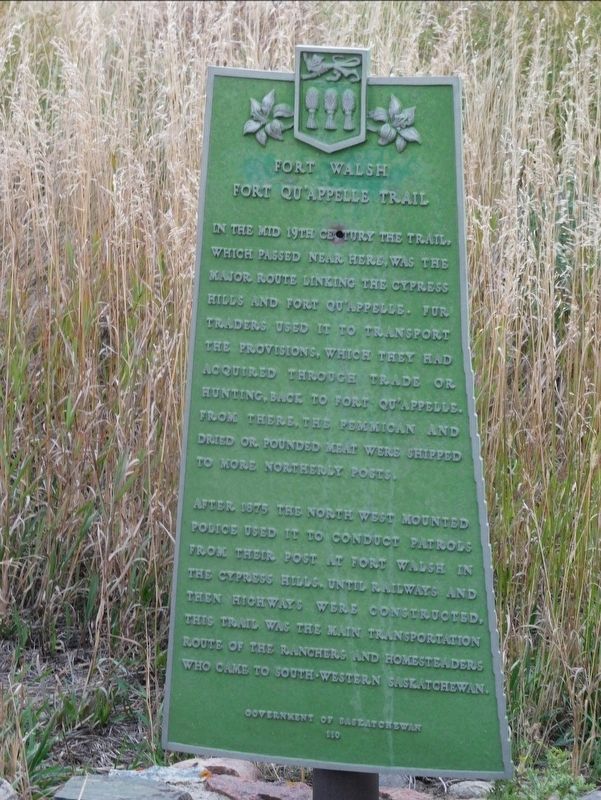
Photographed by Jimmy Emerson, September 30, 2024
1. Fort Walsh Marker
After 1875, the North West Mounted Police used it to conduct patrols from their post at Fort Walsh in the Cypress Hills, until railways and then highways were constructed. This trail was the main transportation route of the ranchers and homesteaders who came to southwestern Saskatchewan.
Erected by Government of Saskatchewan. (Marker Number 110.)
Topics. This historical marker is listed in these topic lists: Forts and Castles • Law Enforcement • Roads & Vehicles. A significant historical year for this entry is 1875.
Location. 49° 45.344′ N, 107° 44.601′ W. Marker is in Cadillac, Saskatchewan, in Wise Creek No. 77. It is on Saskatchewan 4 (Saskatchewan Route 4), on the right when traveling north. Touch for map. Marker is in this post office area: Cadillac SK S0N 0K0,
this page online

Regionally, this marker is in Southwest Saskatchewan. It is also in the Prairies. Globally, it is in North America, the Western Hemisphere, the Western World, and the Anglosphere. Historically, it finds itself in what was once a British colony and also Rupert’s Land.
Credits. This page was last revised on November 22, 2025. It was originally submitted on November 22, 2025, by Jimmy Emerson of Dalton, Georgia. This page has been viewed 34 times since then and 15 times this year. Photo 1. submitted on November 22, 2025, by Jimmy Emerson of Dalton, Georgia. • Andrew Ruppenstein was the editor who published this page.
