
Chatsworth in Murray County, Georgia — The American South (South Atlantic)
Forks of the Old Federal Road

Photographed by Tim Fillmon, October 27, 2025
1. Forks of the Old Federal Road Marker
The Old Federal Road crossed Cherokee territory at the southeast boundary in the direction of Athens. Georgia. It branched at this point toward Knoxville and Nashville, Tennessee. The right fork led north toward Knoxville through Chatsworth and Tennga. Georgia, while the left fork led northwest toward Nashville through Spring Place and Rossville. Georgia. Formal permission for the US government to use this way was granted by the Cherokees in the 1805 Treaty of Tellico. Tennessee. This thoroughfare followed the course of an early trading path to Augusta. Georgia, and became northwest Georgia's first vehicular and postal route.
Erected 2023 by Georgia Historical Society. (Marker Number 105-9.)
Topics. This historical marker is listed in these topic lists: Indigenous Peoples and Communities • Roads & Vehicles. A significant historical year for this entry is 1805.
Location. 34° 41.835′ N, 84° 44.136′ W. Marker is in Chatsworth, Georgia, in Murray County. It is at the intersection of Old Highway 411 and U.S. 76, on the left when traveling north on Old Highway 411. Touch for map. Marker is at or near this
this page online

Regionally, this marker is in Georgia’s Mountains. It is also in the American South, specifically in the Deep South, in Appalachia, and specifically in Southern Appalachia. Globally, it is in North America, the Western Hemisphere, the Western World, and the Anglosphere. Historically, it finds itself in what was once the original Cherokee Nation, the territory of the Mississippian Culture, one of the original Thirteen Colonies, one of the Confederate States of America, and the Antebellum South.
Other nearby markers. At least 8 other markers are within 7 miles of this marker, measured as the crow flies: Fort Gilmer (approx. 2.9 miles away); Old Federal Road (approx. 4.9 miles away); Murray County (approx. 5.2 miles away); Wright Hotel (approx. 5.2 miles away); Old Holly Creek P.O. (approx. 5.8 miles away); Mystery Shrouds Fort Mountain (approx. 5.8 miles away); Legends of Fort Mountain (approx. 6 miles away); Fort Mountain State Park (approx. 6.1 miles away). Touch for a list and map of all markers in Chatsworth.
Another
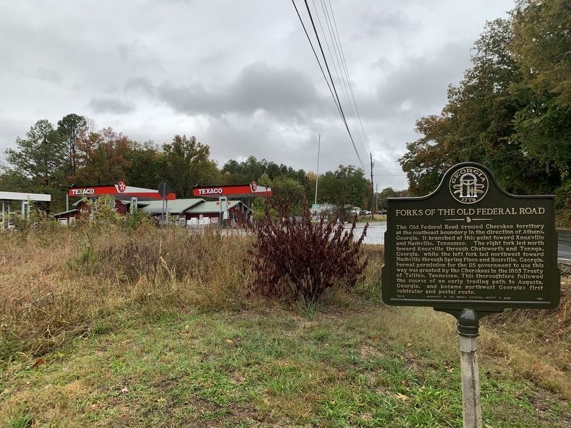
Photographed by Tim Fillmon, October 27, 2025
2. Forks of the Old Federal Road Marker
Credits. This page was last revised on November 23, 2025. It was originally submitted on November 23, 2025, by Tim Fillmon of Webster, Florida. This page has been viewed 72 times since then and 43 times this year. Photos: 1, 2. submitted on November 23, 2025, by Tim Fillmon of Webster, Florida.
