
Northfields near Charlottesville in Albemarle County, Virginia — The American South (Mid-Atlantic)
Bowles Homestead & Cemetery
Documentation and Preservation of an Early African American Freehold at the Heart of Free State
Photographed by TheJellyBeans
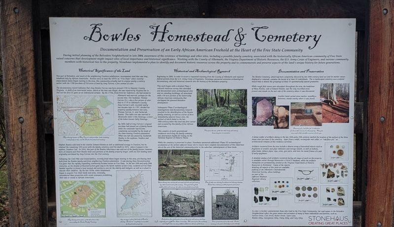
1. Bowles Homestead & Cemetery Marker
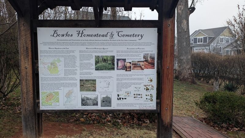
During initial planning of the Belvedere Neighborhood in late 2004, awareness of the existence of buildings and other sites, including a possible family cemetery, associated with the historically African American community of Free State raised concerns that development might impact sites of local importance and historical significance. Working with the County of Albemarle, the Virginia Department of Historic Resources, the U.S. Army Corps of Engineers, and various community members with historical ties to the property, Stonehaus implemented a plan to identify and document historic resources across the property and to commemorate and preserve aspects of the land’s unique history for future generations.
Historical Significance of the Land
This part of Belvedere, and much of the neighboring Dunlora subdivision, encompasses land that was long inhabited only by African Americans. Known since at least the 1870’s as “Free State” when recently–emancipated slaves began moving to the area, this community actually had its origins nearly a century earlier with the 1788 purchase of 224 acres of land by Amy Farrow, a free woman
this page online
The documentary record indicates that Amy Bowles Farrow was born around 1735 in Hanover County, Virginia. A child of an interracial union, which at the time was illegal, she was required by Virginia law to live out her first 31 years as an indentured servant. By the 1770s, freed from her indenture, she had moved to Albemarle and married, perhaps for the second time. Her husband, Thomas Farrow (Sr.), also a free person of color, died in 1777 in Albemarle County. Amy Farrow’s will, recorded nearly two decades later in 1797, divided her property equally between two sons, Thomas Farrow, Jr., and Zachariah Bowles. This latter son was married to Monticello slave Critta Hemmings, a sister of the better-known Sally Hemings.
By 1850, half of Amy Farrow’s original purchase had passed out of family hands while the remainder had become entangled among the lands of the slave-owning Dunlora plantation. The last part was purchased by Zachariah Bowles to his nephews, Stephen and Peter Bowles.
Stephen Bowles sold land to his relative Edward Bowles as well as additional acreage to Dunlora, but he retained the remaining 100% acres which
Photographed by TheJellyBeans, November 19, 2025
2. Bowles Homestead & Cemetery Marker
Following the Civil War and Emancipation, recently freed slaves began moving into the area, purchasing land and building homes, beginning what would become known as Free State. In the late 19th and early 20th centuries, this thriving, tight-knit farming community became home to generations. Free State Presbyterian Church helped form the backbone of the community. A benevolent society helped the residents of Free State bury their loved ones. In the late 1920s, white landowners in the area began using racially restrictive covenants to exclude African Americans from buying or renting land or homes. These covenants were included in deeds until as late as the 1940s, and precluded their rental to African Americans.
Documentation and Preservation
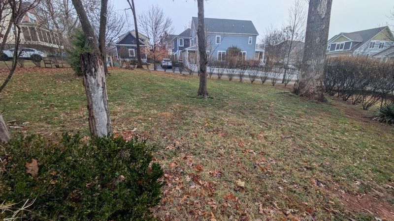
The Bowles Cemetery, which
Photographed by TheJellyBeans, November 19, 2025
3. Preservation of the Cemetery as Green Space
While rough field stones were abundant throughout the area, the headstone of Mary Bowles, wife of Edward Bowles, was the only inscribed stone present and stands on the east side of the cemetery where it was discovered.
A dense scatter of artifacts dating to the late 18th–early 19th-century marked the location of the earliest of the three house sites just west of the cemetery. Apart from a small, rectangular root cellar, or “sub-floor pit,” no architectural remains of this residence survived.
Artifacts recovered from the area include a diverse array of household objects such as fragments of ceramic and glass tableware and storage vessels; small objects such as buttons, glass beads, tobacco pipes, toys, coins, gun parts, and even the metal frames of a pair of early eyeglasses.
A detailed catalog of all artifacts recovered during all stages of work on

Photographed by TheJellyBeans, November 19, 2025
4. Located on Bowles Alley, at the T-intersection with Tyree Lane.
In order to further commemorate those who lived in the Free State Community, the road names in the Belvedere Neighborhood reflect the given names and surnames of many of those individuals and families, such as, Farrow Drive, Cole Street, Butler Street, Tyrone Lane, Bowles Alley, Georgianna Alley, Daisy Alley, and Caty Alley.
Historical and Archaeological Research
Beginning in 2004, in order to secure a requested rezoning from the County of Albemarle and required federal permits from the U.S. Army Corps of Engineers, Stonehaus sponsored extensive archaeological, documentary, and oral historical research into the history of the Belvedere property.
This work began with a detailed first-phase I cultural resources survey that identified and documented seven archaeological sites and six standing buildings, all of which are consistent with a 30-acre portion of the historically African American community that developed there prior to residential development.
Subsequent Phase II archaeological investigations and documentary research resulted in the identification of the Bowles family cemetery and remains of the three immediately adjacent house sites, all of which date to the late 18th-century when this land was first owned and occupied by this family of free African Americans.
This complex of multi-generational residences encircling the family cemetery was deemed eligible for listing on the National Register of Historic Places.
While the cemetery is preserved in place, Stonehaus sponsored additional (Phase III) archaeological excavations at the earliest adjacent house site to ensure more complete documentation of this important site at the core of the historical community prior to the suburban redevelopment of these lands.
Erected by Stonehaus Builders.
Topics. This historical marker is listed in these topic lists: African Americans • Cemeteries & Burial Sites. A significant historical year for this entry is 1770.
Location. 38° 4.339′ N, 78° 27.508′ W. Marker is near Charlottesville, Virginia, in Albemarle County. It is in Northfields. It is at the intersection of Tyree Lane and Bowles Alley, on the left when traveling west on Tyree Lane. This marker is situated in the green space at the intersection of Tyree Lane and Bowles Alley, near 549 Tyree Lane in Charlottesville, VA. It is easily visible from the street signs marking the Tyree Lane and Bowles Alley intersection. Parking spaces are available on Bowles Alley. Touch for map. Marker is at or near this postal address: 555 Tyree Ln, Charlottesville VA 22901, United States of America. Touch for directions.

Regionally, this marker is in the Piedmont and in Central Virginia. It is also in the American South and specifically in the Upper South. Globally, it is in North America, the Western Hemisphere, the Western World, and the Anglosphere. Historically, it finds itself in what was once the territory of the Mississippian Culture, one of the original Thirteen Colonies, one of the Confederate States of America, and the Antebellum South.
Other nearby markers. At least 8 other markers are within 3 miles of this marker, measured as the crow flies: Amy Bowles Farrow (here, next to this marker); Free State (about 800 feet away, measured in a direct line); Pvt. Shadrach Battles (ca. 1753-1822) (approx. 0.2 miles away); Rio Hill 1864 Skirmish (approx. 1.2 miles away); Rio Hill (approx. 1.2 miles away); Skirmish at Rio Hill (approx. 1.3 miles away); Rio Mills (approx. 2.1 miles away); Monacan Indian Village (approx. 2.1 miles away). Touch for a list and map of all markers in Charlottesville.
Credits. This page was last revised on January 16, 2026. It was originally submitted on November 24, 2025, by TheJellyBeans of Central, Virginia. This page has been viewed 133 times since then and 85 times this year. Photos: 1, 2, 3, 4. submitted on November 24, 2025, by TheJellyBeans of Central, Virginia. • Devry Becker Jones was the editor who published this page.
