Marker Logo
THE HISTORICAL
MARKER DATABASE
“Bite-Size Bits of Local, National, and Global History”
Newtonville in Fayette County, Alabama — The American South (East South Central)
 

Freeman Lake

Fayette County
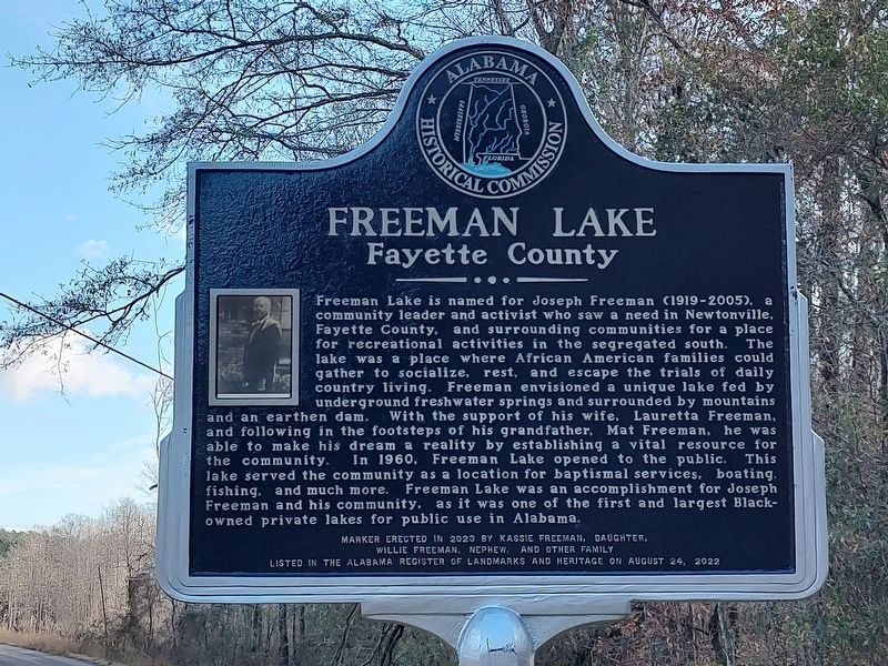
 
 
Freeman Lake Marker image. Click for full size.
Photographed by Jimmy Emerson, November 26, 2025
1. Freeman Lake Marker
Inscription. Freeman Lake is named for Joseph Freeman (1919-2005), a community leader and activist who saw a need in Newtonville, Fayette County, and surrounding communities for a place for recreational activities in the segregated south. The lake was a place where African American families could gather to socialize, rest, and escape the trials of daily country living. Freeman envisioned a unique lake fed by underground freshwater springs and surrounded by mountains and an earthen dam. With the support of his wife, Lauretta Freeman, and following in the footsteps of his grandfather, Mat Freeman, he was able to make his dream a reality by establishing a vital resource for the community. In 1960, Freeman Lake opened to the public. This lake served the community as a location for baptismal services, boating, fishing, and much more. Freeman Lake was an accomplishment for Joseph Freeman and his community, as it was one of the first and largest Black-owned private lakes for public use in Alabama.
Listed in the Alabama Register of Landmarks and Heritage on August 24, 2022

 
Erected 2023 by Alabama Historical Commission,
Paid Advertisement
Click or scan to see
this page online
Kassie Freeman, daughter, Willie Freeman, nephew, and other family.
 
Topics. This historical marker is listed in these topic lists: African AmericansCivil RightsWaterways & Vessels. A significant historical year for this entry is 1960.
 
Location. 33° 31.998′ N, 87° 50.037′ W. Marker is in Newtonville, Alabama, in Fayette County. It is on County Road 12 2.2 miles east of State Highway 171, on the left when traveling west. Touch for map. Marker is at or near this postal address: 3752 Co Rd 12, Fayette AL 35555, United States of America. Touch for directions.

Regionally, this marker is in the American South and specifically in the Deep South. Globally, it is in North America, a Gulf of Mexico state, the Western Hemisphere, the Western World, and the Anglosphere. Historically, it finds itself in what was once the territory of the Mississippian Culture, one of the Confederate States of America, and the Antebellum South.

Other nearby markers. At least 8 other markers are within 11 miles of this marker, measured as the crow flies: Shady Grove Missionary Baptist Church and Cemetery (approx. 1.9 miles away); Town of Belk / Belk Community Center Park
Freeman Lake Marker image. Click for full size.
Photographed by Jimmy Emerson, November 26, 2025
2. Freeman Lake Marker
(approx. 9.4 miles away); History of Fayette (approx. 10.4 miles away); Roxy Theatre/ Fayette's Newspapers (approx. 10.4 miles away); In Memory of the Patriots of the American Revolution (approx. 10½ miles away); Fayette World War II Memorial (approx. 10½ miles away); United Daughters of the Confederacy Memorial (approx. 10½ miles away); In Memory of the Soldiers of the Southern Confederacy (approx. 10½ miles away).
 
 
Credits. This page was last revised on November 27, 2025. It was originally submitted on November 26, 2025, by Jimmy Emerson of Dalton, Georgia. This page has been viewed 176 times since then and 120 times this year. Photos:   1, 2. submitted on November 26, 2025, by Jimmy Emerson of Dalton, Georgia. • James Hulse was the editor who published this page.

m=289191

CeraNet Cloud Computing sponsors the Historical Marker Database.
This website earns income from purchases you make after using our links to Amazon.com. We appreciate your support.
Paid Advertisement
Aug. 2, 2026