Buckhead in Atlanta in Fulton County, Georgia — The American South (South Atlantic)
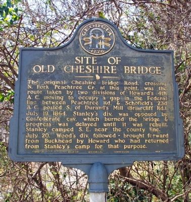
Site of Old Cheshire Bridge
Photographed by David Seibert, March 20, 2010
1. Site of Old Cheshire Bridge Marker
July 19, 1864. Stanley’s div. was opposed by Confederate cav. which burned the bridge & progress was delayed until it was rebuilt. Stanley camped S.E. near the county line.
July 20. Wood’s div. followed -- brought forward from Buckhead by Howard who had returned from Stanley’s camp for that purpose.
Erected 1954 by Georgia Historical Commission. (Marker Number 060-21.)
Topics and series. This historical marker is listed in this topic list: War, US Civil. In addition, it is included in the Georgia Historical Society series list. A significant historical month for this entry is July 1943.
Location. 33° 49.532′ N, 84° 21.103′ W. Marker is in Atlanta, Georgia, in Fulton County. It is in Buckhead. It is at the intersection of Buford Highway (U.S. 23) and Shady Valley Drive, on the right when traveling east on Buford Highway. Touch for map. Marker
this page online

Regionally, this marker is in the Piedmont. It is also in the American South and specifically in the Deep South. Globally, it is in North America, the Western Hemisphere, the Western World, and the Anglosphere. Historically, it finds itself in what was once the territory of the Mississippian Culture, one of the original Thirteen Colonies, one of the Confederate States of America, and the Antebellum South.
Other nearby markers. At least 8 other markers are within 2 miles of this marker, measured as the crow flies: Between the Peachtree Cr. Forks (approx. 0.6 miles away); Stanley & Wood March To Durand's Mill (approx. 1.3 miles away); First Stand-Alone Restaurant (approx. 1.3 miles away); The Saga of Gold Tooth John (approx. 1.4 miles away); King's Brigade (approx. 1.6 miles away); 4th A.C. at Buckhead (approx. 1.7 miles away); Durand's Mill (approx. 1.8 miles away); Meet You at the Buck's Head / The Commercial Core Reimagined (approx. 1.9 miles away). Touch for a list and map of all markers in Atlanta.
Another marker is
Photographed by David Seibert, March 20, 2010
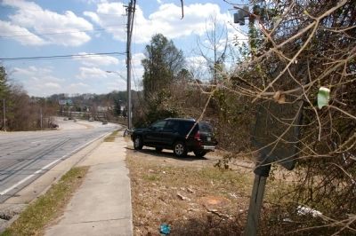
2. Site of Old Cheshire Bridge Marker
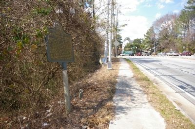
Looking east on Buford Highway toward the North Fork or Peachtree Creek and the site of Old Cheshire Bridge. The bridge is now six lanes of concrete (the last car is on the bridge). The marker can barely be seen to the right in the brush.
Photographed by David Seibert, March 20, 2010
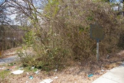
3. Site of Old Cheshire Bridge Marker
Photographed by David Seibert, March 20, 2010
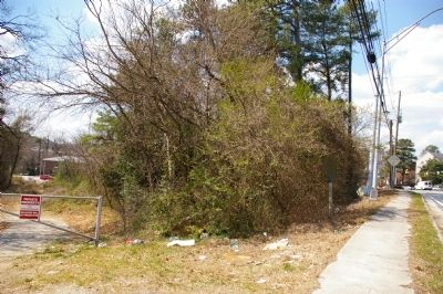
4. Site of Old Cheshire Bridge Marker
Looking west, the marker is in the right of the brush in the foreground
Photographed by David Seibert, March 20, 2010
5. Site of Old Cheshire Bridge Marker
Looking west on Buford Highway; the intersection in the distance is at North Druid Hills Road
Credits. This page was last revised on February 8, 2023. It was originally submitted on March 21, 2010, by David Seibert of Sandy Springs, Georgia. This page has been viewed 1,407 times since then and 33 times this year. Photos: 1, 2, 3, 4, 5. submitted on March 21, 2010, by David Seibert of Sandy Springs, Georgia. • Craig Swain was the editor who published this page.
